Clearing skies Thursday; Colder weekend ahead
A cold front coming out of Minnesota and moving eastward will provide another round of thunderstorms after midnight. After that, a few showers are possible early Thursday then we will see clearing skies. Colder air will lag behind, arriving Thursday night.
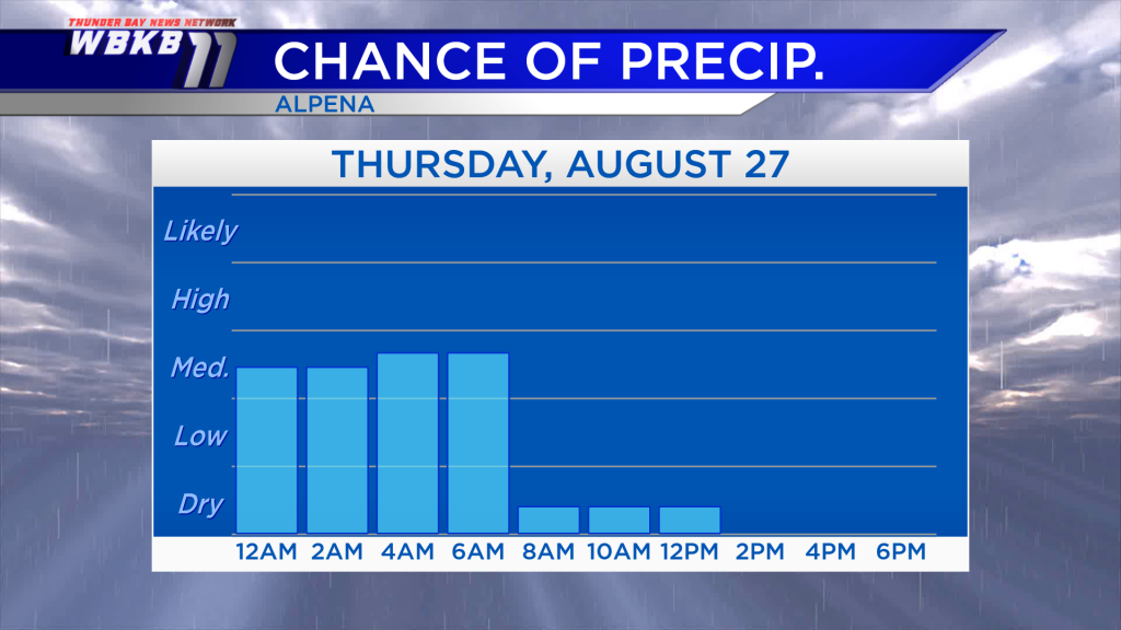
Scattered showers and thunderstorms will move through Northern Michigan overnight, then drier conditions will move in tomorrow, giving way to clearing skies. Following the early-morning hours, chances of showers will drop off and become very low.
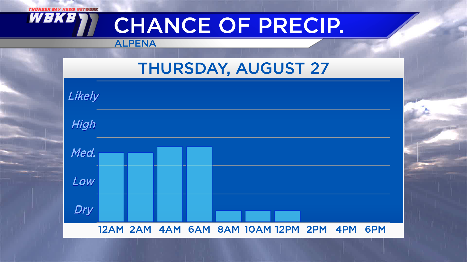
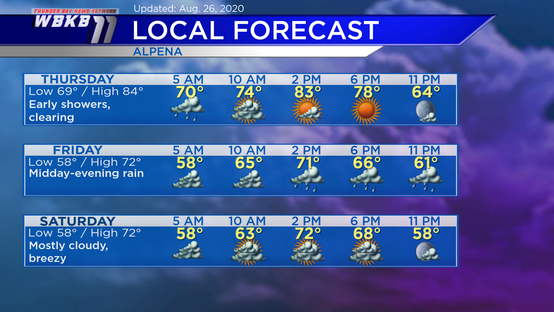
Thursday: A chance of showers early, then partly cloudy in the afternoon. Early-morning lows will be around 69 degrees. By the late-morning, temperatures will be in the middle 70s. Afternoon highs will climb to about 84 degrees (once the sunshine breaks out). Early-evening temperatures will be in the middle 70s.
Friday: Cooler, periods of rain will move in midday and continue into the evening. Predawn temperatures will be in the upper 50s. Late-morning temperatures will rise to the middle 60s. Afternoon highs will reach only about 72 degrees. Early-evening temperatures will be in the middle 60s.
Saturday: Mostly cloudy and breezy. Early-morning temperatures will start in the upper 50s. Afternoon highs will be in the lower 70s. Early-evening temperatures will be in the middle 60s.
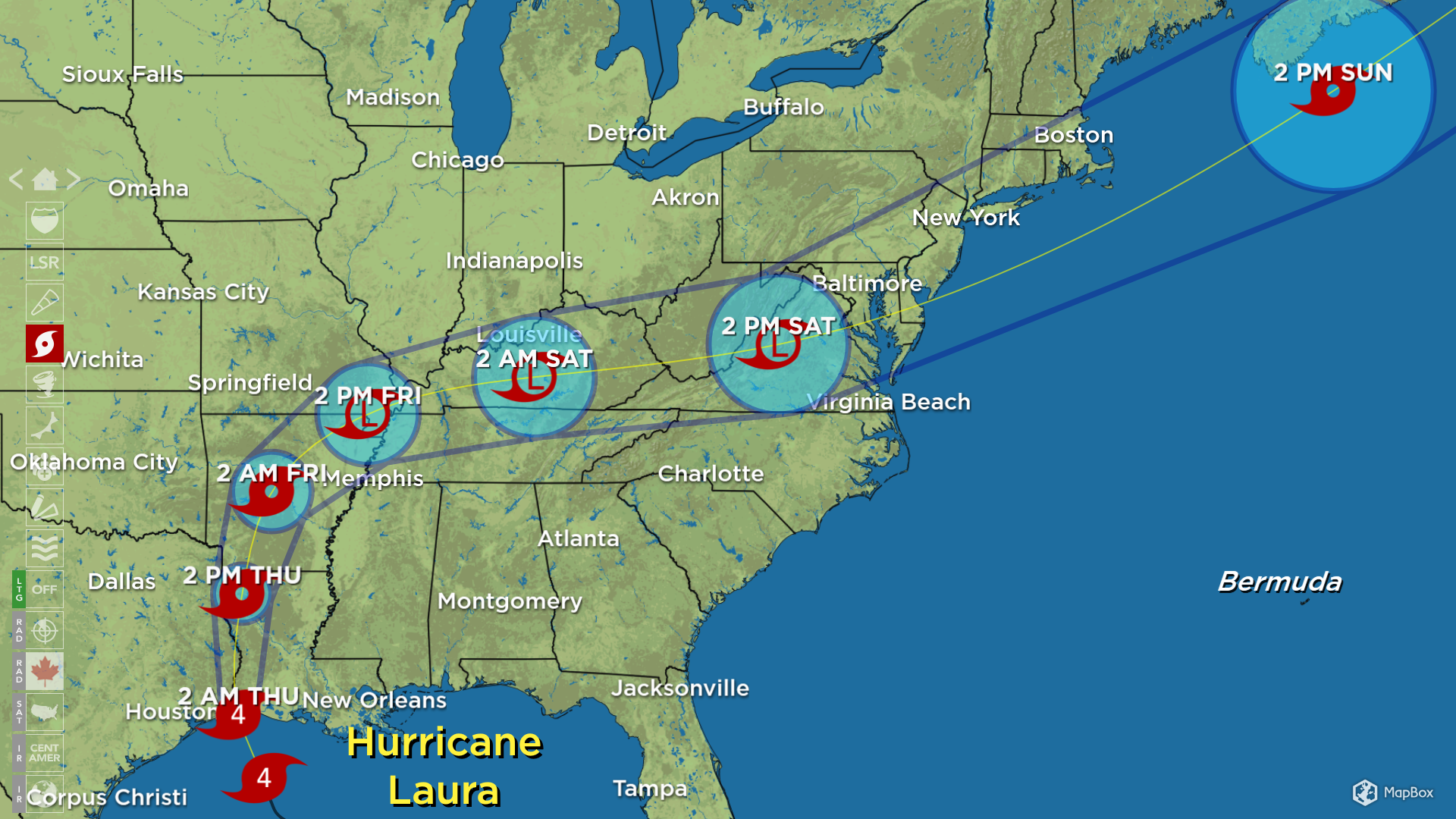
Hurricane Laura has strengthened to category 4 with maximum winds near 150 mph in the eyewall. This will be bring destructive storm surge off the Gulf Coast and violent winds to areas near the southwest Louisiana/southeast Texas border. Laura is forecast to weaken later Thursday, becoming a tropical storm as it heads north. Beyond that Laura will weaken further and turn eastward, heading to the mid-Atlantic.
For the rest of Northeast Michigan’s weather forecast, watch the latest weather video by clicking the weather tab at the top of the page.