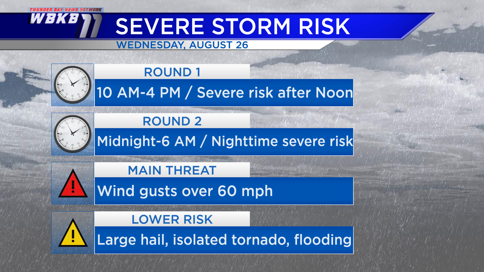
Two rounds of potentially severe thunderstorms Wednesday

This evening we have mostly clear skies over Northeast Michigan. A storm system currently affecting the Upper Plains/northern Rocky Mountains region will move into our area Wednesday. One boundary near the international border will become a warm front and affect Northeast Michigan in the midday-afternoon hours. A cold front currently sweeping through Montana will move in late Wednesday night (or predawn early Thursday).
Locally, two rounds of severe thunderstorms will be possible. The first round of rain and thunderstorms will start around 10 a.m. and taper off around 4 p.m., but the risk of severe storms will increase after 12 noon. Then there will be a few hours of dry weather lasting into the evening. The second round of thunderstorms will move in after midnight, including a second risk of severe storms. The most widespread threat will be wind gusts over 60 mph which have the capability to cause damage. There is a low chance of an isolated tornado somewhere in Northern Michigan (but this is not a guarantee). Large hail and heavy rain are also severe weather risks with Wednesday’s setup — but will likely be isolated.
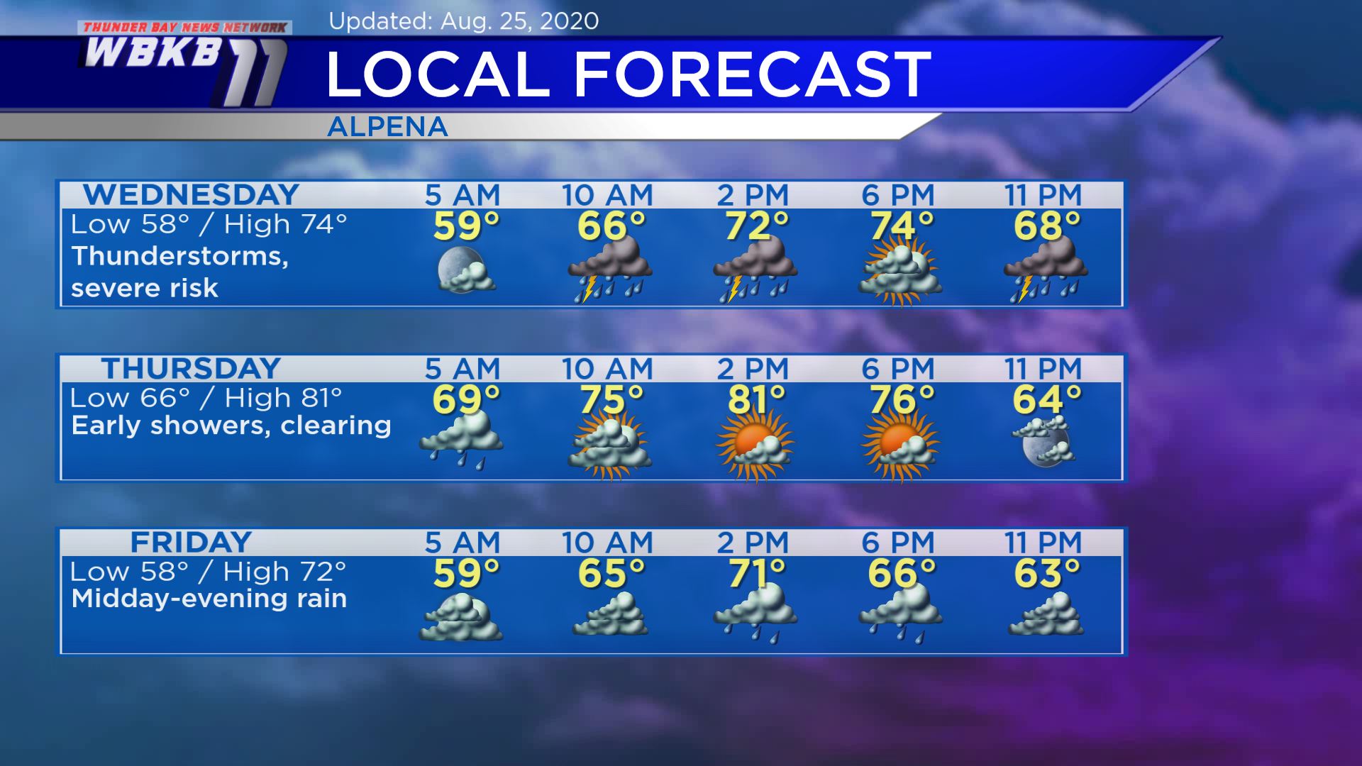
Wednesday: Two rounds of thunderstorms are expected (midday-afternoon and overnight), some storms could be severe. Predawn temperatures will be in the upper 50s. Afternoon highs will be close to 74 degrees. Early-evening temperatures will be in the lower 70s.
Thursday: Possibly an early shower, then becoming partly cloudy. Early-morning lows will be in the middle/upper 60s. Afternoon highs will reach about 81 degrees. Early-evening temperatures will be in the lower/middle 70s.
Friday: A chance of rain from midday through the evening hours. Early-morning temperatures will be in the upper 50s. Afternoon highs will be near 72 degrees. Temperatures will be in the middle 60s during the early-evening.
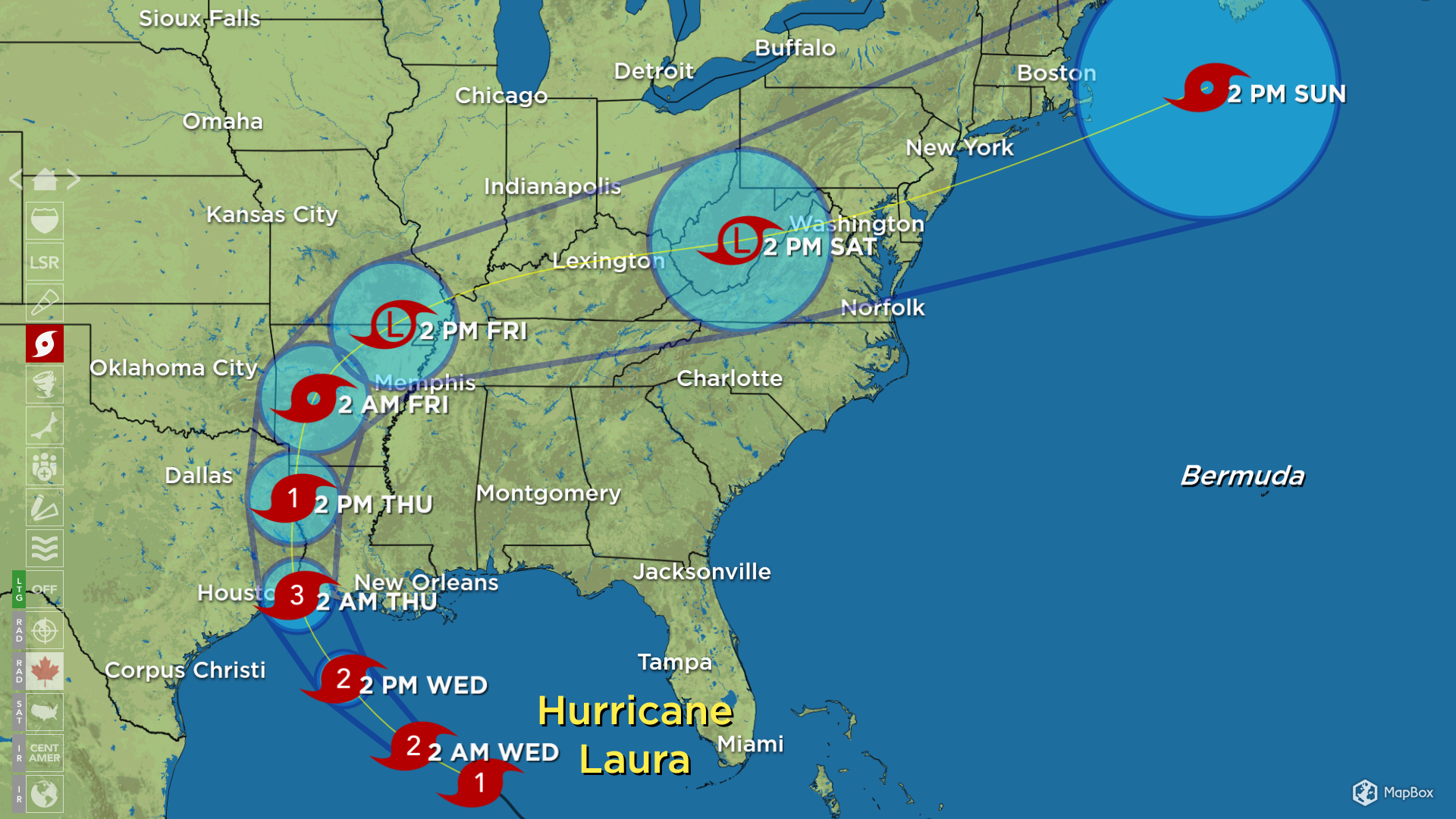
Looking to the Gulf Coast, Hurricane Laura is expected to make landfall late Wednesday night or very early Thursday. Laura is currently a category 1 hurricane, but is expected to intensify to a category 3 hurricane Wednesday. Laura will likely make landfall somewhere near the Louisiana-Texas border. Impacts due to hurricane-strength wind, flooding rain and storm surge will be felt across the eastern Texas and Louisiana coastline.
For the rest of Northeast Michigan’s weather forecast, watch the latest weather video by clicking the weather tab at the top of the page.