Humidity and rain chances increase Tuesday
Clouds are increasing from south to north this evening. An incoming storm system will roll in from the south, bringing rain and thunderstorms for Tuesday. Then we’ll catch a break of dry weather Tuesday night to Wednesday afternoon.
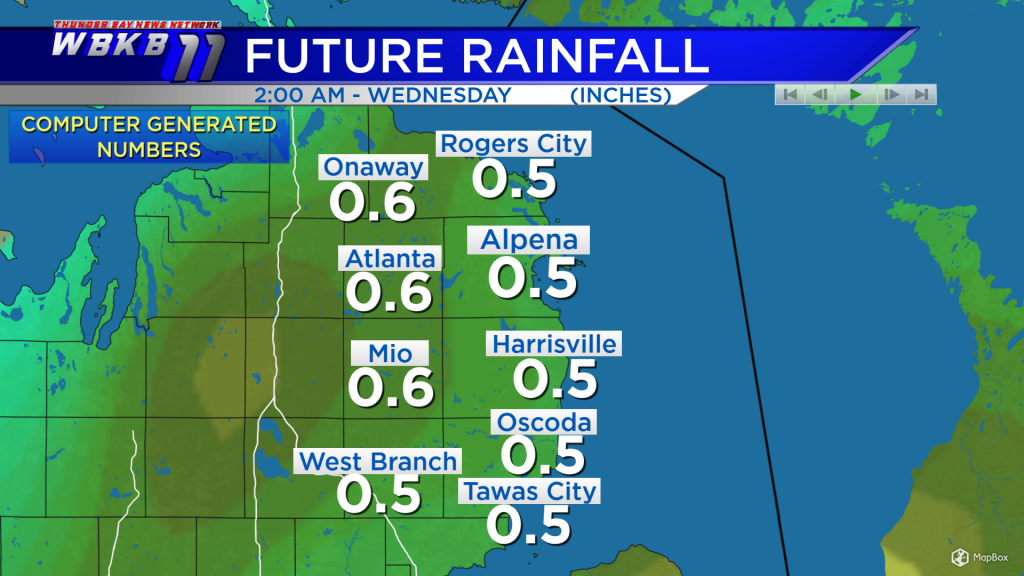
Rainfall amounts could potentially get up to a half-inch across Northeast Michigan Tuesday. More rain will come later in the week.

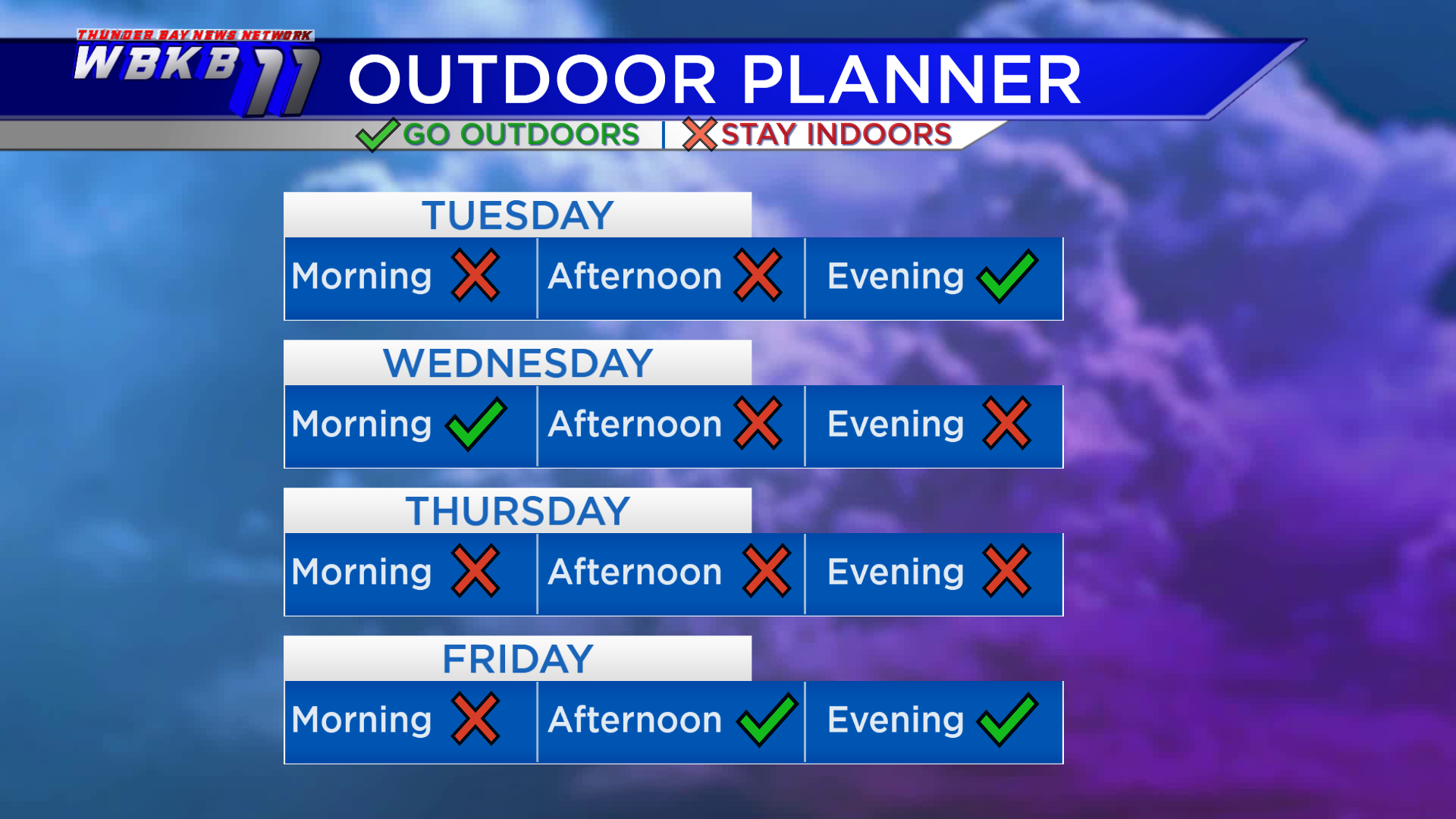
Plan on indoor activities Tuesday morning and afternoon. Then that storm system will lift to the north and head out of our area. The start of Wednesday looks dry. Late-day Wednesday, a chance of scattered showers and thunderstorms will develop. The bulk of the next storm system will move in from the west, bringing soaking rain Wednesday night into Thursday.
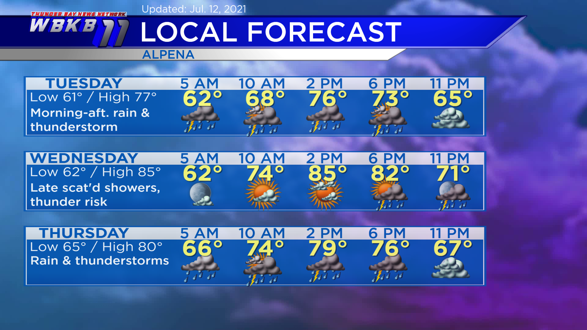
Tuesday: Scattered showers and thunderstorms in the morning-afternoon. Early-morning lows will head down to near 61 degrees. Afternoon highs will reach about 77 degrees. Evening temperatures will go into the lower 70s and upper 60s.
Wednesday: Dry into the afternoon, then a chance of scattered showers and thunderstorms late. Warmer and feeling more humid. Predawn temperatures will begin with lows close to 62 degrees. Temperatures will rise to the middle 70s in the late-morning. Afternoon highs will get up to around 85 degrees. Evening temperatures will fall to the 70s.
Thursday: Rainy with a risk of thunderstorms. Early-morning lows will be about 65 degrees. Afternoon highs will head up to near 80 degrees. Evening temperatures will be in the lower 70s to upper 60s.
For the rest of Northeast Michigan’s weather forecast, watch the latest weather video by clicking the weather tab at the top of the page.