Chance of spotty storms Friday through Sunday, but no washouts expected
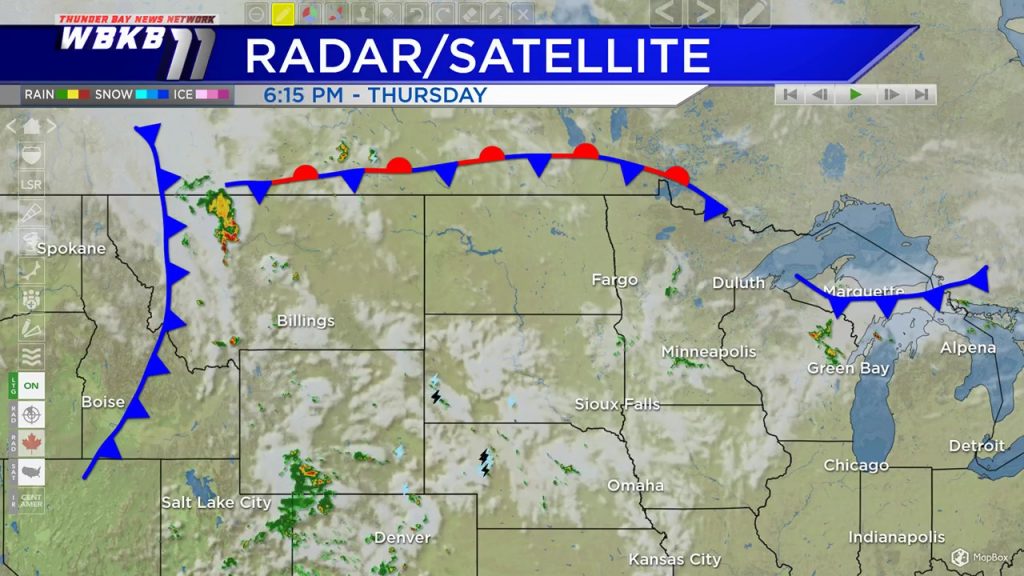
A few different weather boundaries will be affecting Northern Michigan over the next few days. A cold front from a storm system in central Canada is bringing a few showers near the Tip of the Mitt this evening. A stationary front near the United States-Canada border will keep a buoyant air mass in the Upper Plains and Upper Midwest (south of the front) and there will be impulses of instability leading to a chance of spotty thunderstorms Friday and Saturday during the midday/afternoon/early evening hours. A cold front currently over Montana will move through our area Sunday.
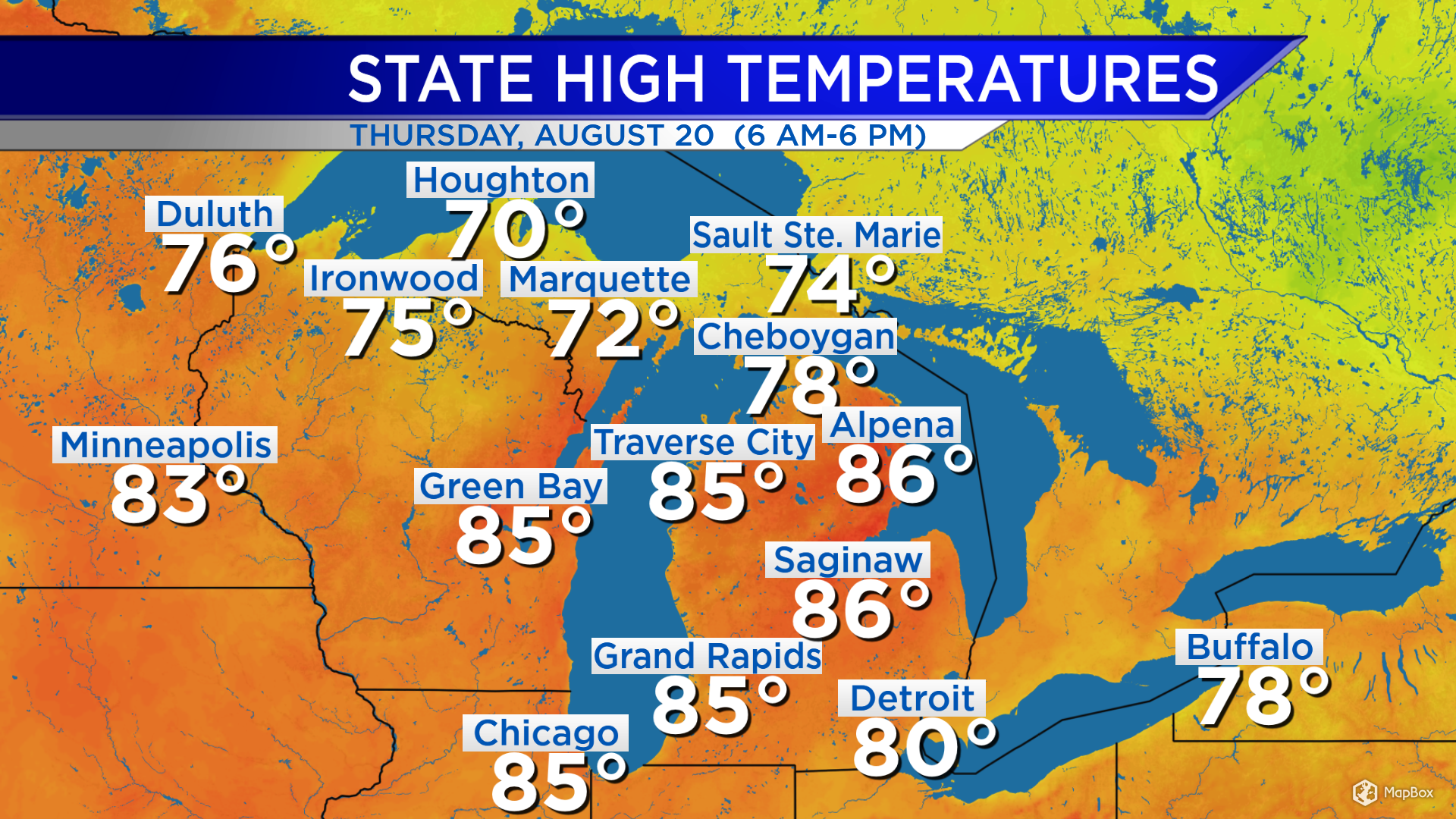
High temperatures today reached 86 degrees in Alpena and 85 degrees in Grand Rapids. The previously-mentioned cold front has brought colder temperatures to the Upper Peninsula, where highs reached 74 degrees in Sault Ste. Marie and 70 degrees in Houghton.
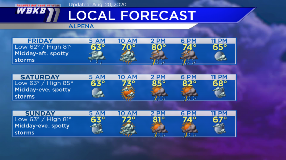
Friday: Spotty showers or thunderstorms will be possible midday-afternoon. Predawn temperatures will be in the lower 60s. Late-morning temperatures will be close to 70 degrees. Afternoon highs will reach around 81 degrees. Early-evening temperatures will be in the lower 70s.
Saturday: Spotty showers or thunderstorms will be possible midday through early evening. Early-morning lows will be in the lower 60s. Temperatures will rise to the lower/middle 70s in the late-morning. Afternoon highs will warm to about 85 degrees. Early-evening temperatures will be near 80 degrees.
Sunday: Spotty showers or thunderstorms will be possible midday through early evening. Early-morning lows will be in the lower 60s. Late-morning temperatures will be in the lower 70s. Afternoon highs will be close to 81 degrees. Early-evening temperatures will be in the lower 70s.
For the rest of Northeast Michigan’s weather forecast, watch the latest weather video by clicking the weather tab at the top of the page.