Bitter cold Tuesday night through Thursday morning
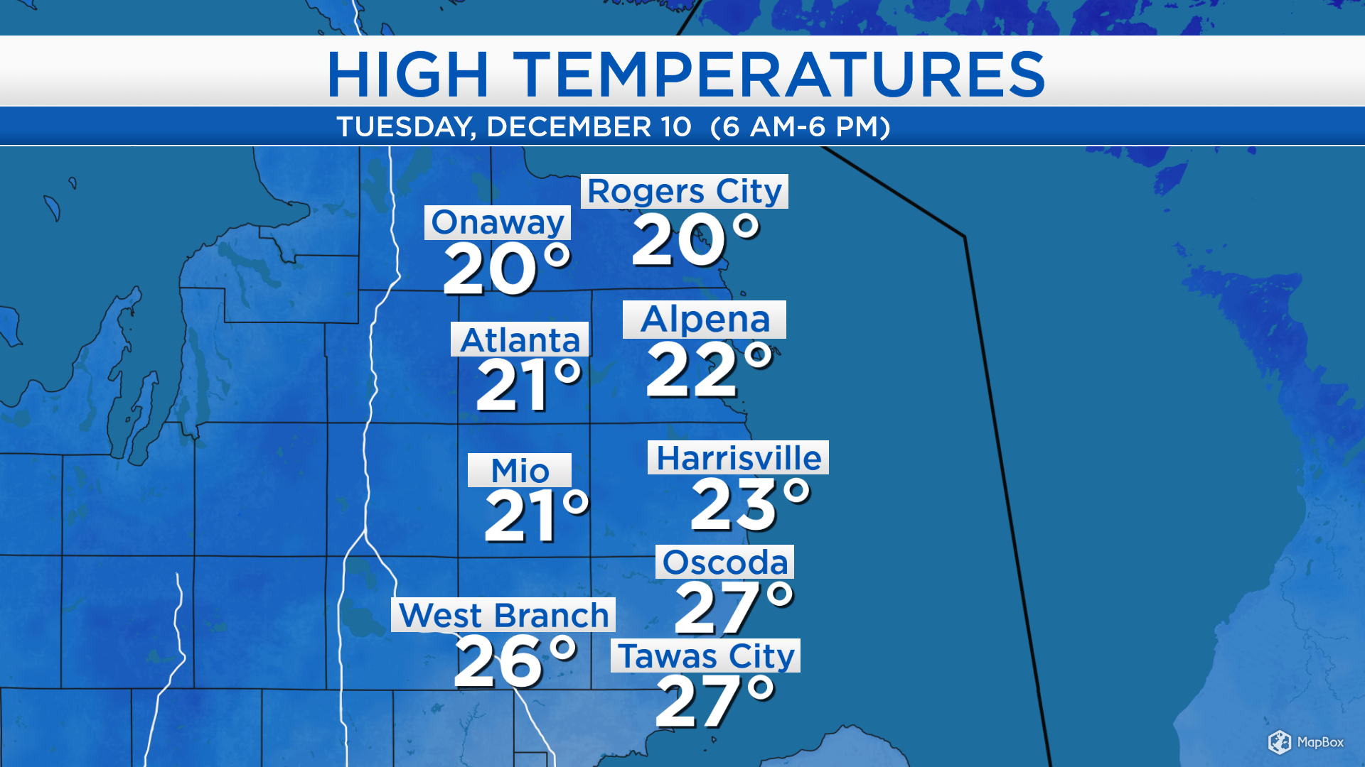
High temperatures today reached the lower to middle 20s across the state. Cold air rushing over the waters of Lake Michigan generated lake effect snow showers. They were more substantial to the west of I-75, but some snowflakes reached as far east as Alpena.
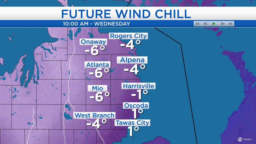
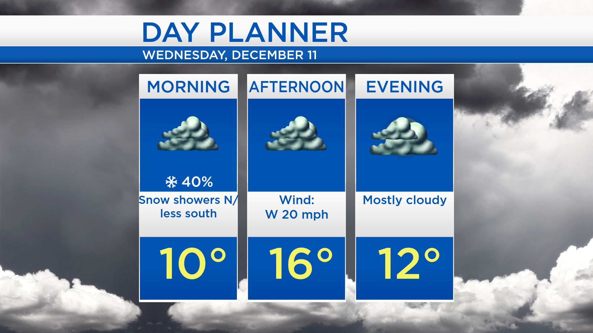
Low temperatures will drop to 10 degrees, and wind chills will drop below 0 tonight to Wednesday morning. Wind speeds close to 10 mph will make it feel very chilly tonight, then winds will increase to 20 mph tomorrow midday-afternoon.
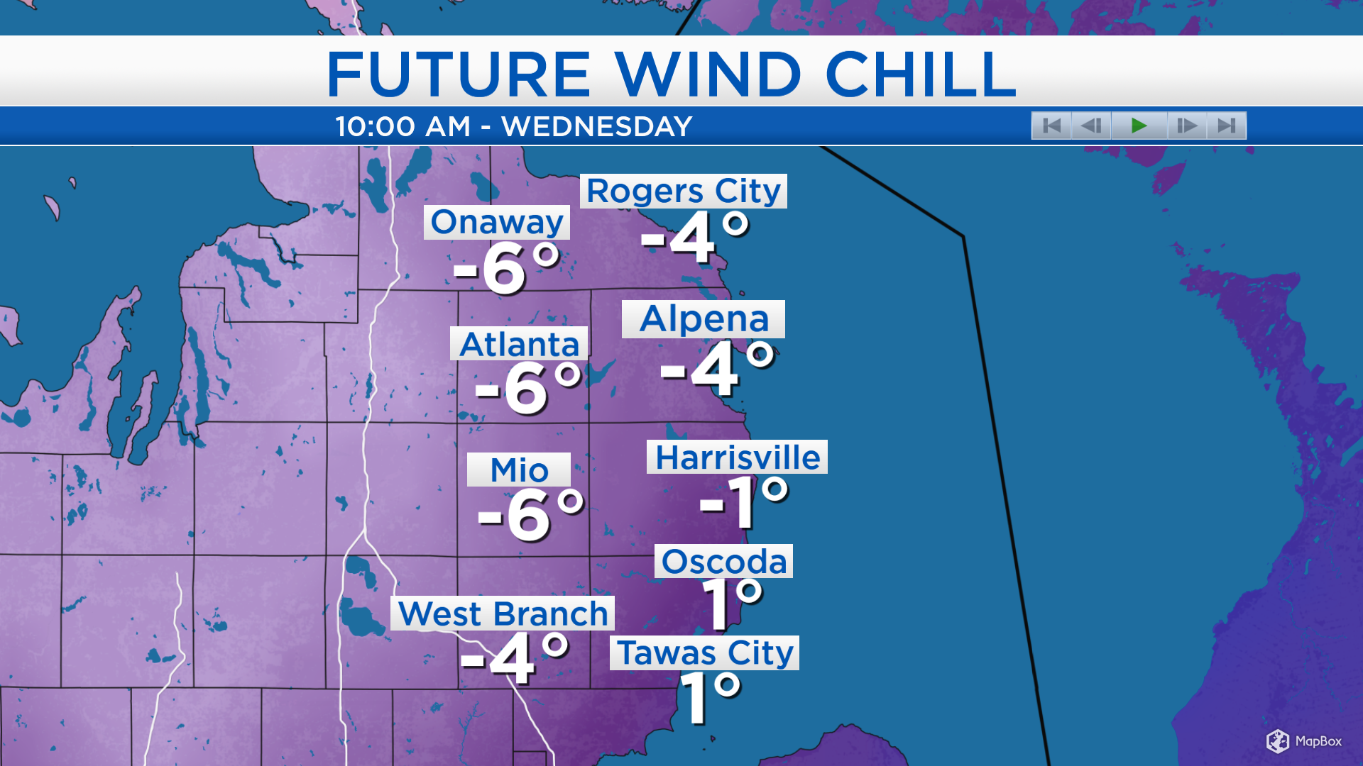
A few flurries are possible north of M-32 tonight and early tomorrow. Otherwise, mainly cloudy skies are expected. High temperatures will reach only the middle to upper teens. Afternoon wind chills will be close to 0, so it will feel brutally cold onto any exposed skin.
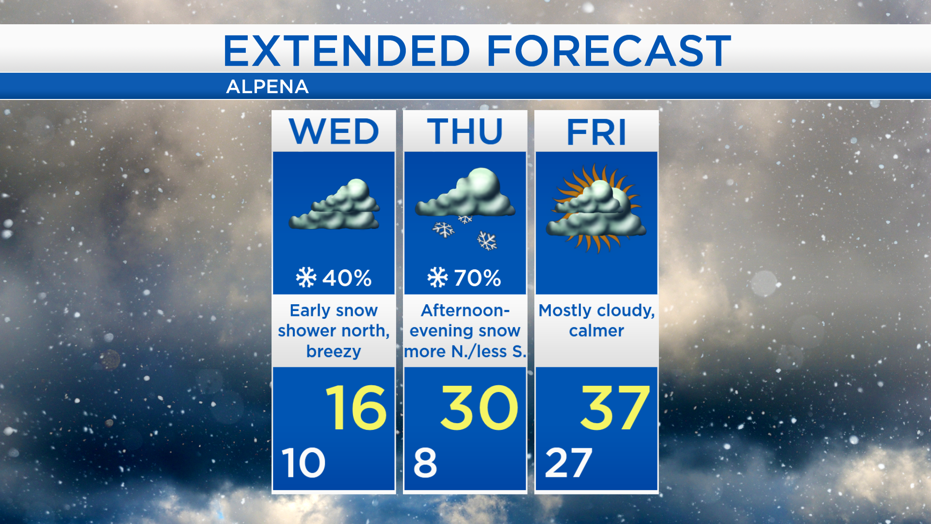
Wednesday night will also be very cold, low temperatures will drop to the single digits heading into early Thursday. A light breeze out of the south will help temperatures warm to 30 degrees Thursday afternoon. High temperatures will climb to the upper 30s Friday and Saturday.
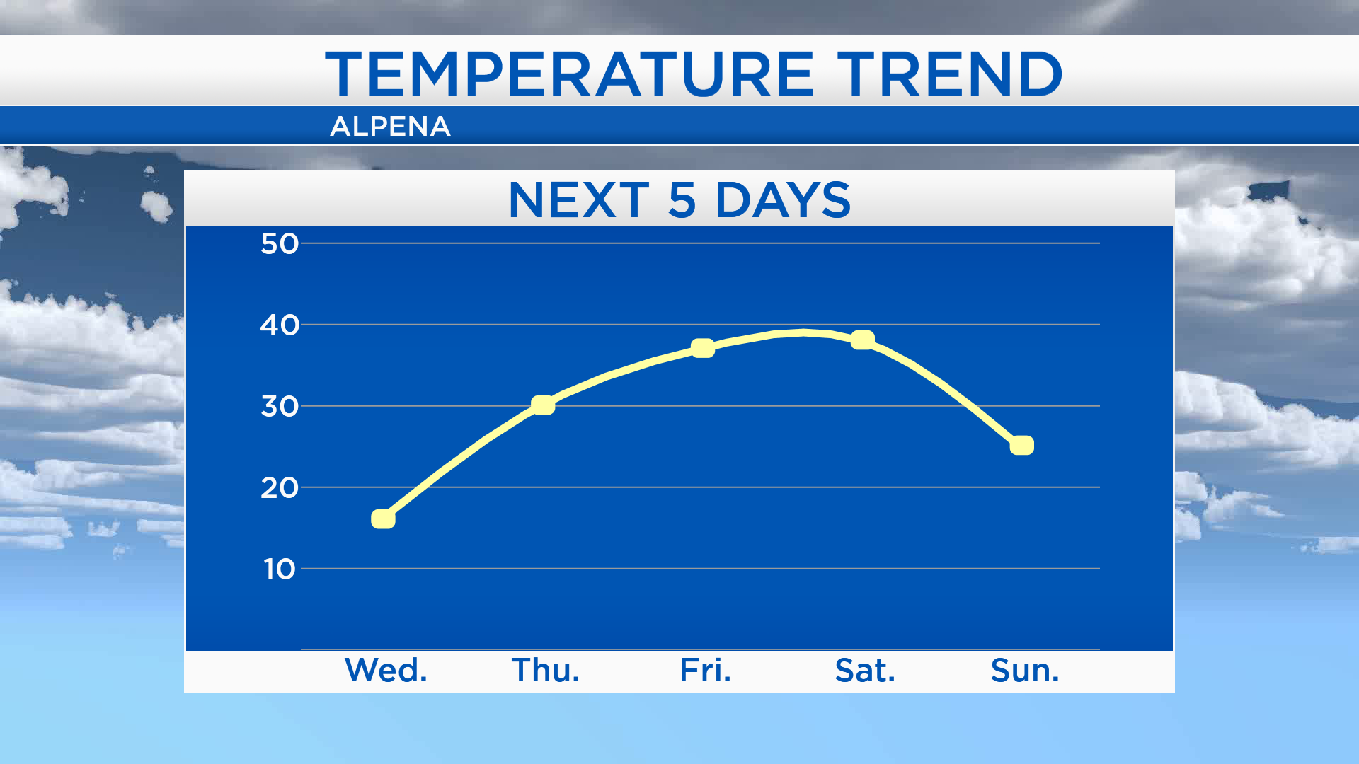
Wednesday will be very cold with gray skies. Snow showers will likely move in Thursday afternoon and continue Thursday evening. Snowfall amounts will be highest north of Hubbard Lake, and less south of the Alcona County border. Dry conditions are expected Friday with mostly cloudy skies. Rain showers changing to snow showers will be possible Saturday with highs in the upper 30s then cooler temperatures Sunday. For the rest of Northeast Michigan’s weather forecast, watch the latest weather video by clicking the weather tab at the top of the page.