Another cold morning, then snow Thursday afternoon-evening
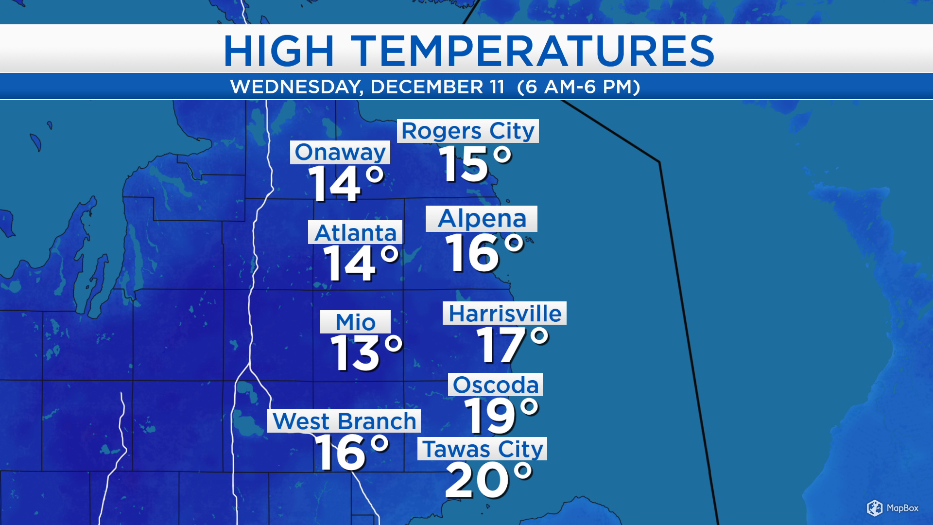
High temperatures today reached only the middle to upper teens for most of Northeast Michigan — today’s highs were 15 to 20 degrees below normal! Winds out of the west occasionally gusted close to 30 mph, which created afternoon wind chills near zero. Temperatures will rise tomorrow, likely taking until after sunset to reach Thursday’s high temperature.
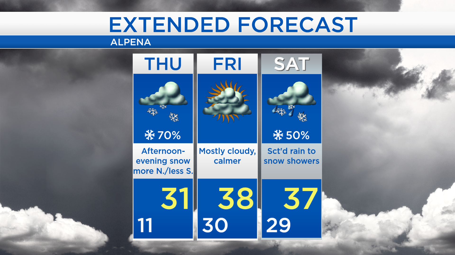
Our next storm system has been producing snow over North Dakota and Montana. It’s moving east, and will give snow to Northern Michigan and the Upper Peninsula. After that, dry conditions are likely on Friday.
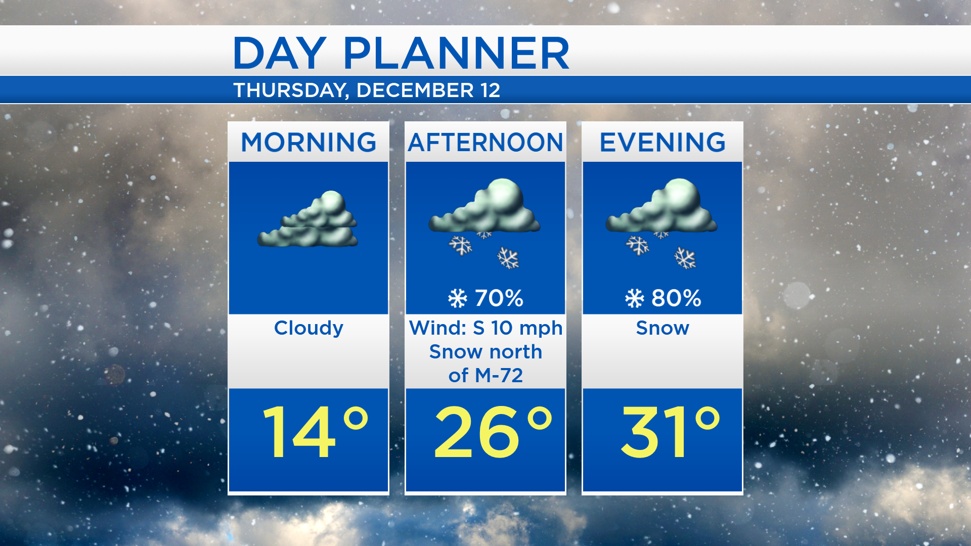
Tomorrow will start with cold temperatures, near 14 degrees in the morning under cloudy skies. Snow showers will move in around midday. There could be a break in the late-afternoon, then more snow showers in the evening. Afternoon temperatures will reach the middle to upper 20s, then temperatures will continue to climb to 31 degrees after sunset.
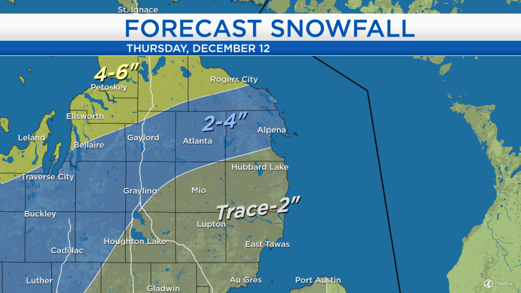
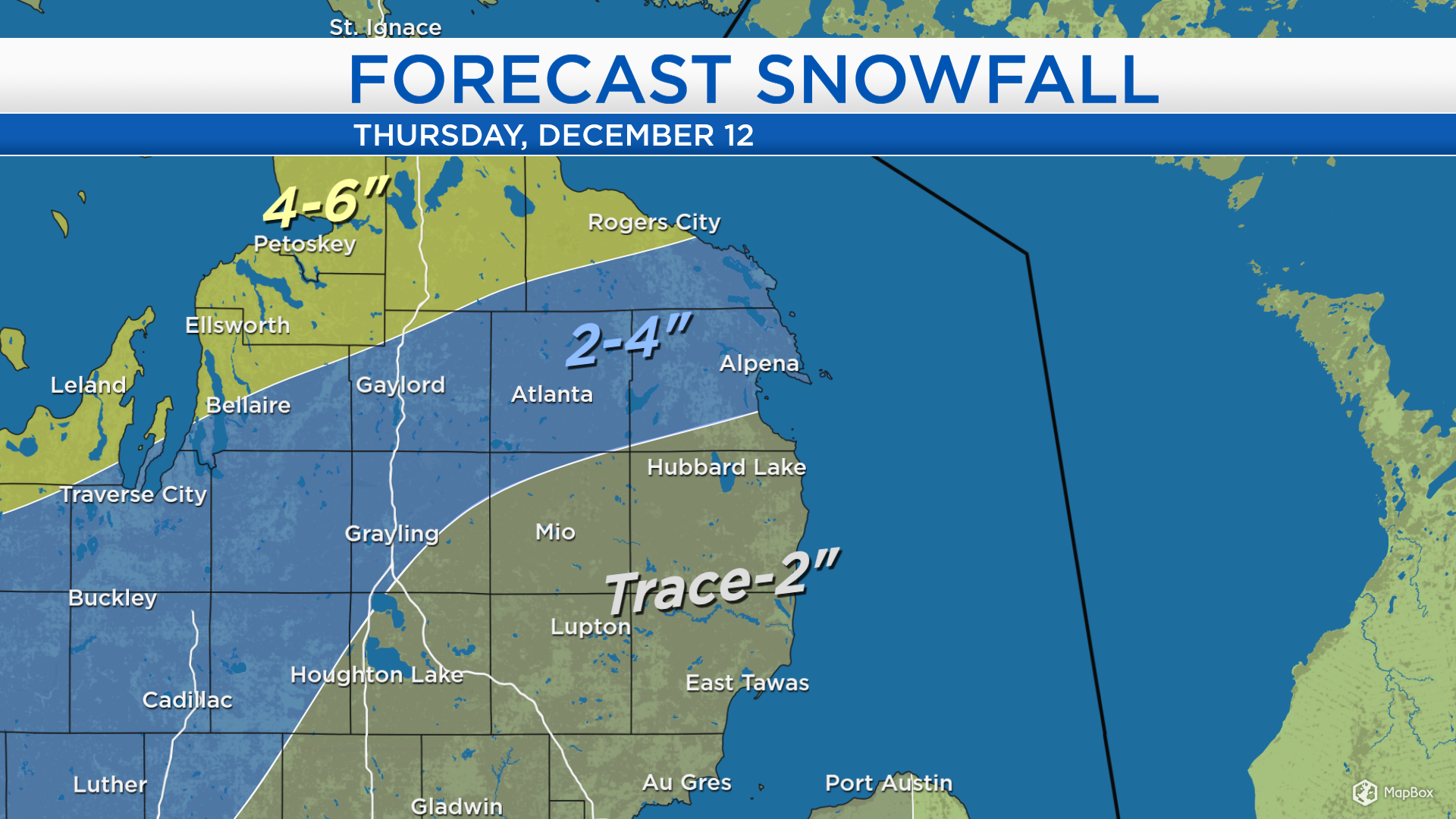
Snowfall amounts Thursday will be greatest north of Alpena. Parts of Presque Isle County, Cheboygan County, and west toward Petoskey will get 4-6 inches of snow. Alpena, west along M-32 to Gaylord and along I-75 to Grayling, 2-4 inches of snow are forecast. South of Hubbard Lake, snowfall amounts will be less.
Thursday, snow will be most likely in the afternoon and evening. Mainly dry conditions and warmer temperatures will move in Friday, highs will get up to about 38 degrees. Scattered rain showers are possible Saturday afternoon, changing to a chance of scattered snow showers Saturday evening. Colder temperatures will return Sunday. For the rest of Northeast Michigan’s weather forecast, watch the latest weather video by clicking the weather tab at the top of the page.