Wet Wednesday; Temperatures trend colder late-week
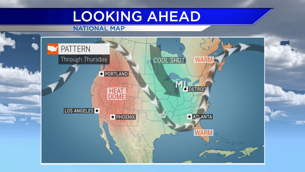
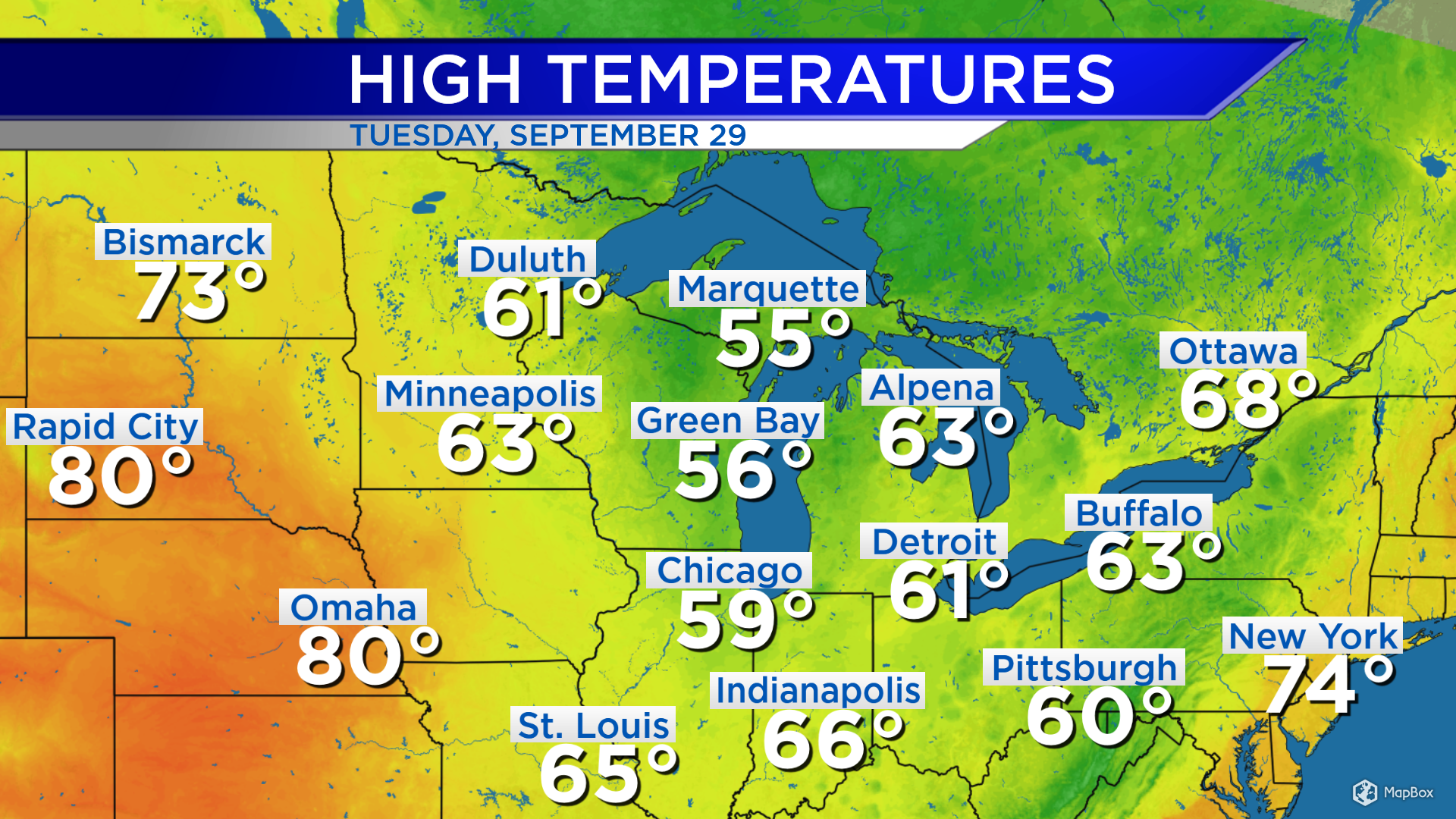
High temperatures across the Great Lakes were ranging from the middle 50s to lower 60s. The jet stream is diving well into the southeastern states, causing colder air from the north to spread into the Great Lakes region. Another cold front will move through our area Thursday, bringing in even colder temperatures late-week.
Heat is building out west and up the East Coast. The jet stream acts as a major divider between hot and cold air. Cold air will spill as far south as the jet stream. The jet stream will be positioned well south of Michigan, allowing even colder air into Northern Michigan.

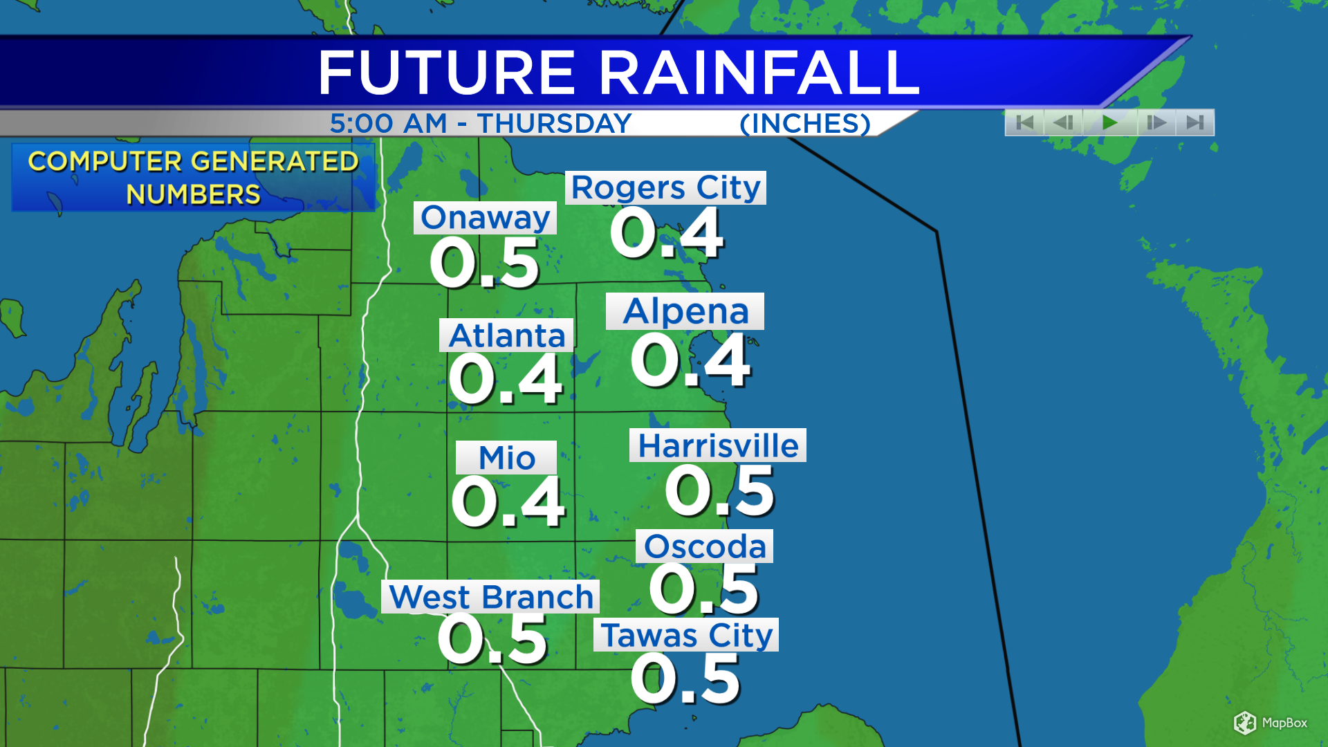
In addition to the cold air, showery weather will arrive early Wednesday and continue into Thursday. There will likely be periods of dry weather Wednesday night to early Thursday. Rainfall amounts Wednesday morning to evening will likely be around 0.25-0.5 inches throughout Northeast Michigan.
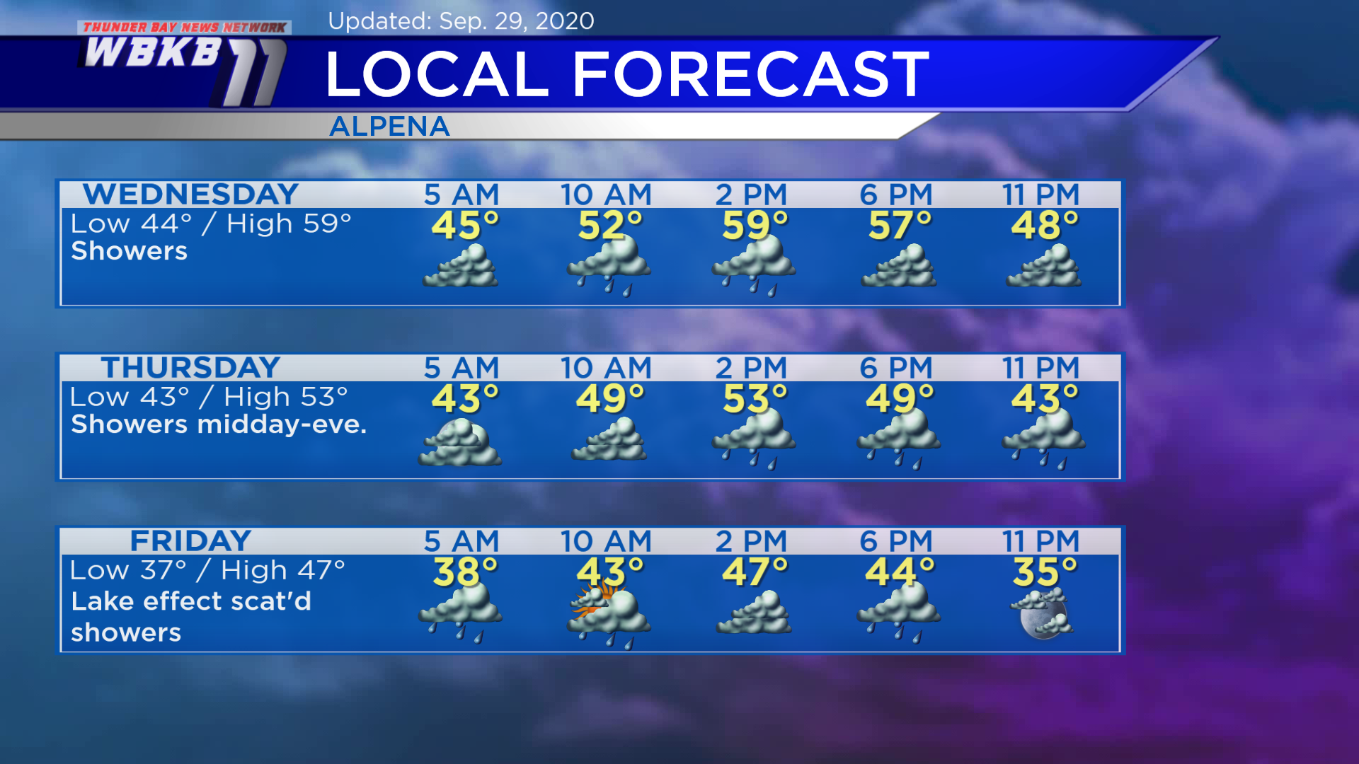
Wednesday: Showers until the early-evening. Predawn temperatures will cool to the middle 40s. Late-morning temperatures will be in the lower 50s. Afternoon highs will reach about 59 degrees. Early-evening temperatures will be in the middle 50s.
Thursday: Rain chances increase midday. Temperatures will start around the lower 40s in the early-morning. Late-morning temperatures will be close to 50 degrees. Afternoon highs will be near 53 degrees. Early-evening temperatures will dip to the upper 40s.
Friday: Scattered rain showers possible. Temperatures will drop to the upper 30s predawn. Late-morning temperatures will rise to the middle 40s. Afternoon highs will reach only the upper 40s. Early-evening temperatures will be in the lower 40s.
For the rest of Northeast Michigan’s weather forecast, watch the latest weather video by clicking the weather tab at the top of the page.