Wet overnight to early Tuesday, drying out in the afternoon

A low pressure system over southern Wisconsin is bringing showers to our area. More showers will move in overnight and last until early Tuesday. A stationary boundary parked across Mid-Michigan divides much warmer temperatures south of it compared to the cool temperatures over Northeast Michigan. This boundary also acts as a guide for where showers will end up, mainly along it and just north.
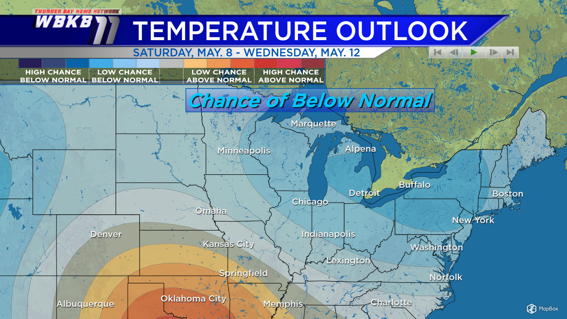
The long-range temperature outlook shows the likelihood of values above or below normal from the weekend to the middle of next week. At this point, the Climate Prediction Center is forecasting a chance of below-normal temperatures throughout this period. Cool temperatures will last all of this week and possibly into part of next week.
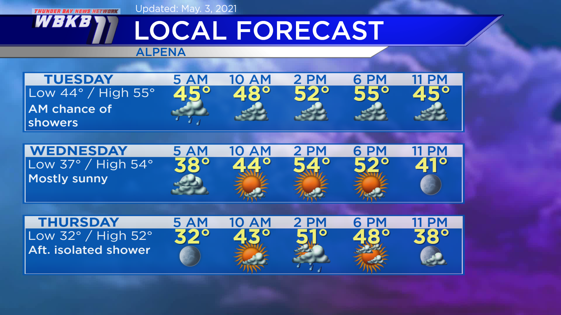
Tuesday: Chance of showers early, then mainly cloudy. Early-morning lows will head down to about 44 degrees. Afternoon highs will reach close to 55 degrees. Evening temperatures will go from the lower 50s to the upper 40s.
Wednesday: Much brighter, a breeze out of the northwest. Predawn lows will cool to around 37 degrees. Afternoon highs will be near 54 degrees. Evening temperatures will head into the 40s.
Thursday: An isolated shower possible in the afternoon. Early-morning temperatures will begin near 32 degrees. Afternoon highs will get up to about 52 degrees. Evening temperatures will be mainly in the 40s.
For the rest of Northeast Michigan’s weather forecast, watch the latest weather video by clicking the weather tab at the top of the page.
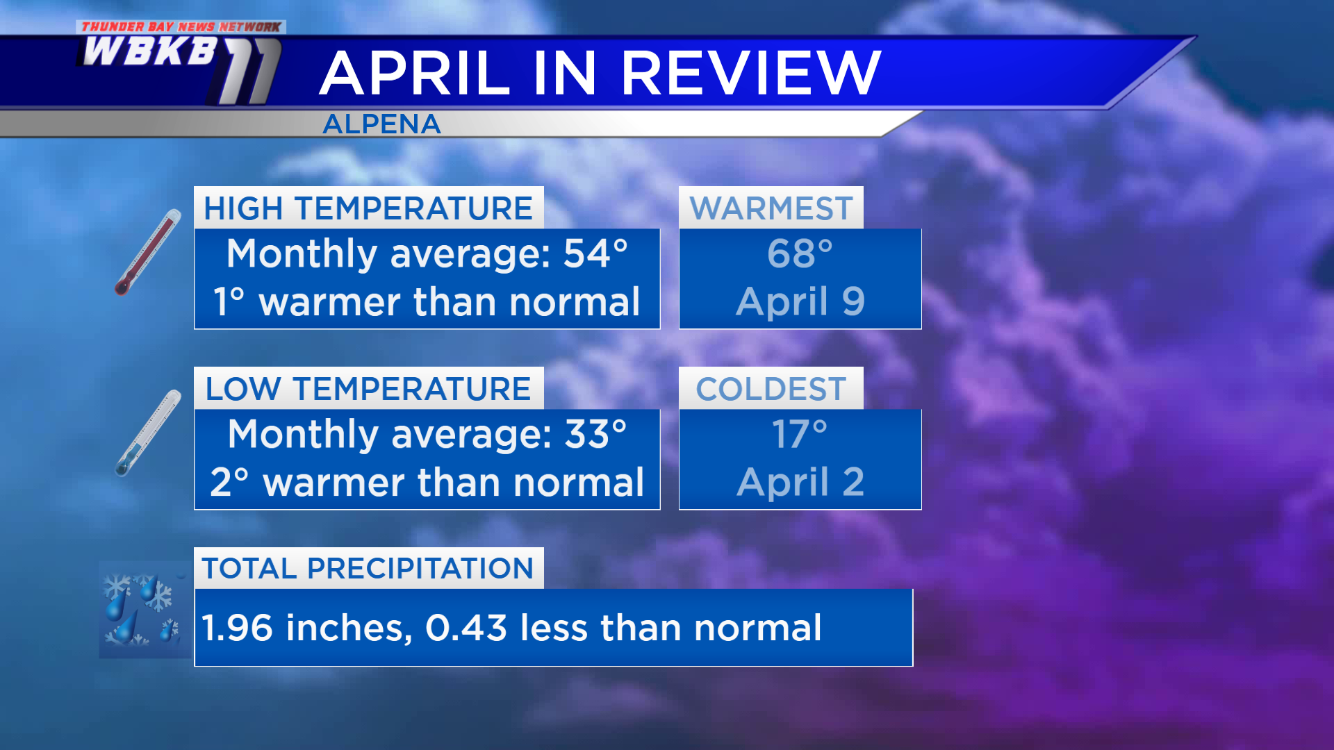
Looking back at April: Temperatures were just slightly warmer than normal, and precipitation a little below normal. The average of the daily highs throughout the previous month was 54 degrees, about 1 degree warmer than normal. Low temperatures throughout April averaged to 33 degrees, which is 2 degrees warmer than normal. Total precipitation, rain and melted snow combined, added up to just under 2 inches, nearly a half-inch less than normal.