Warm Friday morning with another round of rain; Sharply colder Friday afternoon-evening
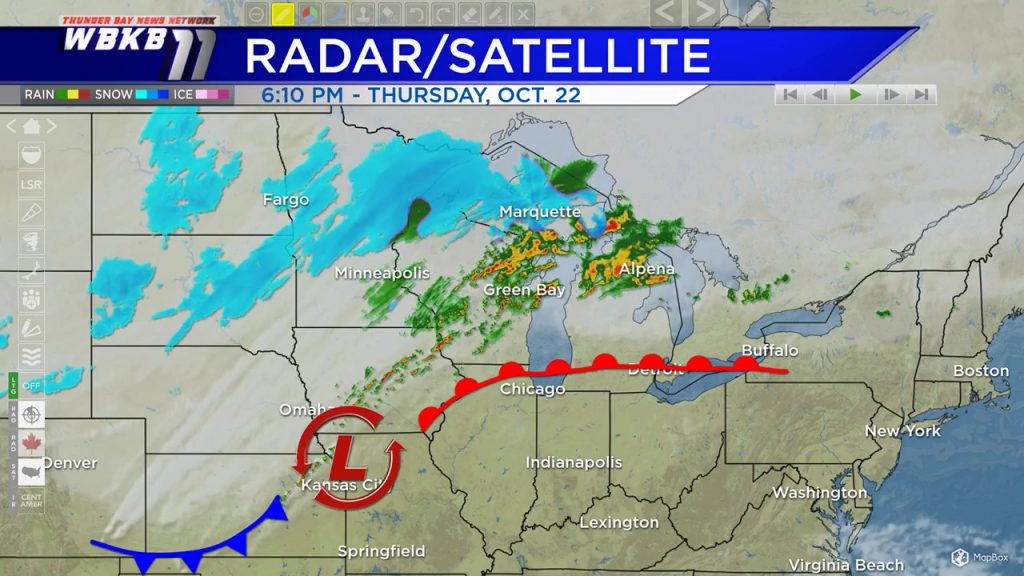
A first round of rain this evening is coming ahead of a warm front moving in from the south. This warm front is associated with a storm system centered the Kansas-Missouri border. This warm front, as it continues to travel northward, will bring rising temperatures overnight.
There could be some gaps of dry weather during the predawn hours early Friday. Then the cold front with this storm system will move across Northern Michigan Friday midday. The cold front will bring a second round of rain/thunderstorms Friday morning-afternoon.
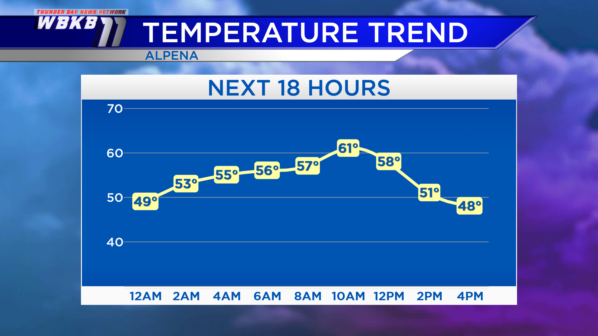
Overnight, temperatures will climb to the middle 50s. Temperatures will rise to the lower 60s Friday morning. Following the cold front, temperatures will drop sharply, heading to the upper 40s in the afternoon.
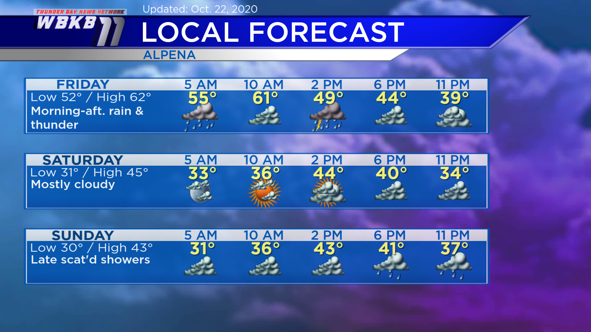
Friday: Rain and thunderstorms during the morning-afternoon. Winds will shift out of the northwest, about 15 mph. Morning temperatures will rise to the lower 60s. Temperatures will drop to the 40s in the afternoon.
Saturday: A dry day, mostly cloudy with cooler temperatures. Early-morning temperatures will begin in the lower 30s. Afternoon highs will be close to 45 degrees. Early-evening temperatures will be in the upper 30s.
Sunday: Gray skies, a chance of showers will move in late. Temperatures will remain cool. Predawn lows will be near 30 degrees. Afternoon highs will reach only around 43 degrees. Evening temperatures will dip to the upper 30s.
For the rest of Northeast Michigan’s weather forecast, watch the latest weather video by clicking the weather tab at the top of the page.