Spotty showers possible Tuesday; Muggy Wednesday
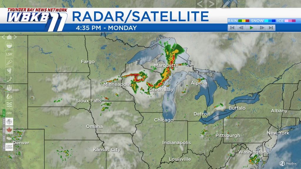
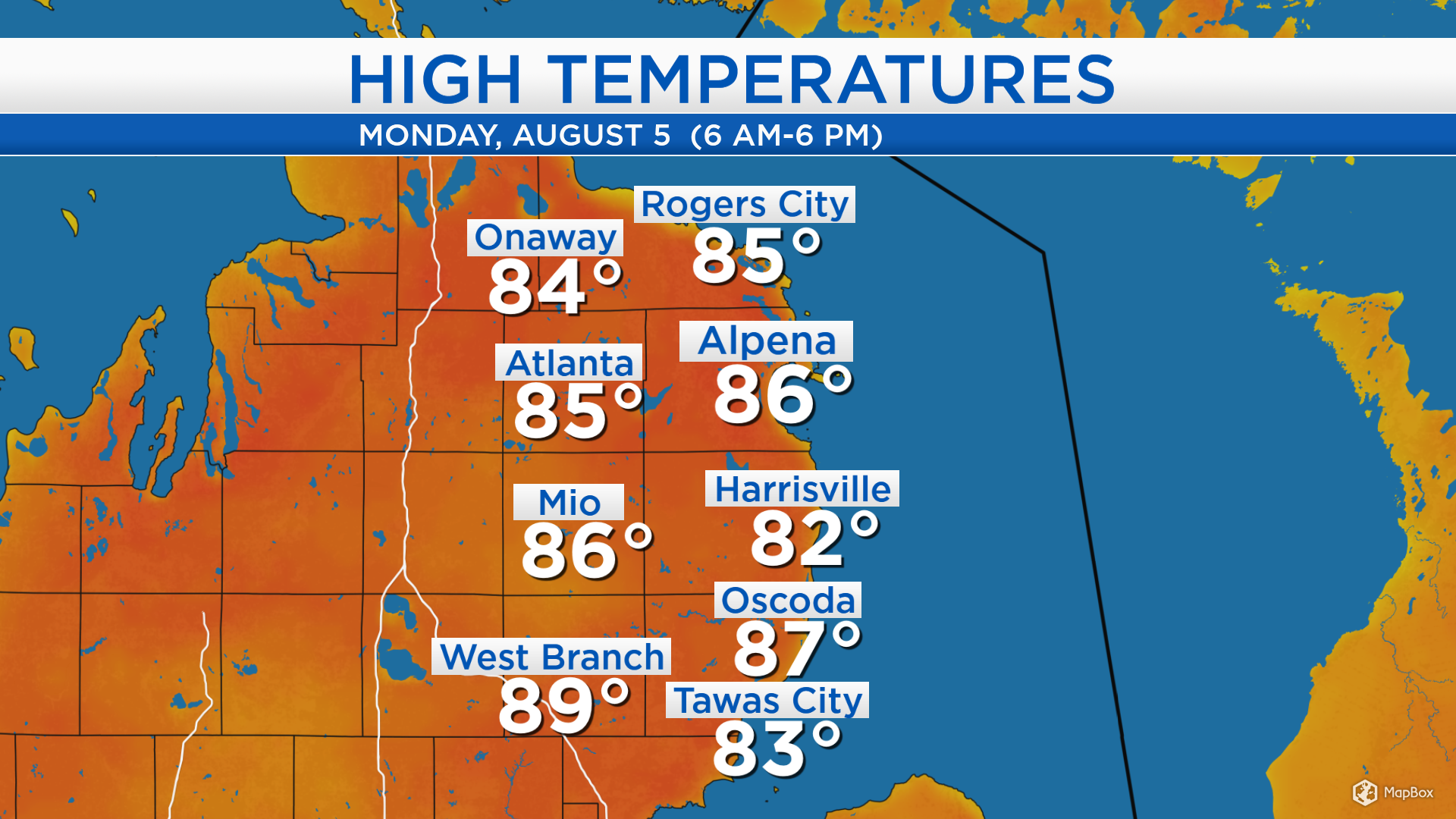
High temperatures today reached the middle 80s under a warm and humid air mass. An incoming cold front has sparked some instability, producing scattered thunderstorms this afternoon. A strong line of thunderstorms will move in from the west later this evening. Tomorrow will be noticeably less stormy.
A cold front will bring thunderstorms this evening. The skies over North Dakota and Minnesota are clearer, and we will likely see some periods of sunshine tomorrow. A few isolated showers are possible, but mostly dry periods are expected. Wednesday will start with sunshine, then the next cold front moving out of central Canada could produce more storms Wednesday night.
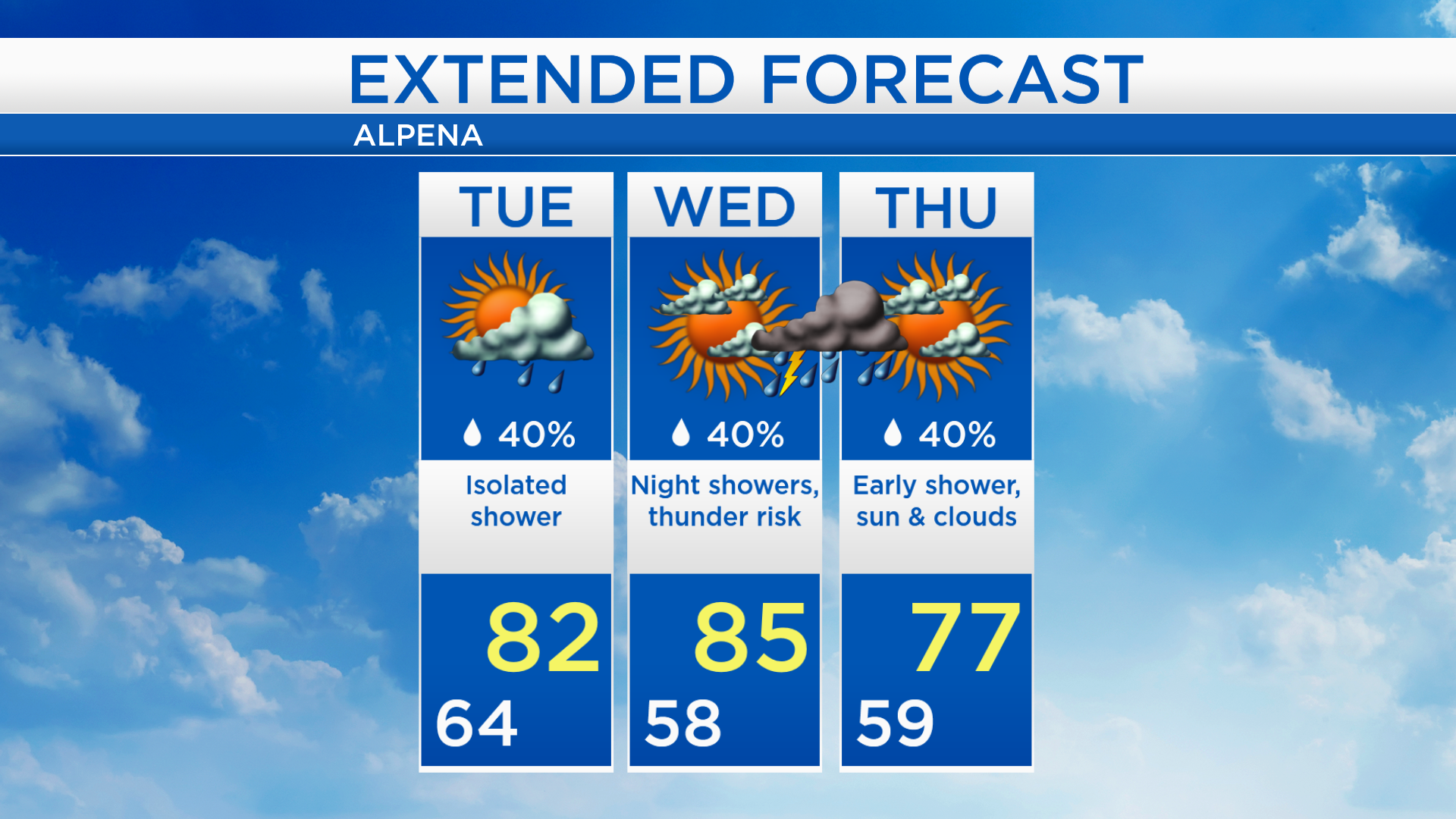
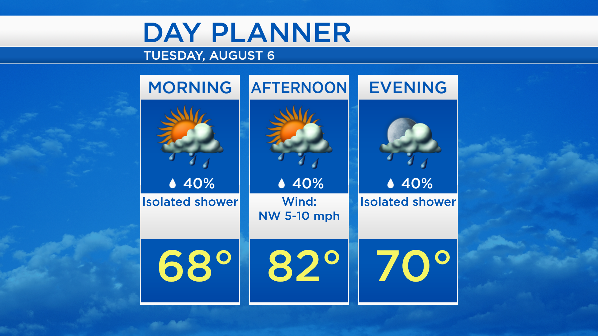
Low temperatures tonight will settle in the lower 60s and the main line of thunderstorms will progress east of our area. Despite a chance of spotty showers, some breaks of sunshine are expected tomorrow. High temperatures will reach the lower 80s and humidity levels will remain elevated.
Temperatures will remain warm and high humidity will continue over the next two days. High temperatures will reach the middle 80s on Wednesday, then a cold front will move through late Wednesday-early Thursday. After that cold front, colder temperatures are expected late-week. High temperatures will reach the upper 70s on Thursday and middle 70s on Friday with noticeably lower humidity.
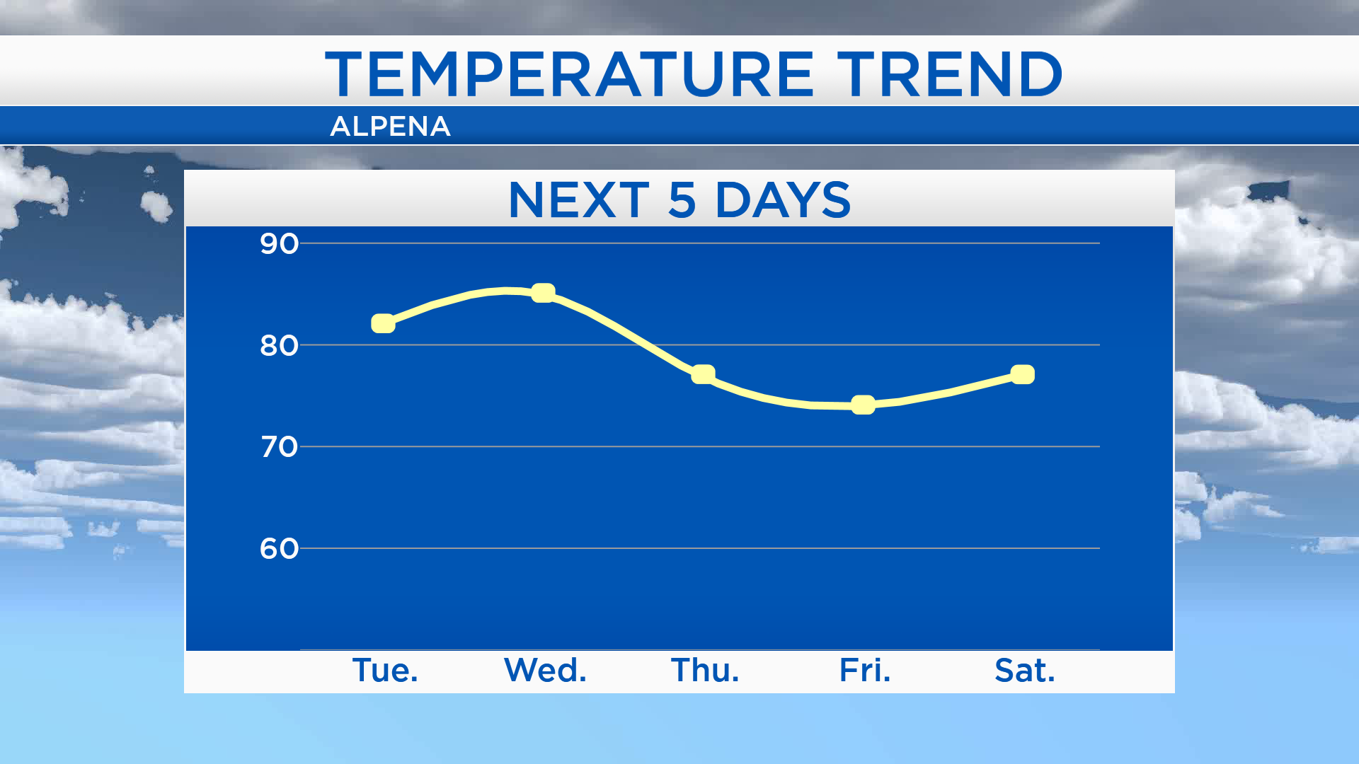
Tomorrow should end up mostly dry but remain warm and muggy as afternoon high temperatures warm up to 82 degrees. Temperatures will climb to 85 degrees on Wednesday with periods of sunshine in the afternoon. A cold front will bring a chance of rain and thunderstorms Wednesday night. Cloud cover will clear on Thursday, and high temperatures are forecast to reach 77 degrees. For the rest of Northeast Michigan’s weather forecast, watch the latest weather video by clicking the weather tab at the top of the page.