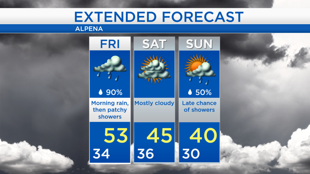
Rain early tomorrow; Less wind and cooler Saturday
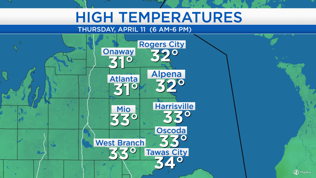
Temperatures as of the late-afternoon reached the lower 30s across Northeast Michigan, but it felt blustery with strong winds out of the east about 20 mph. Snow and sleet fell during the late-morning and afternoon, totaling 1.7 inches and broke the old record for snowfall on April 11 (1.6 inches set in 2007).
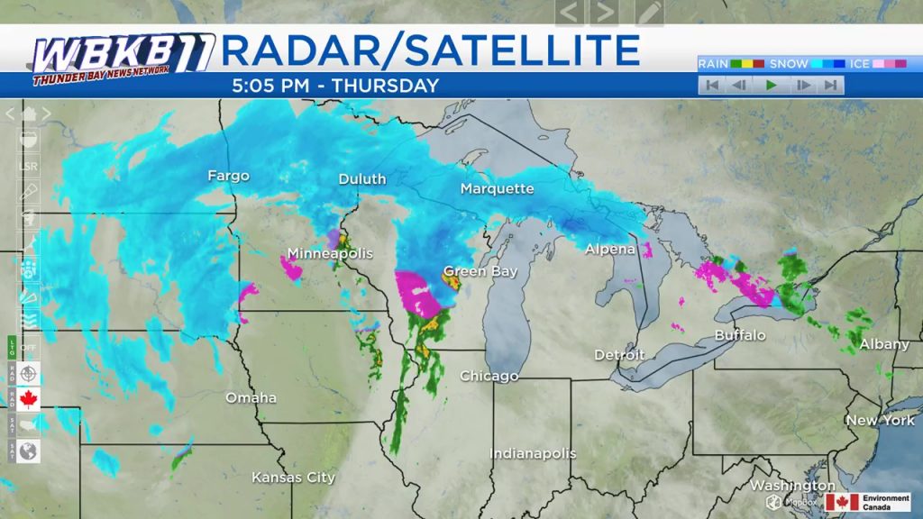
The earlier round of snow and sleet is moving north, through the Straits of Mackinac and the Upper Peninsula. We have a dry break of overcast skies although some patchy drizzle/freezing drizzle cannot be ruled out this evening. Later tonight, a band rain currently in Wisconsin and Illinois will continue to travel east, heading into our area. This could easily soak Northeast Michigan with a half-inch or slightly more rainfall. The center of this low pressure system is currently over western Iowa, and over the next 24 hours it will track through western Lake Superior.
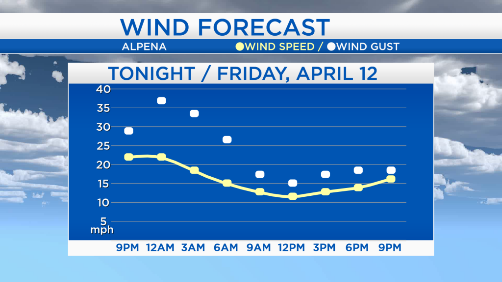
Winds will remain strong this evening and overnight, gusting over 30 mph at times. Winds will begin to ease tomorrow, settling near 15 mph for much of the day. (Occasional wind gusts are shown by the white dots, while sustained wind speeds are shown by the yellow line.)
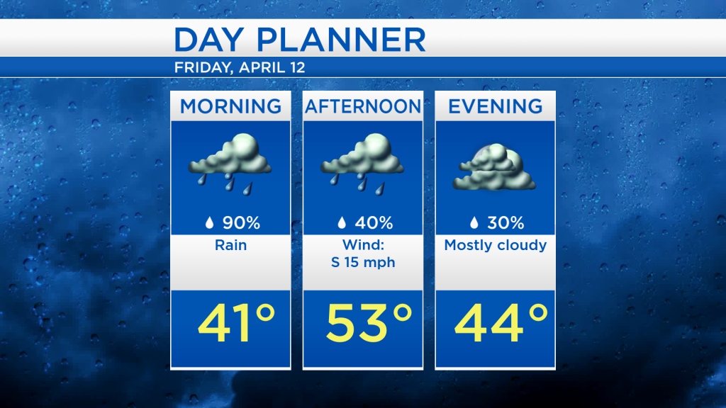
By tomorrow morning, temperatures will rise to the lower 40s with soaking rain likely. Winds out of the south will push warmer air into Northeast Michigan, afternoon temperatures will reach the lower 50s. The chance of showers will decrease tomorrow afternoon.
Tomorrow will start wet but should end drier, then Saturday is looking completely dry. Mostly cloudy skies are expected Saturday with high temperatures in the middle 40s. Temperatures will cool a little on Sunday with highs around 40 degrees. A weaker storm system passing just to our south could bring a chance of showers late Sunday, transitioning to flurries early Monday. For the rest of Northeast Michigan’s weather forecast, watch the latest weather video by clicking the weather tab at the top of the page.