On & off chances of thunderstorms through midweek
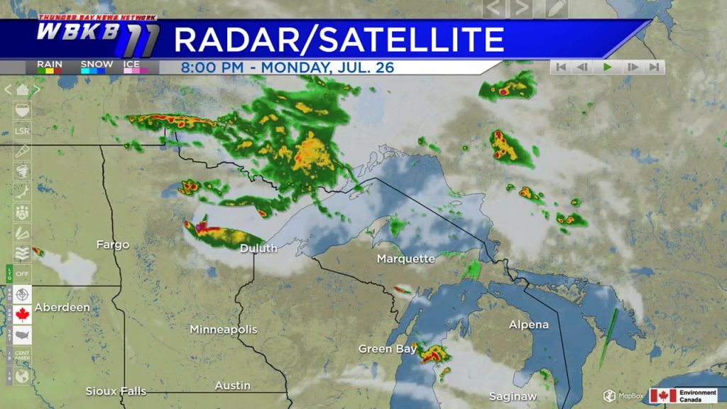
The first storm system to affect Northeast Michigan this week is developing over northern Minnesota. A complex of thunderstorms will travel toward the southeast. We will have rain and thunderstorms overnight to early Tuesday. Then a few spotty thunderstorms will be possible heading into Tuesday afternoon.
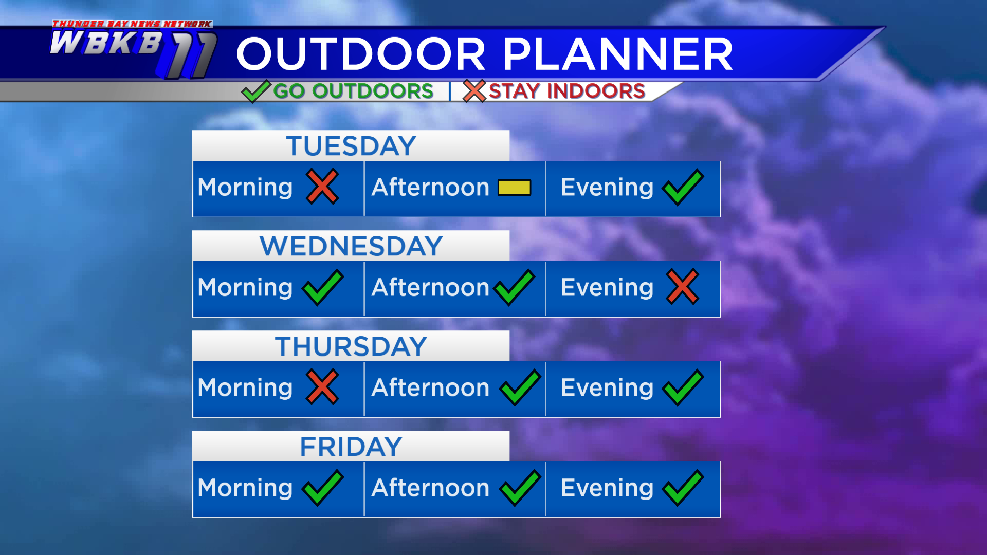
For any outdoor plans, you would likely want to avoid Tuesday morning. Tuesday afternoon, any showers will be hit-and-miss, nothing widespread. Tuesday evening through Wednesday afternoon looks more ideal for outdoor plans with dry weather likely. Then another chance of thunderstorms will move in late Wednesday, and a few showers could linger early Thursday. After that it’s going to turn dry and cooler Friday.
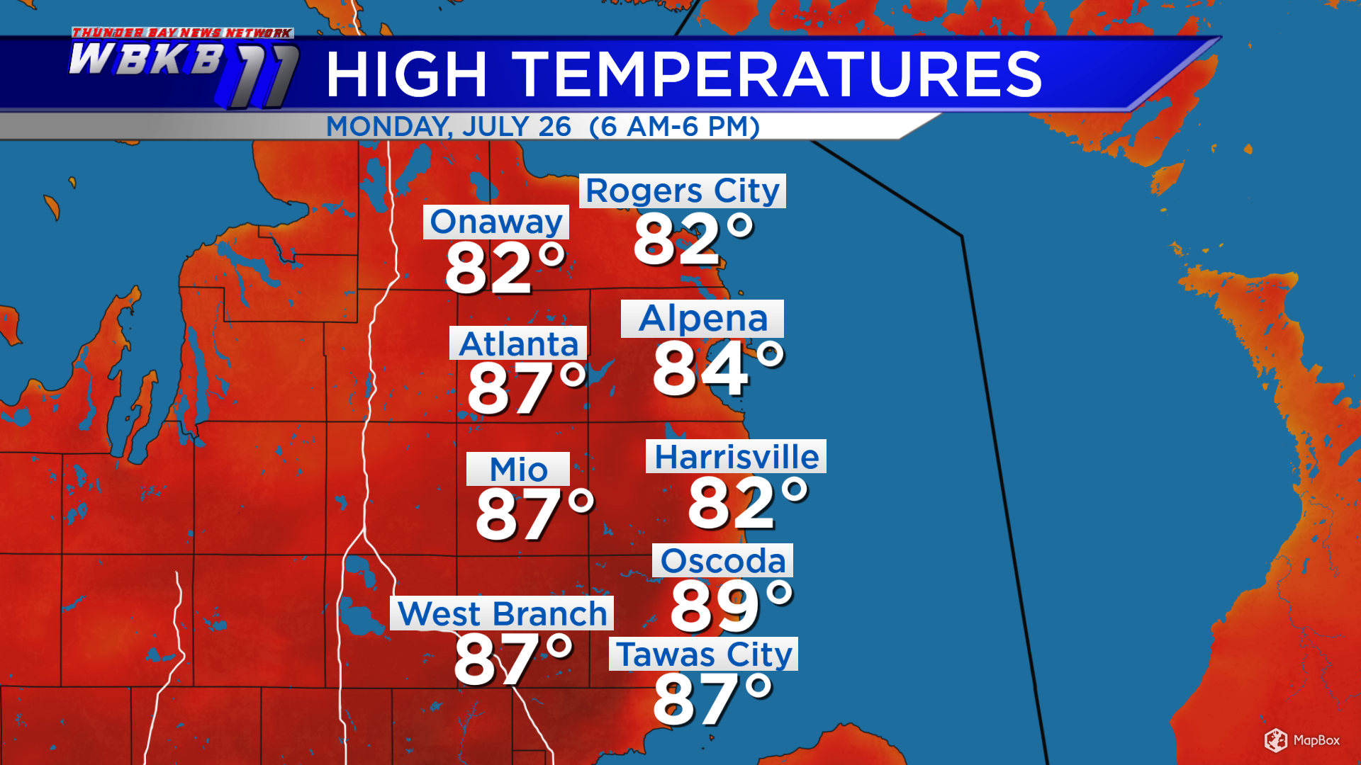
High temperatures Monday heated up to 84 degrees in Alpena, 89 degrees in Oscoda, Michigan and 82 degrees in Rogers City, Michigan. Light winds initially out of the north, then later out of the east on Tuesday will result in cooler temperatures.
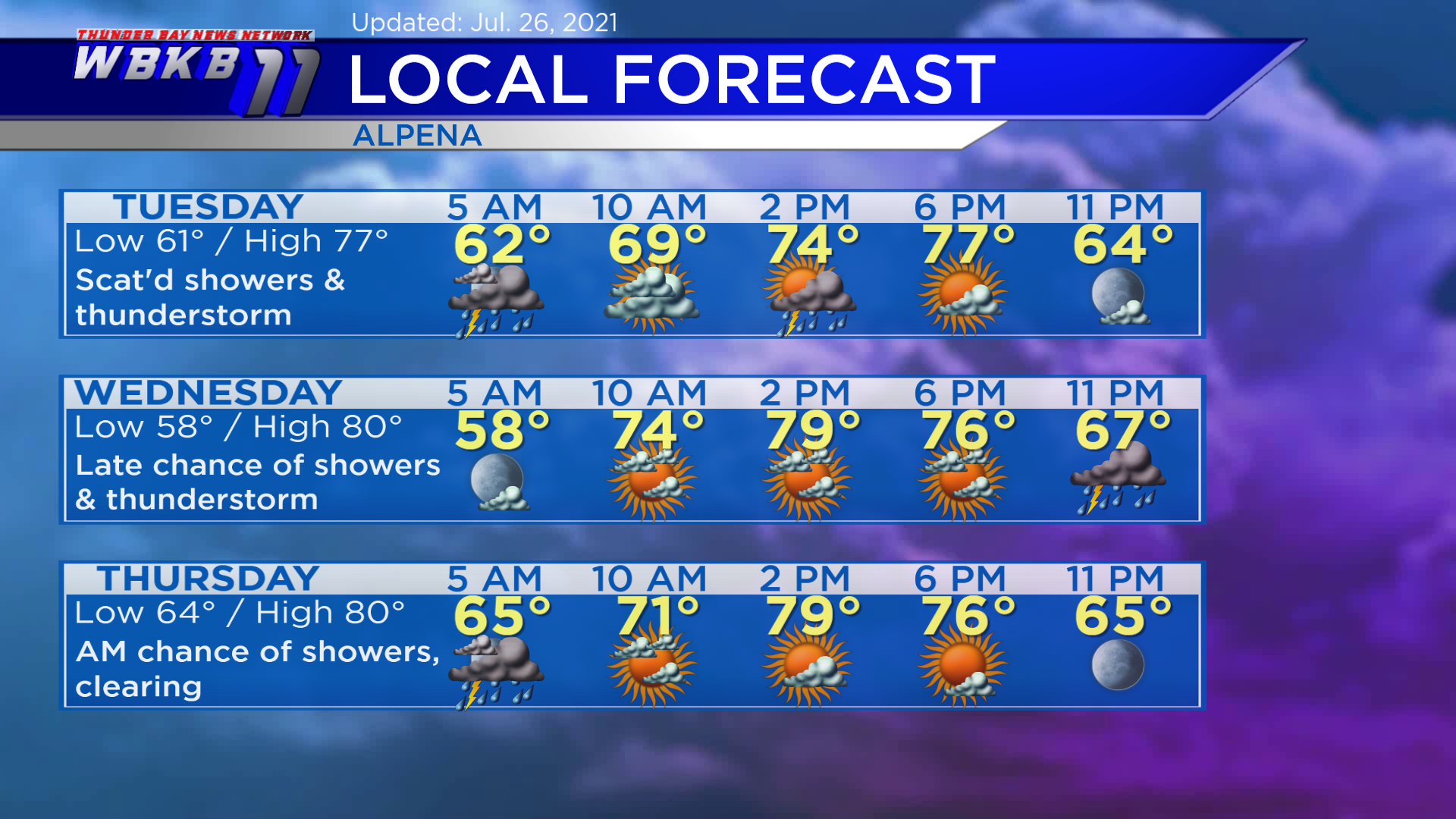
Tuesday: Scattered showers/thunderstorm possible in the morning-afternoon. Early-morning lows will head down to about 61 degrees. Midday temperatures will rise to the lower 70s. Highs will reach close to 77 degrees in the late-afternoon. Evening temperatures will cool from the middle 70s to middle 60s.
Wednesday: Mix of sun and clouds, then a chance of thunderstorms late. Predawn lows will drop to near 58 degrees. Afternoon highs will warm to around 80 degrees. Evening temperatures will go from the middle 70s to upper 60s.
Thursday: A chance of showers/thunderstorm risk early, then clearing. Early-morning lows will be close to 64 degrees. Afternoon highs will get up to about 80 degrees. Evening temperatures will cool from the middle 70s to middle 60s.
For the rest of Northeast Michigan’s weather forecast, watch the latest weather video by clicking the weather tab at the top of the page.