Brighter and warmer midweek; Watching Hurricane Zeta

Monday started with some patchy showers/flurries over Northeast Michigan. Drier air is moving in and shutting off any chances of showers/flurries. Tuesday will be dry although mostly cloudy. Brighter and warmer weather will arrive Wednesday.
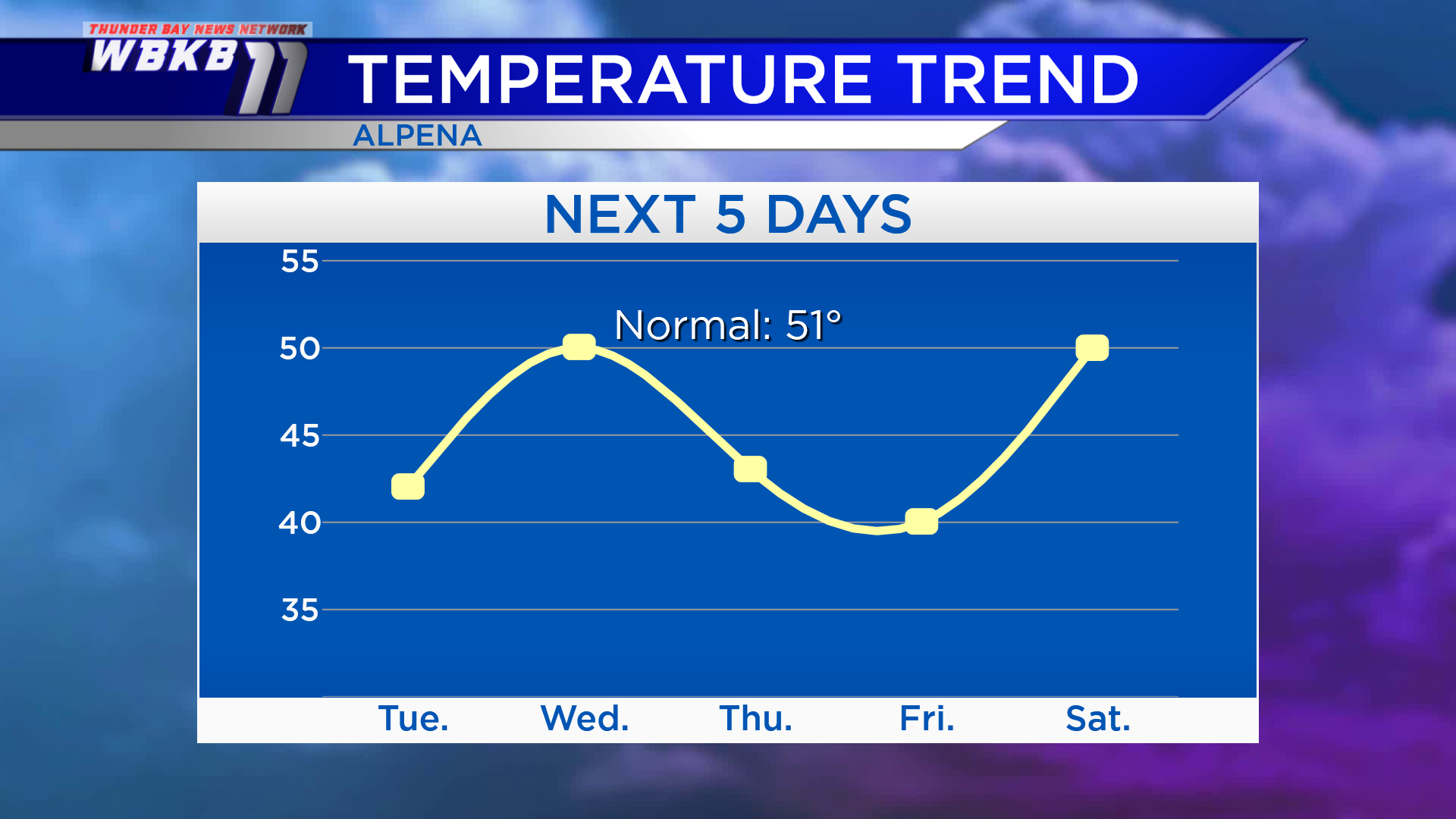
The normal high temperature for late-October is in the lower 50s. Most of this forecast has highs below “normal,” but there will be a couple of gems. A combination of sunshine and warmer temperatures will arrive Wednesday, then take a two-day hiatus, then reappear Saturday. Highs Tuesday will be nearly 10 degrees colder than “normal,” at 42 degrees. Wednesday, temperatures will climb to 50 degrees. Winds out of the NNE will bring a return to cooler temperatures Thursday with highs in the lower 40s. Highs will be near 40 degrees Friday. Temperatures will climb to about 50 degrees Saturday afternoon.
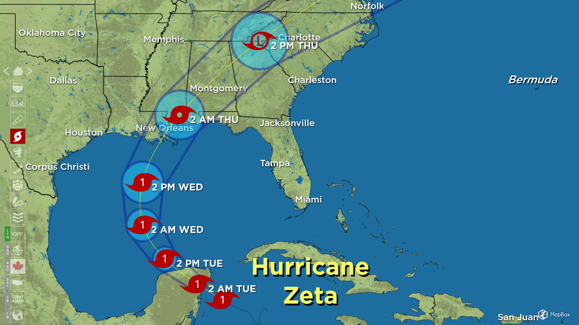
Hurricane Zeta — the 27th named tropical system of the season — will move over the Yucatan Peninsula Tuesday. It will head into the central Gulf of Mexico early Wednesday, likely remaining a category 1 hurricane. Late Wednesday, Zeta is forecast to make landfall somewhere between the central Louisiana coast and the western edge of the Florida Panhandle. After making landfall, its forecast path curves toward the Mid-Atlantic states and is forecast to weaken. The remnants of Zeta will be broad enough, the current forecast calls for rain near the Michigan-Ohio border (but minimal rain chances north of Flint).
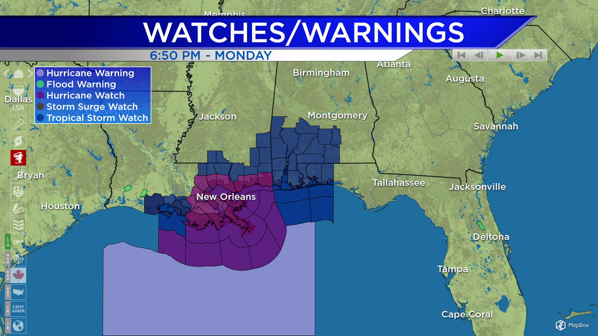
The forecast path of Hurricane Zeta has prompted Hurricane Watches (dark purple) and Tropical Storm Watches (dark blue) throughout parts of the Gulf Coast states, including Louisiana, Mississippi, Alabama and far western Florida. The difference between the two types of watches is the strength of winds expected. Hurricane alerts are issued for peak winds 74 mph and up, Tropical Storm alerts are issued for peak winds of 39-74 mph.
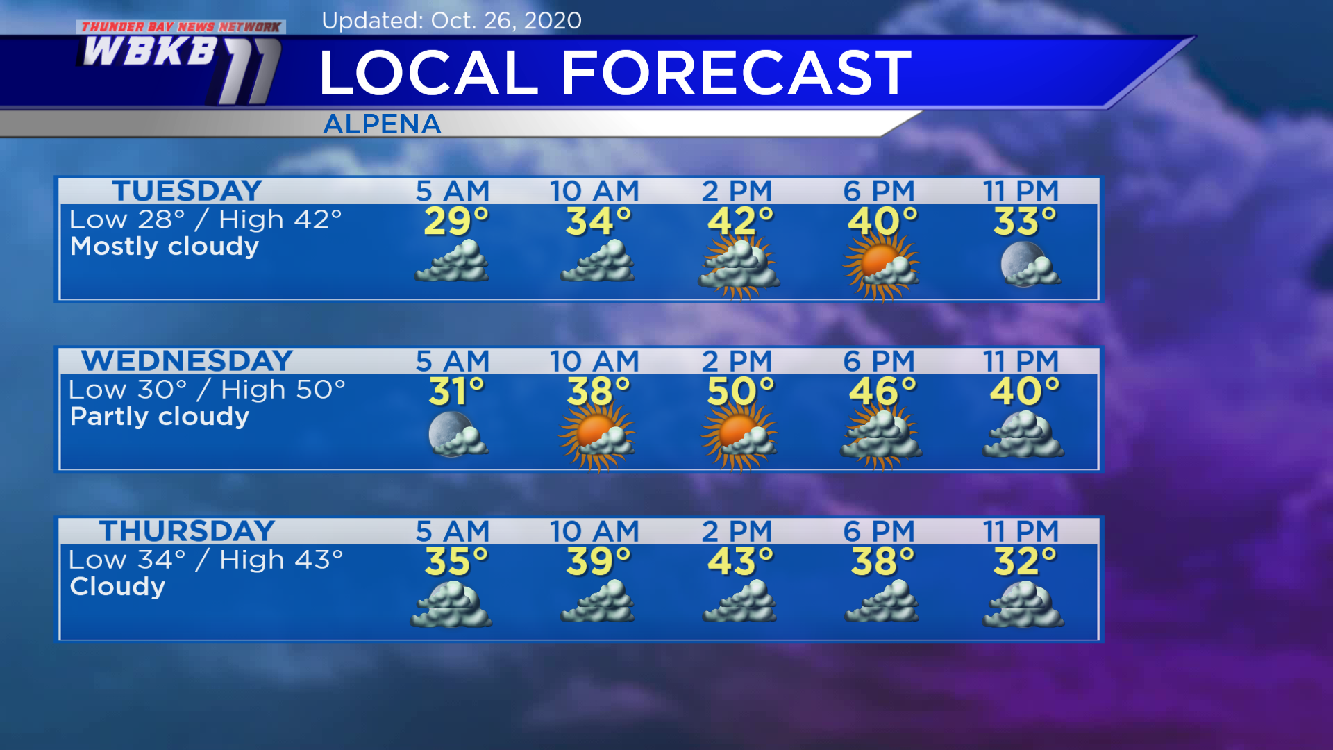
Around Northeast Michigan — Tuesday: Mostly cloudy. Temperatures will begin in the upper 20s predawn. Late-morning temperatures will rise to the middle/upper 30s. Afternoon highs will get up to only 42 degrees. Evening temperatures will cool to the 30s.
Wednesday: A little more sunshine, partly cloudy. Early-morning temperatures will be near 30 degrees. Late-morning temperatures will approach 40 degrees. Afternoon highs will be close to 50 degrees. Evening temperatures will dip to the lower/middle 40s.
Thursday: Gray skies as the remnants of Hurricane Zeta pass to our south. Early-morning temperatures will be in the middle 30s. Afternoon highs will be a cool 43 degrees. Evening temperatures will head into the 30s.
For the rest of Northeast Michigan’s weather forecast, watch the latest weather video by clicking the weather tab at the top of the page.