
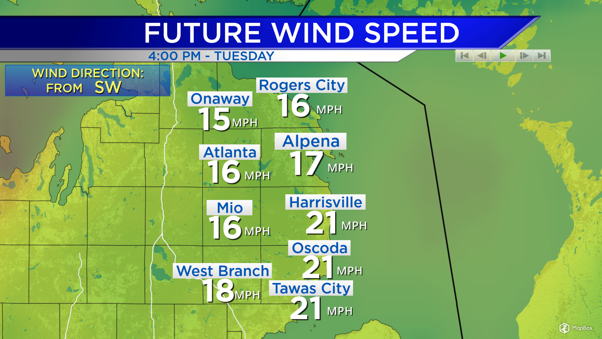
Breezy Tuesday with warmer temperatures by the afternoon

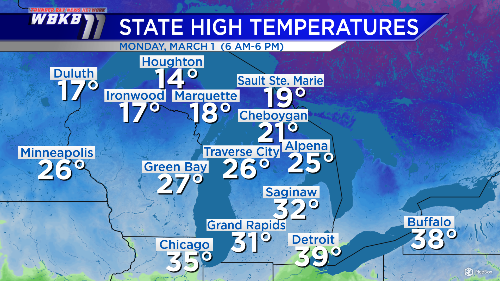
Following a cold front that moved through late Sunday, gusty winds have picked up out of the northwest. Those winds have brought significantly colder temperatures to Northeast Michigan and a few lake effect snow showers coming off of Lake Huron. Daytime highs Monday reached 25 degrees in Alpena, 32 degrees in Saginaw, Michigan and 19 degrees in Sault Ste. Marie, Michigan. A chilly night is in store with low temperatures dropping to the single digits.
The gusty northwest winds have also produced lake effect snow showers. Most of Monday’s lake effect snow fell west of the Alpena area. Within Northeast Michigan, snow showers mainly affected eastern parts of Presque Isle County, also Montmorency and Oscoda counties. A few flurries flew elsewhere, not amounting to anything closer to Alpena.
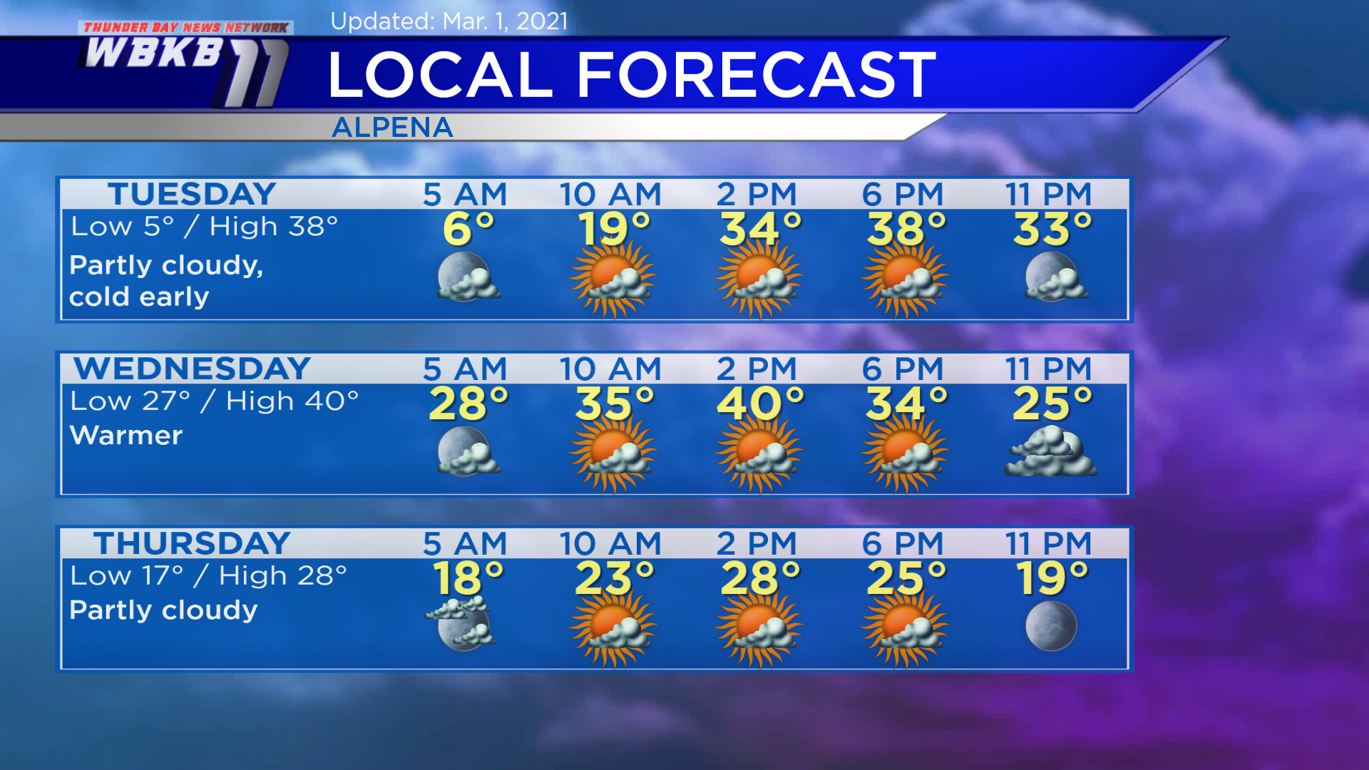
Tuesday: Cold early, partly cloudy. Predawn lows will drop to about 5 degrees. Late-morning temperatures will rise to around 20 degrees. Afternoon highs will get close to 38 degrees. Evening temperatures will remain in the 30s.
Wednesday: Partly cloudy, a little warmer. Early-morning temperatures will dip to the upper 20s. Afternoon highs will reach near 40 degrees. Evening temperatures will cool from the lower 30s to the upper 20s.
Thursday: Partly cloudy, not as warm. Predawn temperatures will go into the upper teens. Afternoon highs will be close to 28 degrees. Evening temperatures will be near 20 degrees or in the lower 20s.
For the rest of Northeast Michigan’s weather forecast, watch the latest weather video by clicking the weather tab at the top of the page.
Taking a look back at February: Temperatures were not as cold, compared to normal, as you might have expected. Despite the arctic outbreak Feb. 6-16, the average of daily high temperatures was 28 degrees, which is just 1 degree cooler than “normal.” That’s because the arctic outbreak was placed between a period of warm temperatures during the first few days of the month and also the last several days of the month. During the prolonged cold weather, temperatures got down to minus 8 degrees on Feb. 10. The average of all the low temperatures throughout the month was 8 degrees, which is 4 degrees cooler than normal. Total snowfall for the month was 17.4 inches, near normal.
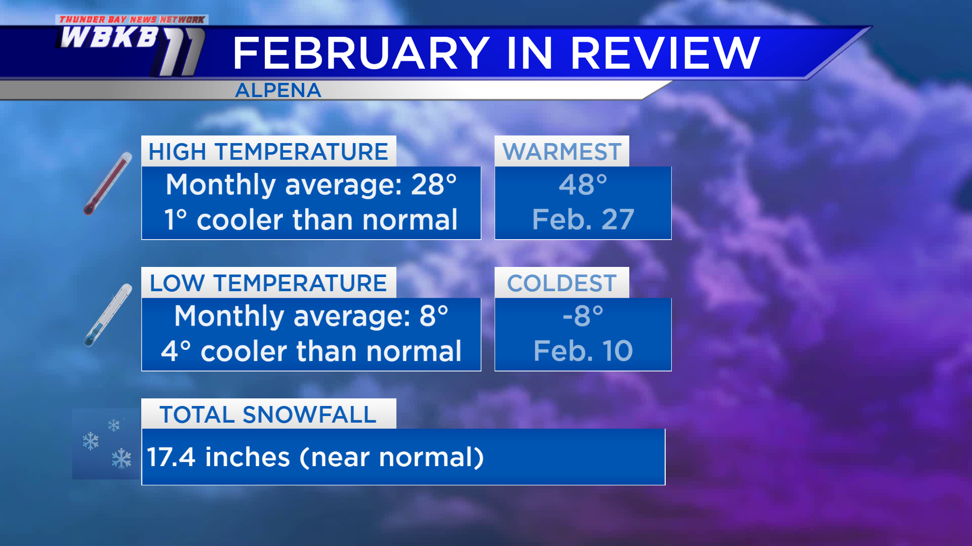
Normal refers to the long-term average, using values from the period of 1981-2010, to compare recent observations.


