Mild temperatures building in mid-week
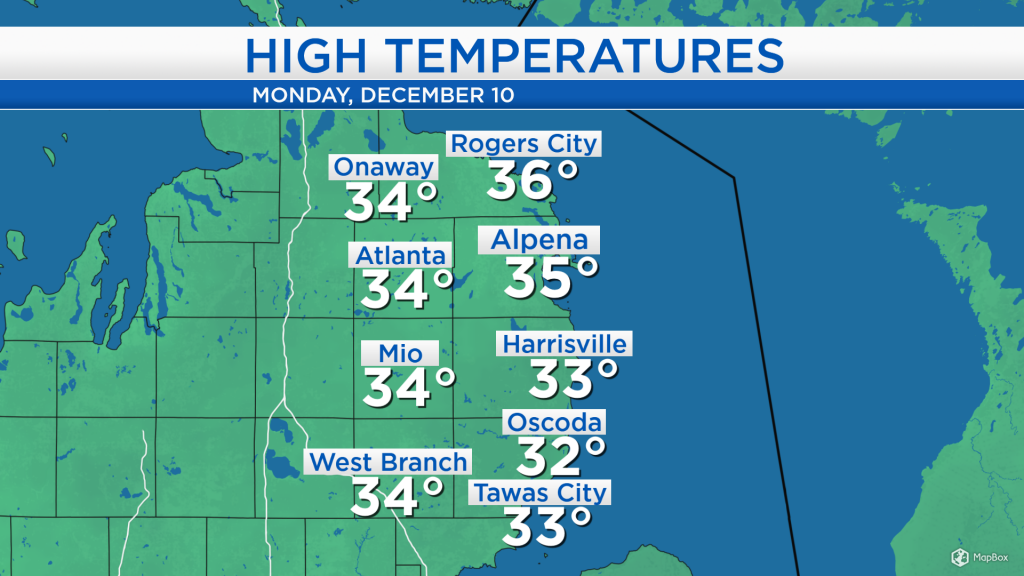
High temperatures today reached the mid-30s with cloudy skies until the mid-afternoon. Light winds shifting out of the south and high pressure over Indiana have brought some sunshine in the late-afternoon. Winds shifting back out of the west will help bring low-level cloud cover off of the Great Lakes as we saw through this morning and early-afternoon.
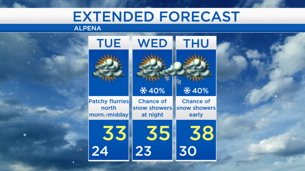
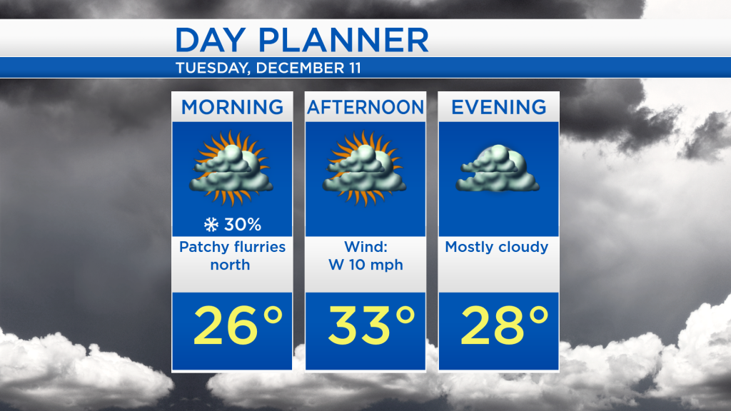
There isn’t a whole lot of active weather showing up across the Midwest. A weak cold front dropping out of Northern Ontario could bring a chance of flurries tomorrow morning, mainly for Alpena, Montmorency, Presque Isle counties and points to the north and west. A separate, weak system currently in southwestern Canada will travel through the Plains states, and produce a chance of short-lived snow showers Wednesday night-early Thursday. A third system, still a way off, currently in the northern Pacific, will travel across the county and likely bring a rain/snow mix on Friday.
Overnight low temperatures will drop to the lower and middle 20s, and dry weather will generally remain through tomorrow. A chance of flurries will move through northern sections of our area tomorrow morning, then mostly cloudy skies are expected throughout the day as highs reach the lower 30s.
Temperatures throughout the week will gradually warm to the upper 30s. The daytime hours of Wednesday should remain dry with highs around 35 degrees, then a chance of snow showers will move through late Wednesday-early Thursday. After a brief round of snow showers, much of Thursday should end up dry as well. The most unsettled day of the forecast will be Friday, when a rain/snow mix will enter the area as high temperatures reach around 38 degrees. For the rest of Northeast Michigan’s weather forecast, watch the latest weather video by clicking the weather tab at the top of the page.