
Few flurries linger Thursday; Getting warmer by the weekend
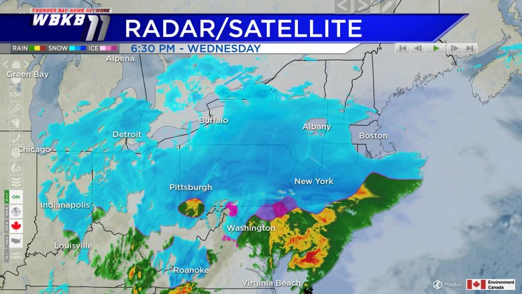
A light breeze from the east generated some patchy flurries coming off of Lake Huron today. Something similar could happen Thursday with a light breeze from the northeast, a few lake effect flurries could drift onshore. The major headline throughout the country is the massive winter storm hammering the Mid-Atlantic and Northeast.
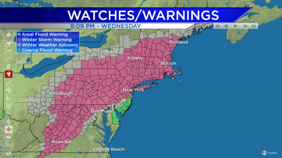
Winter Storm Warnings remain posted from Virginia to Massachusetts and now extend into southern Maine, where heavy snow is expected. Some places highlighted in pink are expecting over a foot of snow through Thursday.
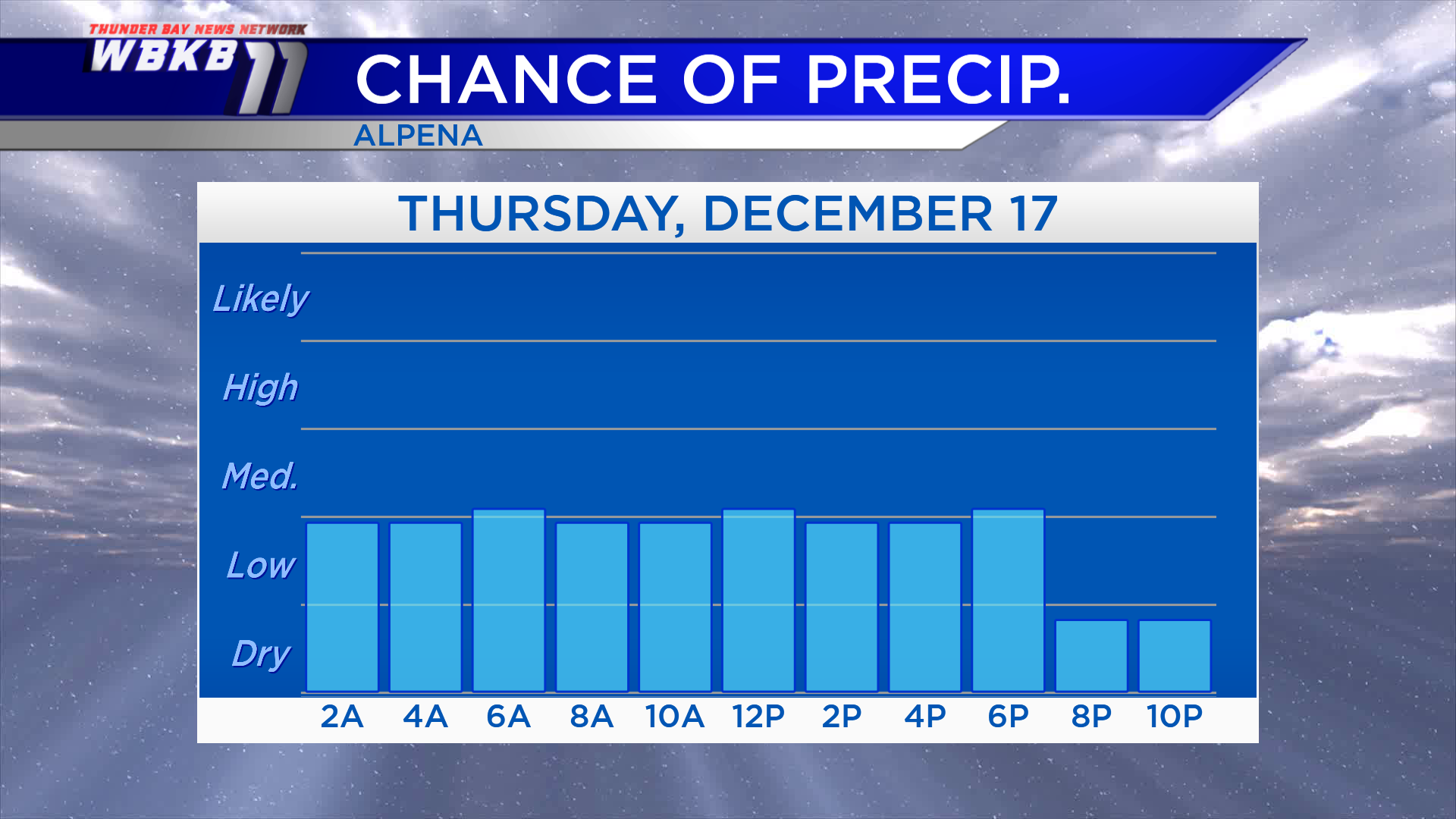
Around Northeast Michigan, patchy flurries are possible overnight through Thursday afternoon. The chance of flurries doesn’t get any higher than medium — indicating some hit-and-miss flurries. Any snowfall will amount to very little (much like Wednesday).
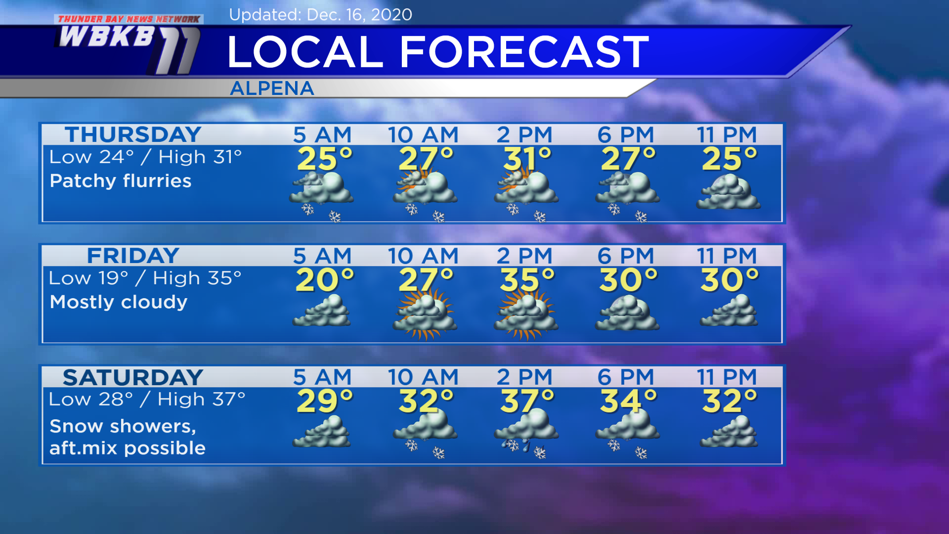
Thursday: Patchy flurries, seasonable afternoon temperatures. Predawn temperatures will begin around 24 degrees. Afternoon highs will be near 31 degrees. Evening temperatures will dip to the middle 20s.
Friday: Mostly cloudy, a breeze picking up from the south will bring warmer afternoon temperatures. Predawn temperatures will drop to about 19 degrees. Afternoon highs will reach close to 35 degrees. Evening temperatures will be near 30 degrees.
Saturday: Scattered snow showers with rain/snow mix possible in the afternoon. An incoming cold front originating from western Canada will bring some unsettled weather, although there will not be much cold air to follow. Early-morning temperatures will be in the upper 20s. Afternoon highs will rise to about 37 degrees. Evening temperatures will be in the lower 30s.
For the rest of Northeast Michigan’s weather forecast, watch the latest weather video by clicking the weather tab at the top of the page.


