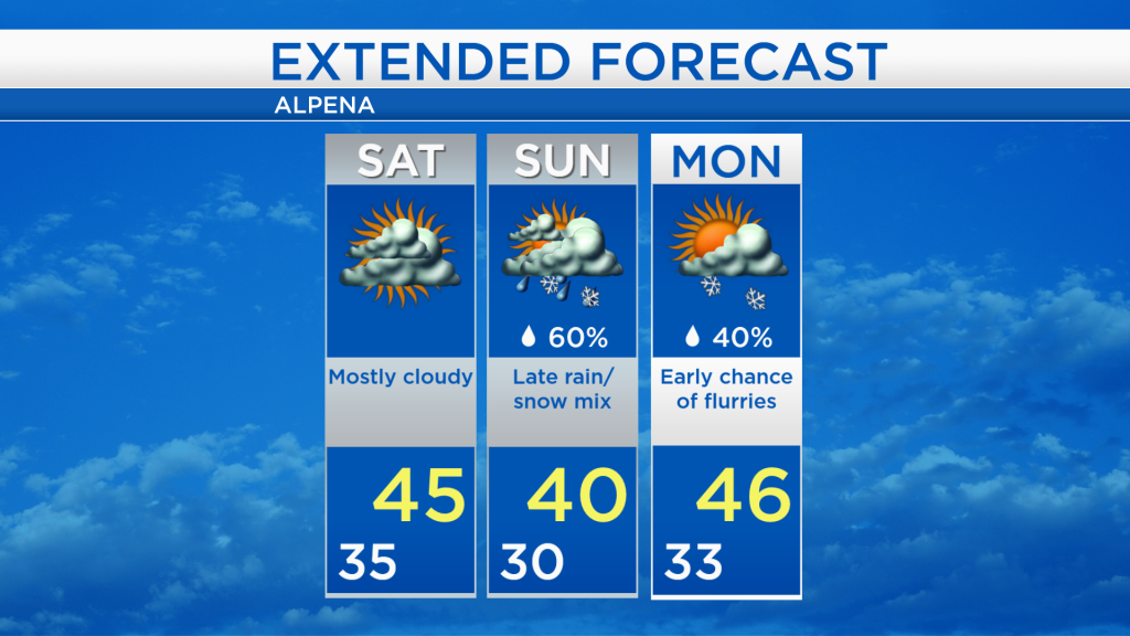
Cooler and drier most of the weekend; Chance of rain/snow late Sunday
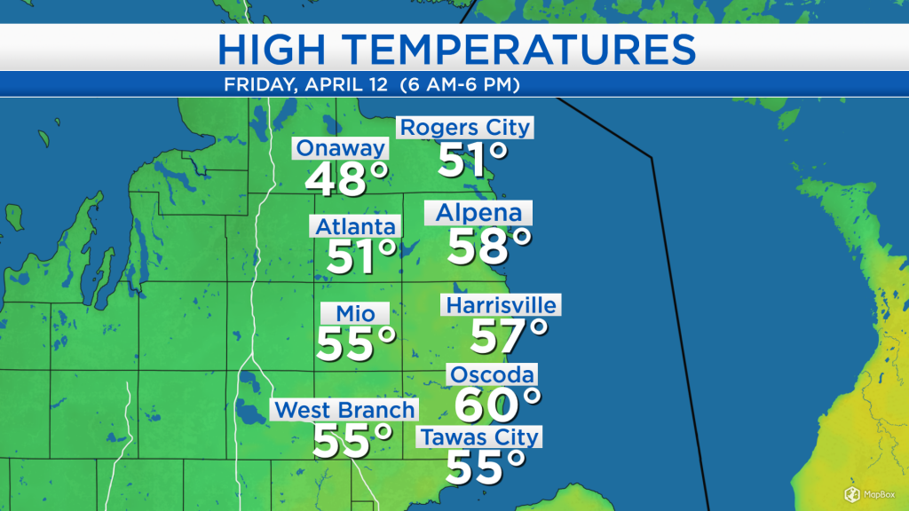
High temperatures today reached the middle 50s for most of Northeast Michigan. After morning rain and even a few predawn thunderstorms, the clouds began to break apart in the afternoon. Some sunshine and winds out of the southwest at 15-20 mph helped give these warm temperatures.
There are still some scattered snow showers across northern Minnesota and northern Wisconsin. As the storm system moves north into central Canada, these snow showers will travel through the Upper Peninsula, but should not be an issue for Northeast Lower Michigan. Mostly cloudy skies are expected tonight-tomorrow.
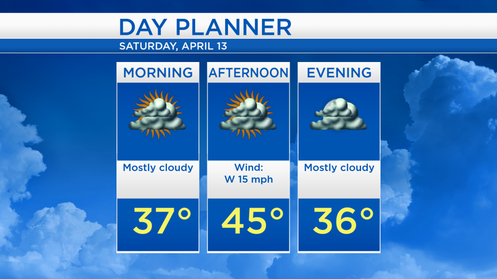
Overnight temperatures will drop to the middle 30s. High temperatures tomorrow afternoon will reach close to 45 degrees with a breeze out of the west about 15 mph. Mostly cloudy skies are expected all day, at least we will see a dry day from start to finish.
Temperatures will cool a little on Sunday, high temperatures will only get up to 40 degrees. Sunday is expected to start with dry weather. Then, a system from the Deep South moving toward the Great Lakes will give a likely chance of showers or flurries beginning in the late-afternoon and continuing through the nighttime hours. Rain and snowfall amounts appear very little for Northeast Michigan. A chance of flurries continues early Monday, but most of Monday and all of Tuesday should end up dry. Daytime highs will also warm early next week, reaching around 50 degrees on Tuesday. For the rest of Northeast Michigan’s weather forecast, watch the latest weather video by clicking the weather tab at the top of the page.