Chance of snow increases tomorrow night; Colder Friday
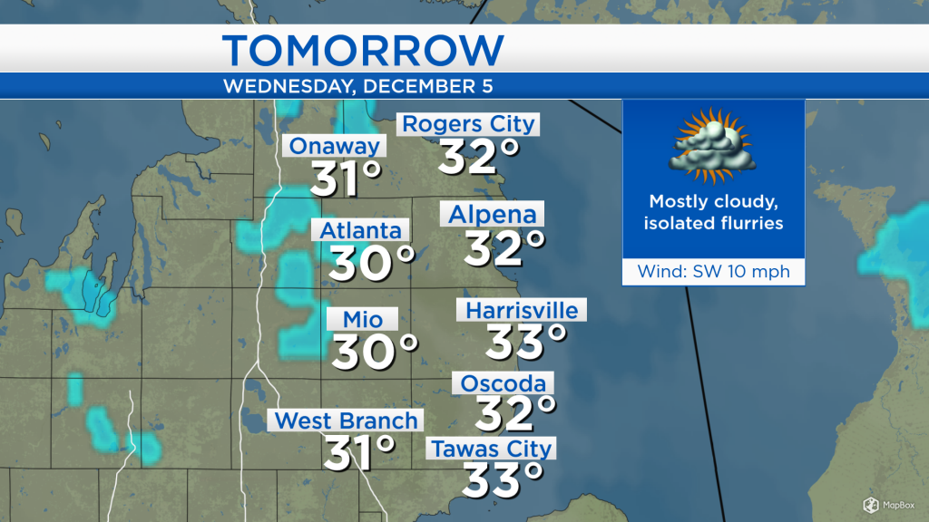
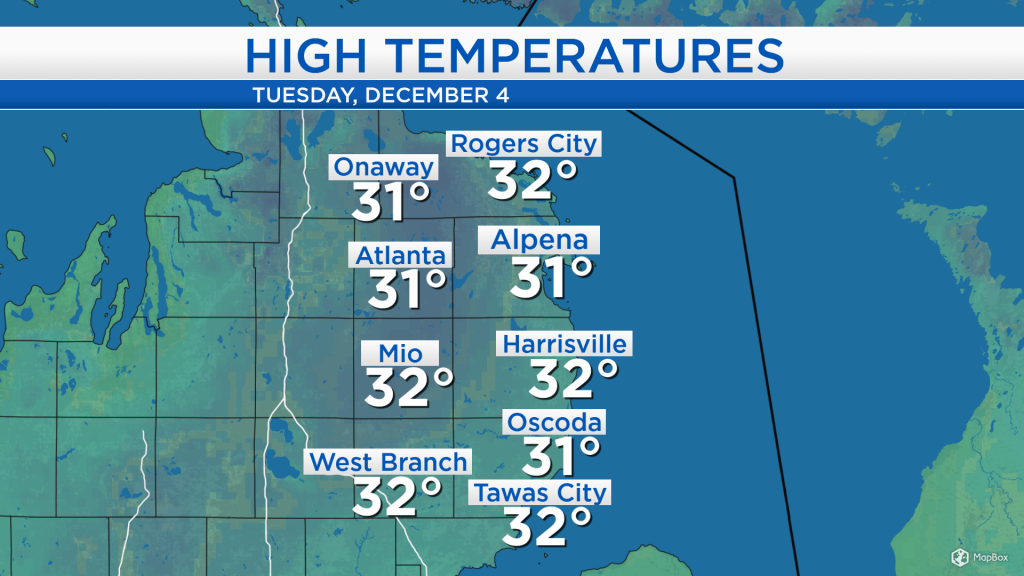
High temperatures have continued to reach the lower 30s across Northeast Michigan under mostly cloudy skies. Highs in the lower 30s are forecast tomorrow and Thursday.
Mostly cloudy skies are persisting over our area, with no organized weather systems currently across the Midwest. A cold front developing in central Canada will drop southward, toward the Upper Great Lakes, increasing the chance of snow showers beginning Wednesday night.
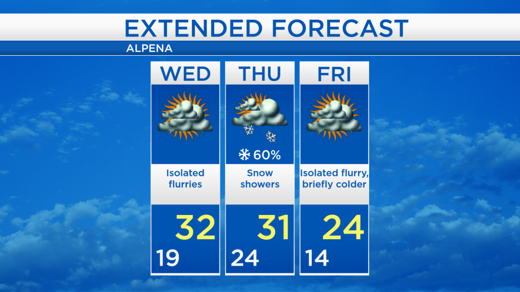
Overnight lows will drop to around 20 degrees, then highs will reach about 32 degrees tomorrow afternoon. The daytime should remain mostly cloudy with a small chance for isolated flurries. The chance of widespread snow showers will begin tomorrow night, lasting through much of Thursday as a cold front passes through Northern Michigan.
High temperatures will remain in the lower 30s until Thursday’s cold front departs. After that, a colder airmass will briefly enter Northern Michigan, producing low temperatures in the teens early Friday and highs in the mid-20s Friday afternoon. Temperatures will then rebound this upcoming weekend.
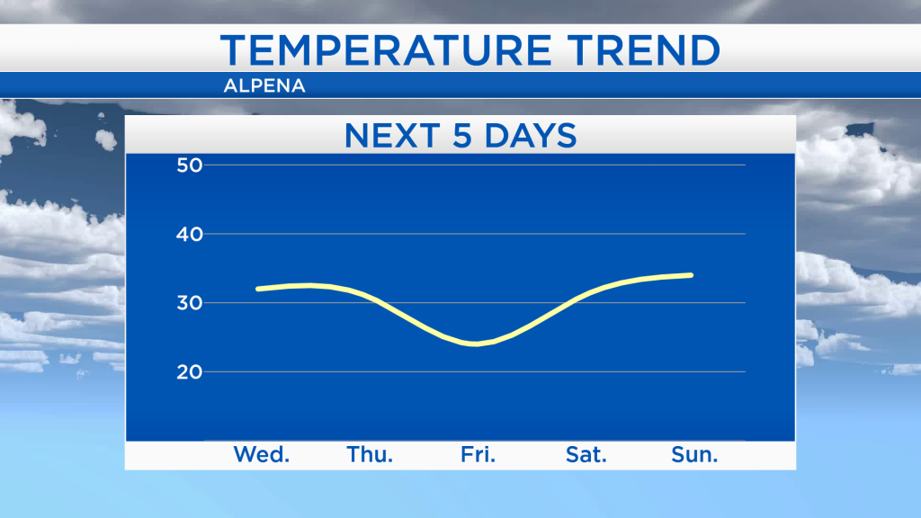
For tomorrow, mostly dry weather is expected other than a chance for isolated flurries. Snow showers are expected tomorrow night through Thursday, and highs on Thursday will reach around 31 degrees. Colder temperatures will move in Friday as highs reach around 24 degrees with mostly cloudy skies. A little more sunshine and slightly warmer temperatures are expected this weekend. For the rest of Northeast Michigan’s weather forecast, watch the latest weather video by clicking the weather tab at the top of the page.