Cool and cloudy through midweek; A look back at a cold and snowy November
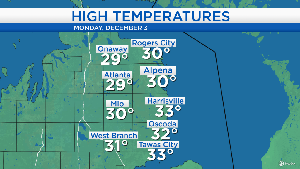
High temperatures today reached the lower 30s in most locations of Northeast Michigan — cooler than the daytime highs over the weekend as winds have shifted out of the north, drawing in colder air.
This past weekend, high temperatures reached close to 40 degrees with a surge of some warmer air ahead of a storm system which brought rain on Saturday, then rain changing to snow on Sunday. That storm system has departed to our east, though cloudy skies remain over our area.
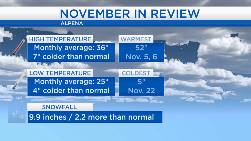
Looking back at November, the month was significantly colder than normal, and had a couple more inches more snow than what normally see in April. (Normal is defined as the average within the timespan of 1981-2010.) The average of all the daily high temperatures resulted in 36 degrees, 7 degrees colder than normal. The average of all the low temperatures was 25 degrees, 4 degrees colder than normal. Nearly 10 inches of snow were measured throughout the month, about 2 inches more than normal.
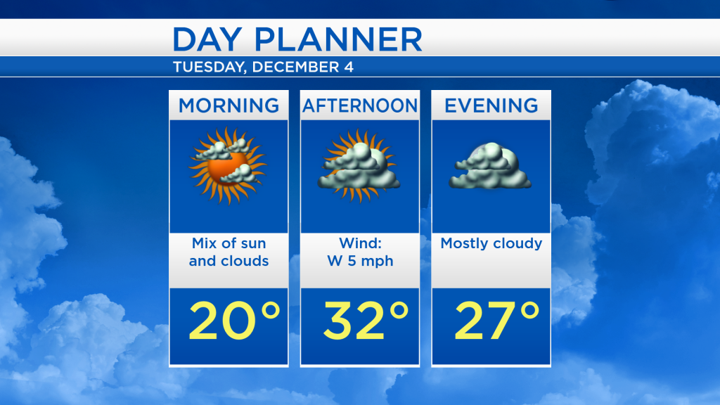
For tomorrow, a little sunshine is possible for a few hours in the morning, then becoming mostly cloudy for the rest of the day. Early-morning temperatures will start close to 20 degrees, than afternoon highs will reach around 32 degrees.
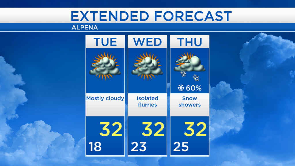
Mostly cloudy skies is the theme through midweek with highs reaching the lower 30s. A few patchy flurries are possible on Wednesday, though many areas will likely remain dry. A more significant chance of snow showers is expected on Thursday, as a cold front moves through Northeast Michigan. Behind the cold front, colder air will arrive Thursday night-Friday. For the rest of Northeast Michigan’s weather forecast, watch the latest weather video by clicking the weather tab at the top of the page.