Sunshine returns tomorrow; Colder Thursday
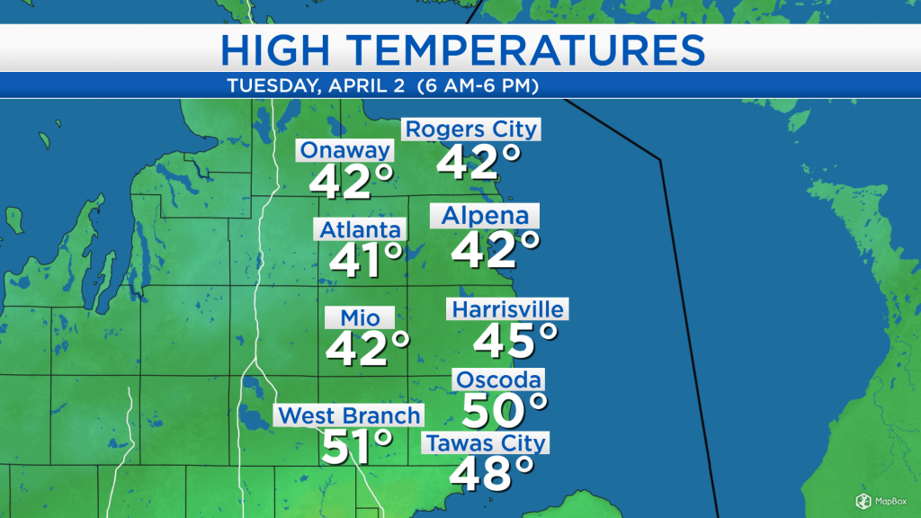
High temperatures today reached the lower to middle 40s for most of Northeast Michigan, except slightly warmer in Iosco and Ogemaw counties. Temperatures reached near-normal values despite overcast skies, aided by winds out of the southwest about 15 mph.
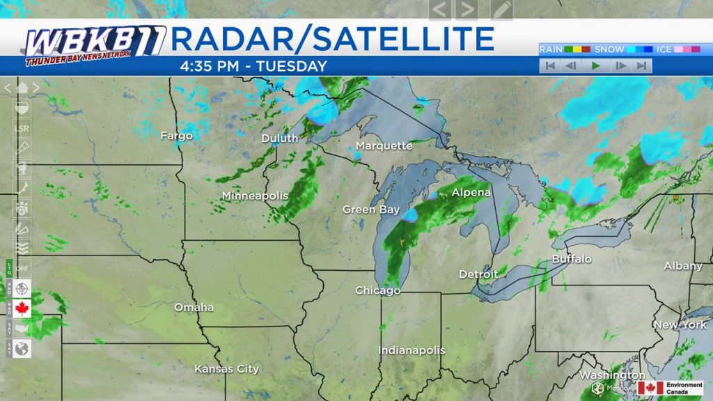
A cold front across Lower Michigan has brought some on-and-off showers throughout the day, and light rain continues this evening. Showers currently in western Wisconsin could bring us a chance of flurries during the predawn hours early tomorrow (temperatures will be cold enough for snowflakes). Then, skies will become partly cloudy as drier air enters from the northwest.
Morning temperatures will start around the lower 30s, and afternoon temperatures will reach about 43 degrees. Some sunshine should give us brighter weather, although it will feel brisk with a breeze at 15-20 mph and occasional wind gusts up to 30 mph.
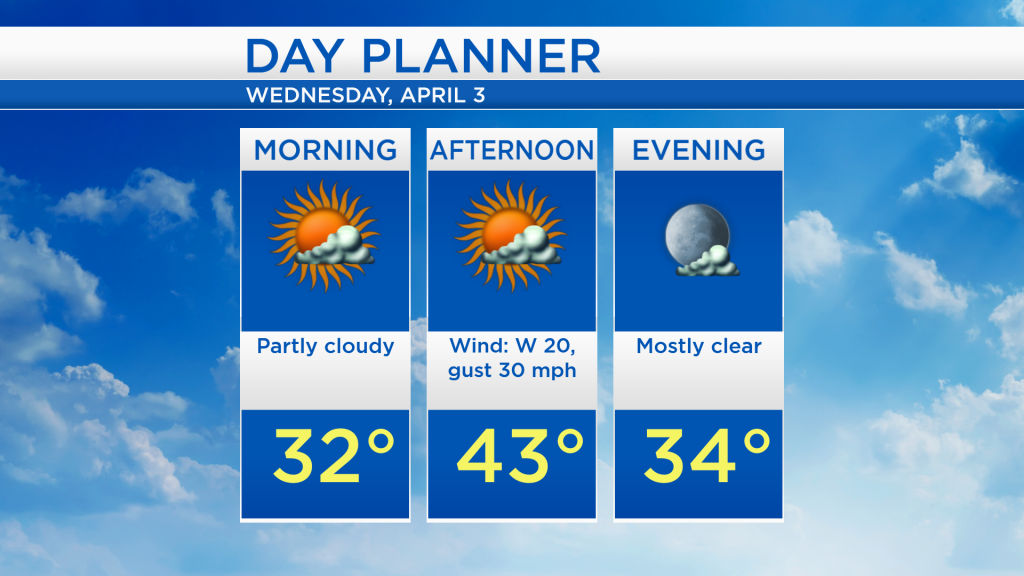
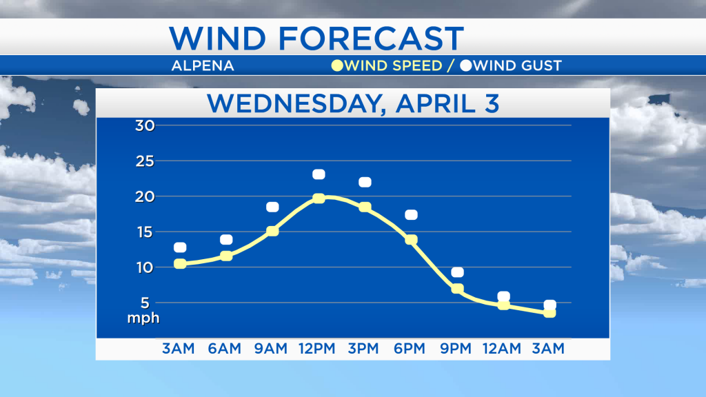
Wind speeds will increase early tomorrow, becoming strongest midday and afternoon. The yellow line shows the sustained (constant) wind speed at a given forecast hour, and the white dots show infrequent wind gusts. Winds could gust as high as 30 mph tomorrow, before subsiding tomorrow evening.
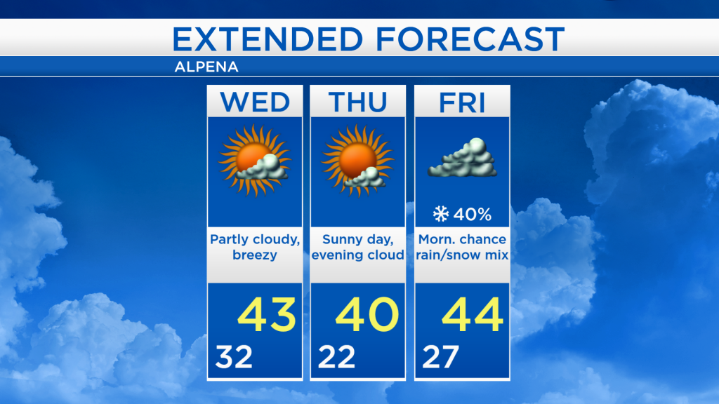
Skies will become partly cloudy early tomorrow with afternoon highs reaching the lower to middle 40s accompanied by brisk winds. Plenty of sunshine is expected Thursday, but early-morning temperatures will start in the lower 20s, and barely reach 40 degrees in the afternoon. Cloud cover will increase late Thursday, a wintry mix is possible early Friday, then cloudy skies with highs around the middle 40s. Temperatures will likely warm into the 50s this weekend. For the rest of Northeast Michigan’s weather forecast, watch the latest weather video by clicking the weather tab at the top of the page.