Some sun around for Tuesday; Getting warmer midweek

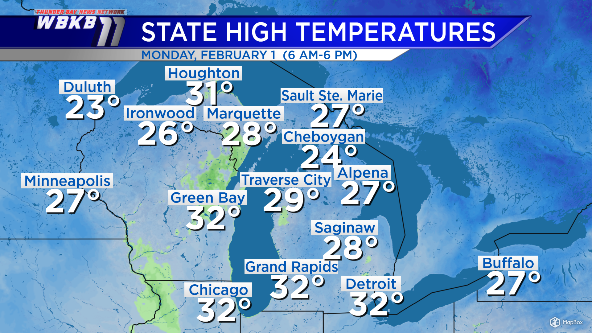
High temperatures Monday got up to 27 degrees in Alpena, 28 degrees in Saginaw, Mich. and 24 degrees in Traverse City, Mich. Those values are around normal for February 1. With a breeze coming from the north-northwest Tuesday, afternoon temperatures will be similar.
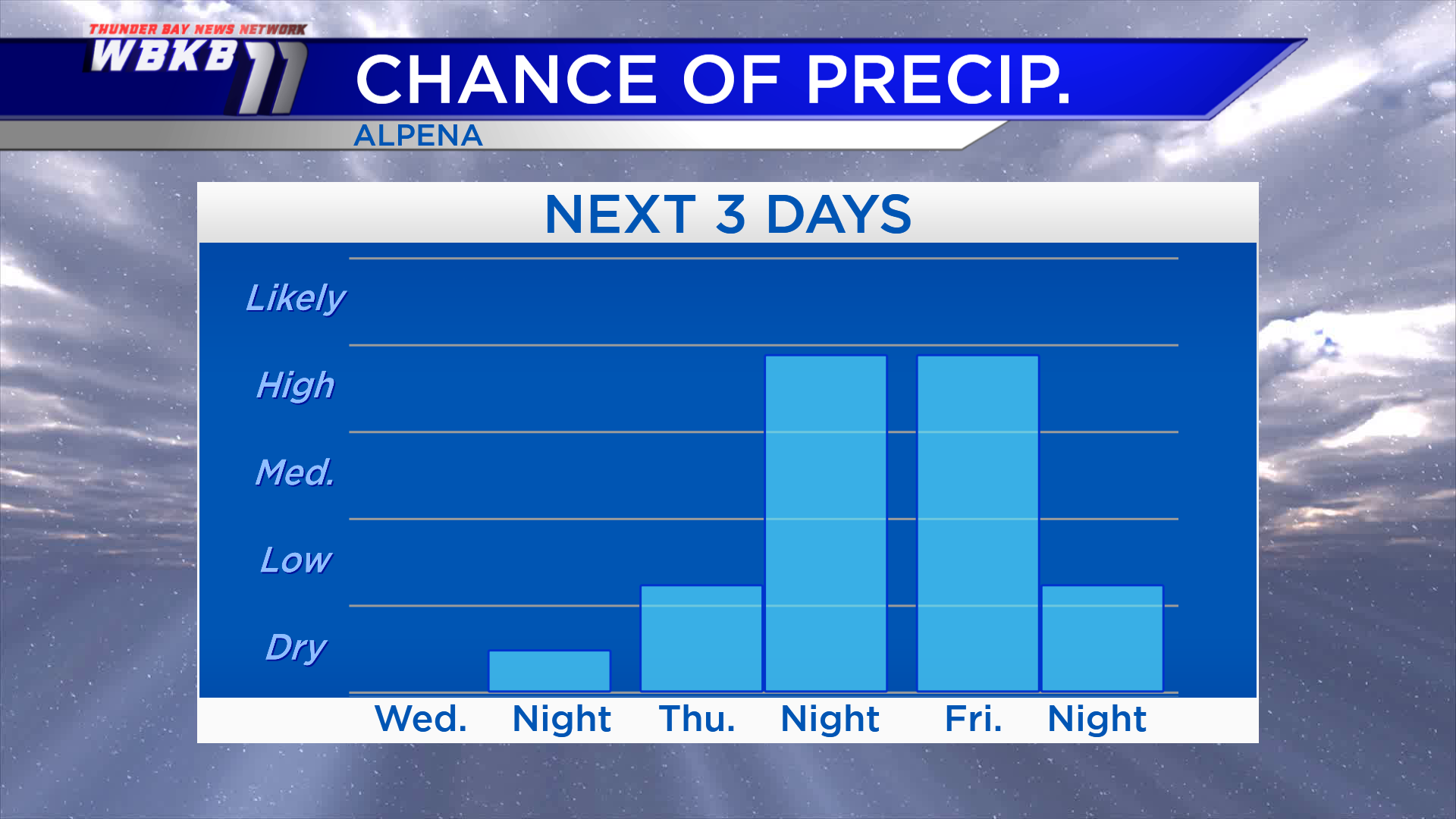
The Detroit area got some snow today, but elsewhere across the state it was dry. Locally, we even saw some sunshine this afternoon. Partly cloudy skies remain in the forecast tonight and Tuesday.
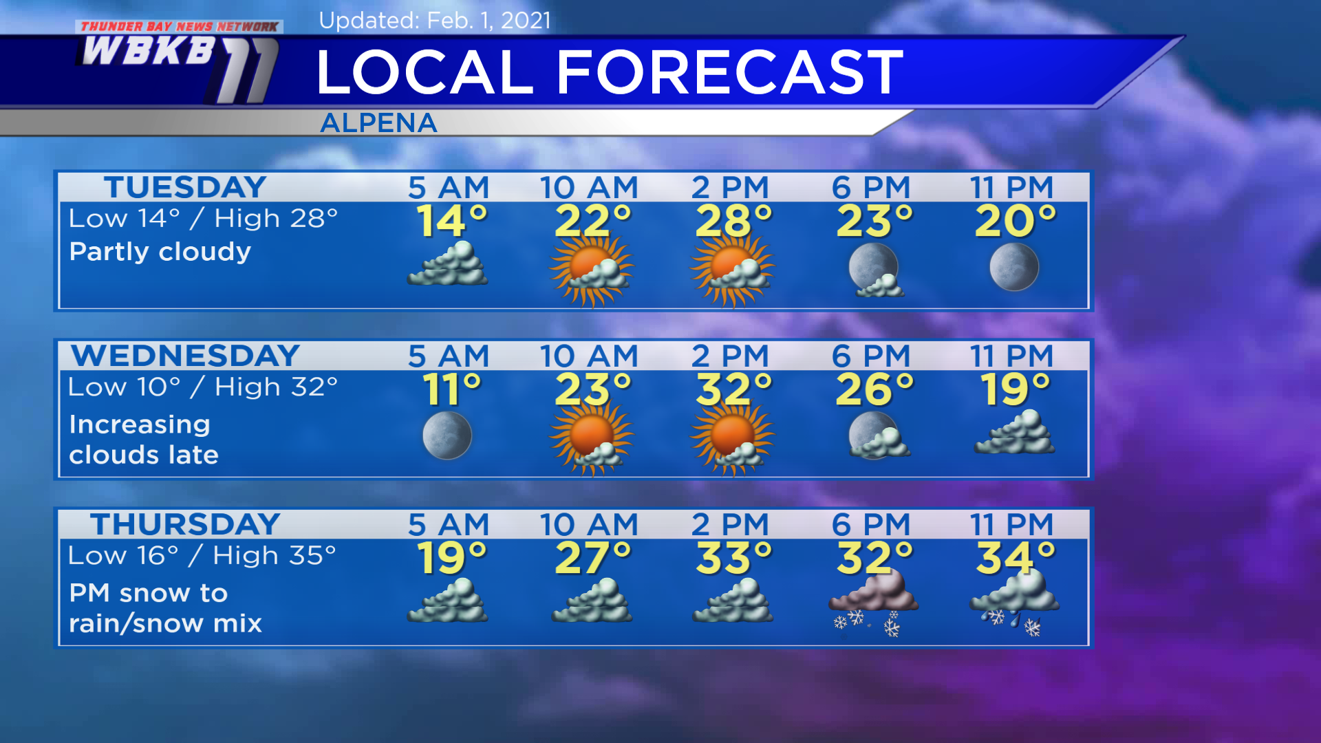
Tuesday: Partly cloudy. Predawn temperatures will begin around 14 degrees. Temperatures will climb to the lower 20s in the late-morning. Afternoon highs will reach about 28 degrees. Evening temperatures will dip to the lower 20s.
Wednesday: Mostly sunny morning-midday, then increasing clouds during the evening. Predawn temperatures will drop close to 10 degrees. Late-morning temperatures will rise to the lower/middle 20s. Afternoon highs will be heading up to 32 degrees. Evening temperatures will cool to the lower 20s.
Thursday: Snow or rain/snow mix moves in late-day. Predawn temperatures will be in the upper teens. Temperatures will rise to the upper 20s in the morning. Afternoon highs will get up to about 34 degrees. Evening temperatures will hover around the lower to middle 30s.
For the rest of Northeast Michigan’s weather forecast, watch the latest weather video by clicking the weather tab at the top of the page.
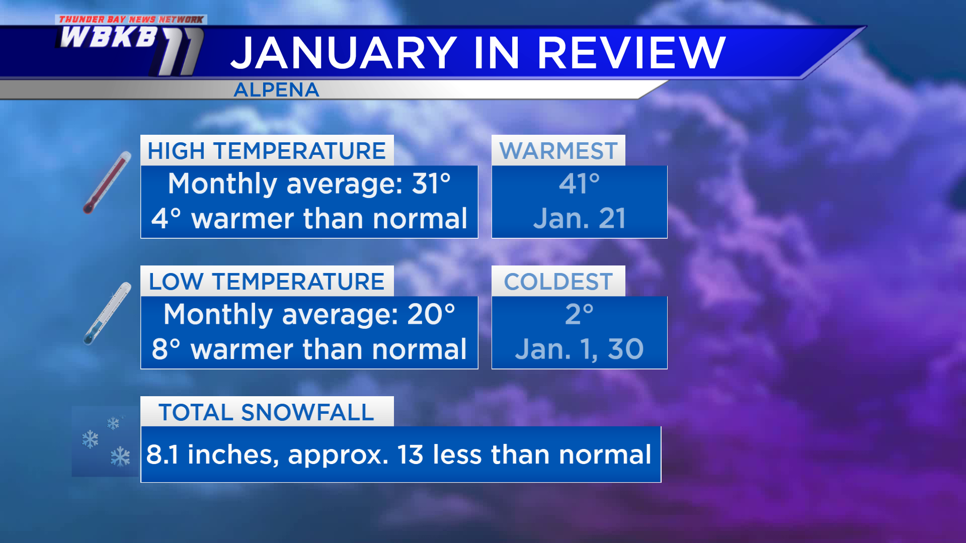
January in review: The month averaged warmer and much less snowy than “normal.” The normal values are the long-term average of January highs, lows and snowfall over a 30-year period (from 1981 to 2010) — a baseline to compare any single January’s numbers. The average of all the daily highs this past month was 31 degrees, that’s 4 degrees warmer than normal. More impressively, the average of all the low temperatures throughout the month was 20 degrees, that’s 8 degrees warmer than normal! Snowfall for the month totaled a meager 8.1 inches, close to 13 inches less than normal.