High winds and waves over Lake Huron tomorrow; Colder for the first weekend of fall
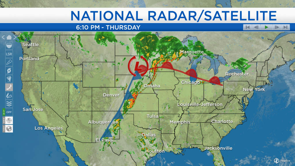
Earlier this afternoon, some steady rain fell in our area, and scattered showers will continue until tomorrow afternoon. North of a warm front draped across the Midwest, there is an extensive area of rain from around Lake Huron all the way to North Dakota. Also, on the north and west side of an area of low pressure near the South Dakota-Minnesota border, plenty of cold air will move into our area.
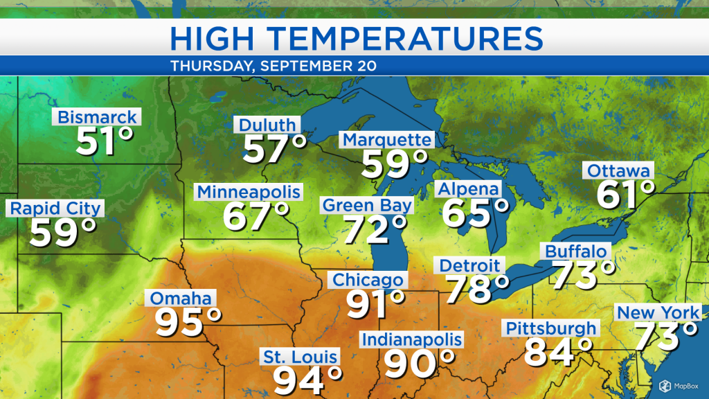
South of the warm front, temperatures heated up into the 90s, compare that to north of the warm front and behind the cold front where temperatures only reached the 50s. The colder air mass knocking on our door will enter tomorrow afternoon.
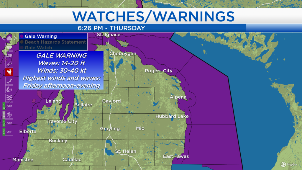
Additionally, strong winds in the wake of the low pressure system have prompted a Gale Warning, issued by the National Weather Service. Over the open waters of Lake Huron, winds will strengthen to 30-40 knots and wave heights are forecast to reach 14-20 feet tomorrow afternoon-early evening.
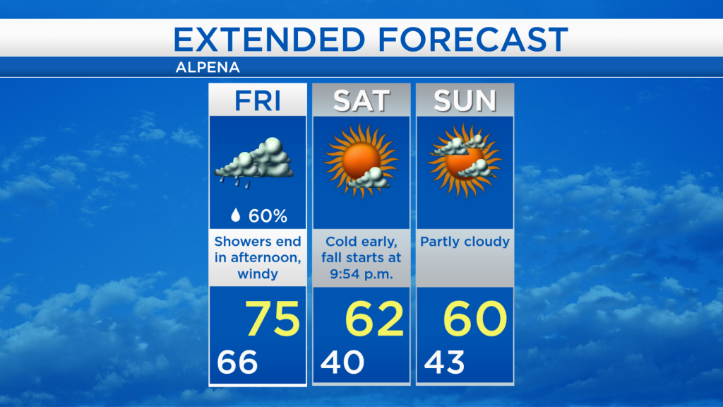
Showers are expected to continue tomorrow morning, and temperatures will reach the mid-70s around noon. In the afternoon, temperatures will fall combined with strong winds out of the west about 20-25 mph.
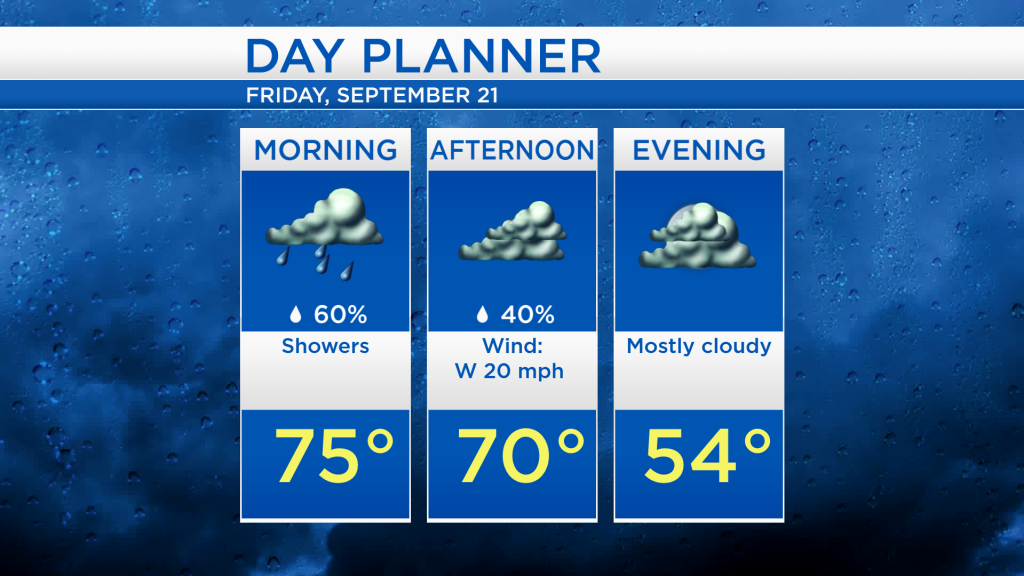
After a warm and damp start, the gray skies will last through the afternoon and temperatures will drop to around 40 degrees late Friday night-early Saturday morning. Mostly sunny skies will brighten the skies on Saturday, and fall begins Saturday evening at 9:54 p.m. Partly cloudy skies are expected Sunday with afternoon highs close to 60 degrees. Warmer temperatures will move into Northeast Michigan briefly on Monday and Tuesday, and the next chance of rain is forecast for Tuesday. For the rest of Northeast Michigan’s weather forecast, watch the latest weather video by clicking the weather tab at the top of the page.