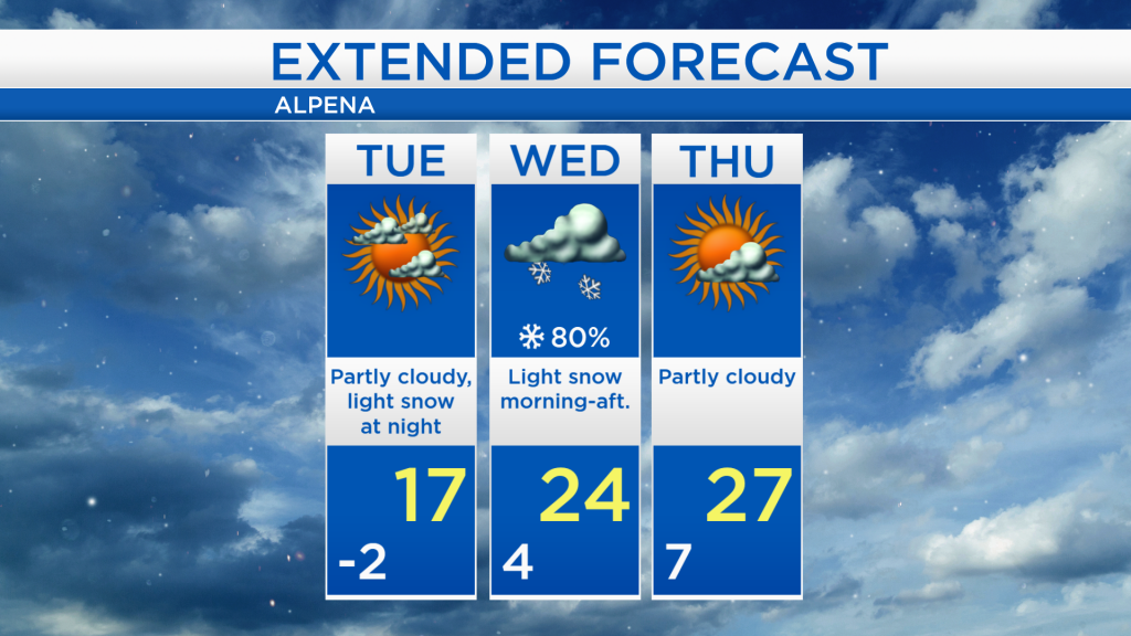
Much colder until midweek; Light snow late Tuesday-Wednesday
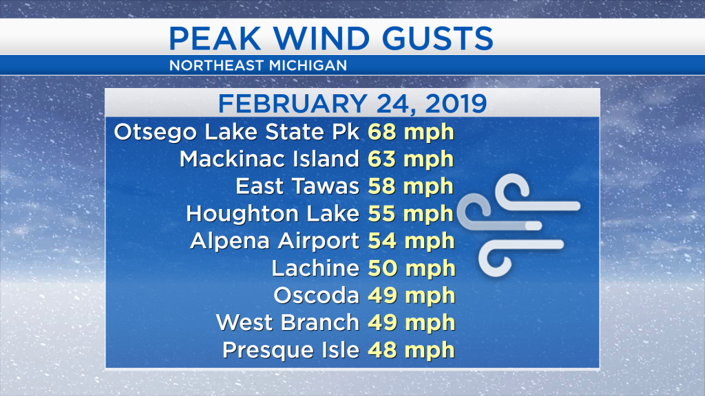
Yesterday’s winds were extremely powerful, and caused blowing snow and whiteouts west of Alpena. Many areas received wind gusts over 50 mph including Alpena, and here are some of the highest wind gust reports around Northeast Michigan from yesterday:
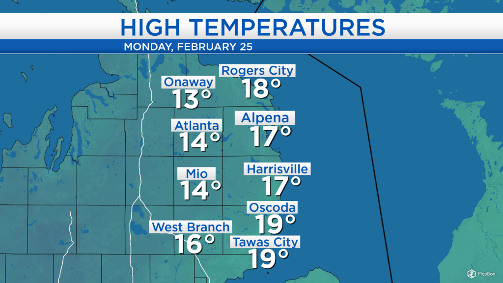
After yesterday’s high wind (and blizzard west of Alpena) moved through our area, temperatures have dropped as winds out of the west have brought colder temperatures from the Upper Plains into our area. Afternoon highs today only reached the teens and similar temperatures will repeat tomorrow afternoon albeit with less wind.
We will continue to see partial clearing this evening. Partly cloudy skies will continue from tonight through tomorrow afternoon as drier air currently over the Upper Midwest goes through Northeast Michigan. Snow currently over Montana will spread into our area Tuesday night.
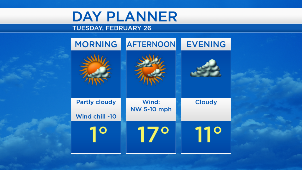
Overnight low temperatures will drop to a couple degrees below 0. Morning temperatures will hover around 1 degree although you will want to bundle up for wind chill values near -10. Afternoon temperatures will reach around 17 degrees, then cloud cover will increase going into tomorrow evening.
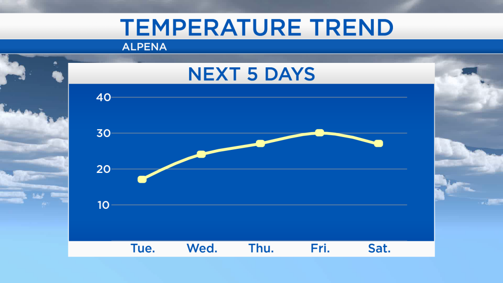
Colder air will last through Tuesday night, then a gradual warming trend will start midweek. Highs will reach the mid-20s on Wednesday, then climb to around 30 degrees on Friday.
The daytime hours tomorrow will remain dry although cold, then some light snow will arrive at night. Light snow with minor accumulations (about 2-4 inches) will continue through most of Wednesday. We will see some sunshine again on Thursday, then slightly milder temperatures on Friday. For the rest of Northeast Michigan’s weather forecast, watch the latest weather video by clicking the weather tab at the top of the page.