More warmth Thursday; Saturday snow potential increasing
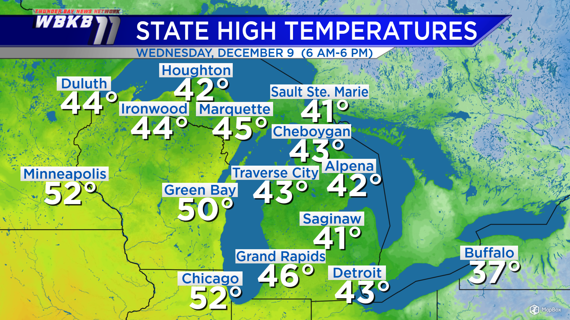
High temperatures Wednesday reached the lower 40s throughout Northern Michigan, that’s nearly 10 degrees above normal! Wednesday’s temperatures got up to 42 degrees in Alpena, 41 degrees in Traverse City, Michigan and 43 degrees in Saginaw, Michigan. Temperatures will reach similar values Thursday afternoon.
An incoming storm system will gain strength near the Texas panhandle Thursday, then move toward the northeast. The range of possible storm tracks is becoming narrower, shown by the shaded area on the map below. Saturday, this storm system could be as far west as the Illinois-Wisconsin border or as far east as Lake Erie.
| A track that goes through Mid-Michigan: | A track that goes through Indiana and Lake Erie: |
|
|
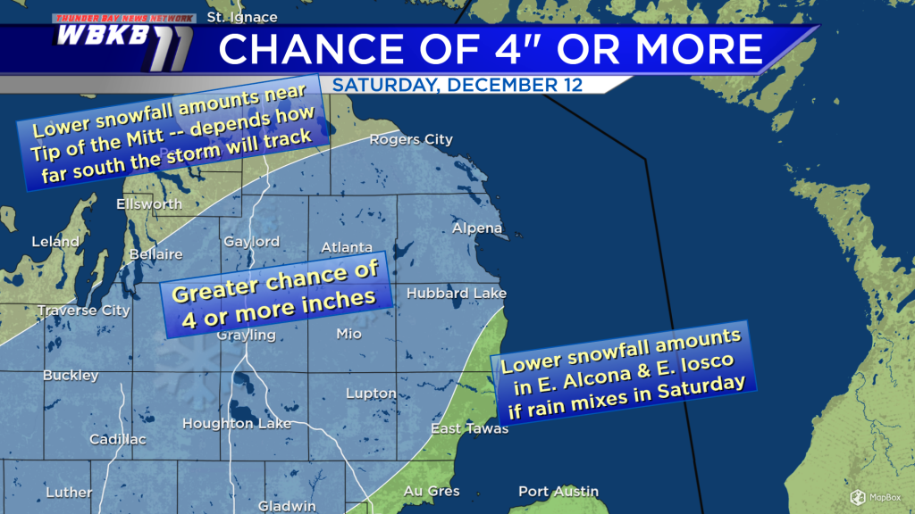
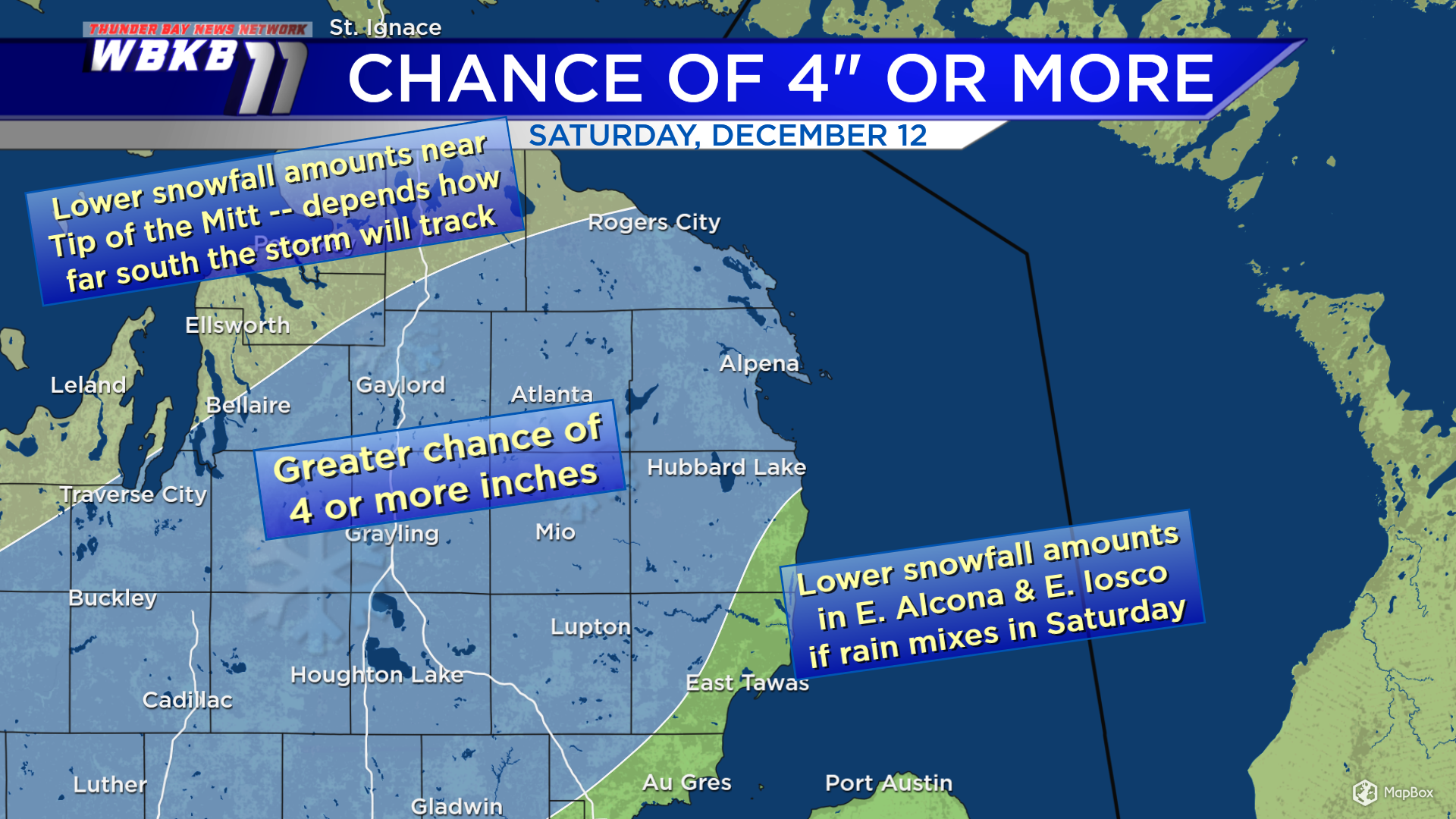
Some early thoughts about where the most substantial snow might occur: The highest chance of snowfall amounts 4 inches or more exists roughly south of a line from Rogers City to Traverse City. Whether the Tip of the Mitt ends up with less snow depends how far south this storm ends up tracking. Snowfall amounts could also be reduced in eastern Alcona and eastern Iosco Counties — if rain mixes in Saturday.
For the rest of Northeast Michigan’s weather forecast, watch the latest weather video by clicking the weather tab at the top of the page.