
Wintry mix early Friday will melt away later in the day
The next batch of moisture will be moving in from the south overnight. It will interact with colder temperatures over Northern Michigan, resulting in some wintry types of weather for Friday morning. Initially, expect this to start as rain during the predawn hours late tonight. But as temperatures drop below freezing we’ll see any initial rain changing to a wintry mix or snow.
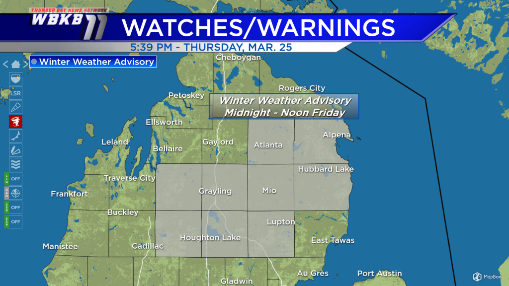
A Winter Weather Advisory is posted from midnight to noon Friday for parts of Northeast Michigan. It includes Alpena, Alcona, Montmorency, Oscoda and Ogemaw counties. Expect roadways to become slippery early Friday with a wintry mix or snow falling throughout the area. The wintry precipitation should end around midday.

Futurecast shows rain showers moving in well after midnight. But that rain changes to a wintry mix (shown in pink) as daybreak approaches early Friday. Then either a wintry mix or snow will last for several hours into Friday morning. This will all move to the northeast and drier weather will take over during the afternoon and evening.
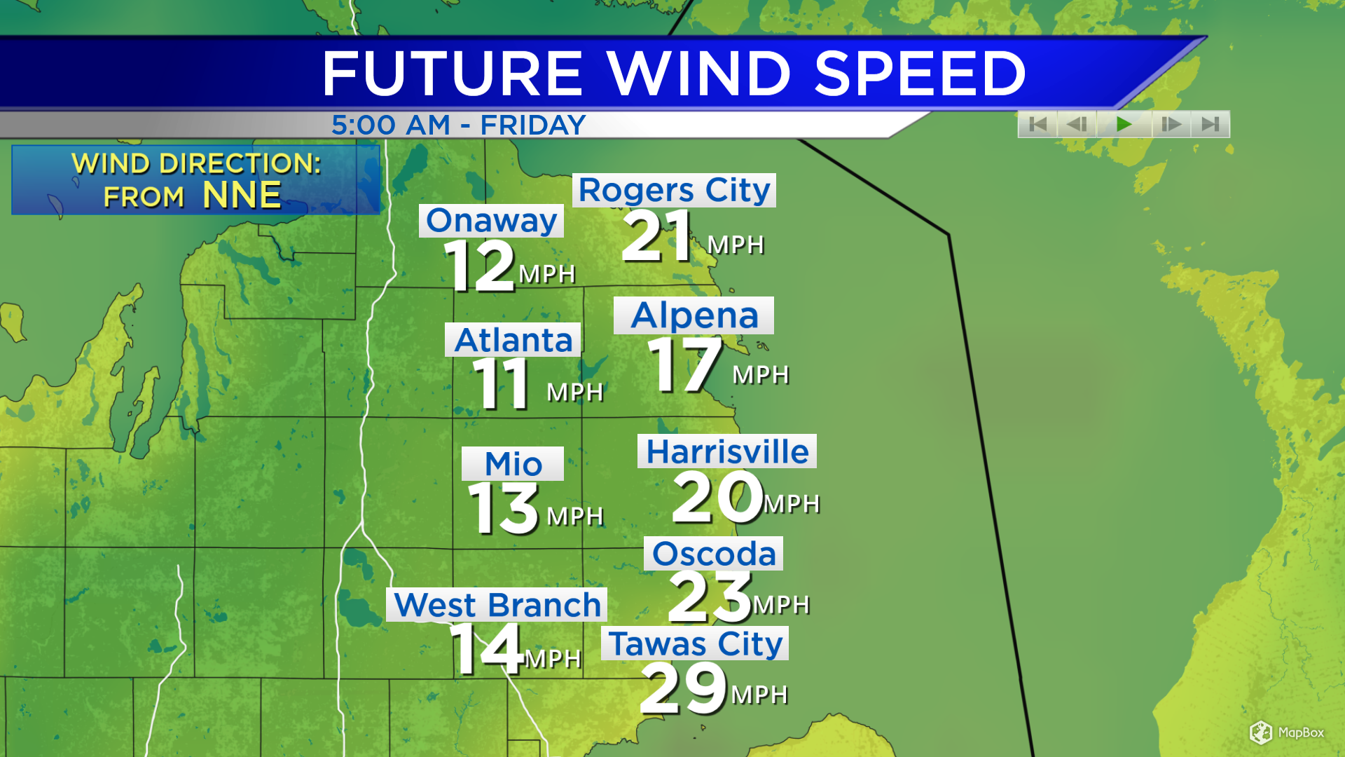
Additionally, winds will become strong for a few hours early Friday. Winds out of the north will be blowing at about 20 mph at the start of the day, then east to near 10 mph late-day.
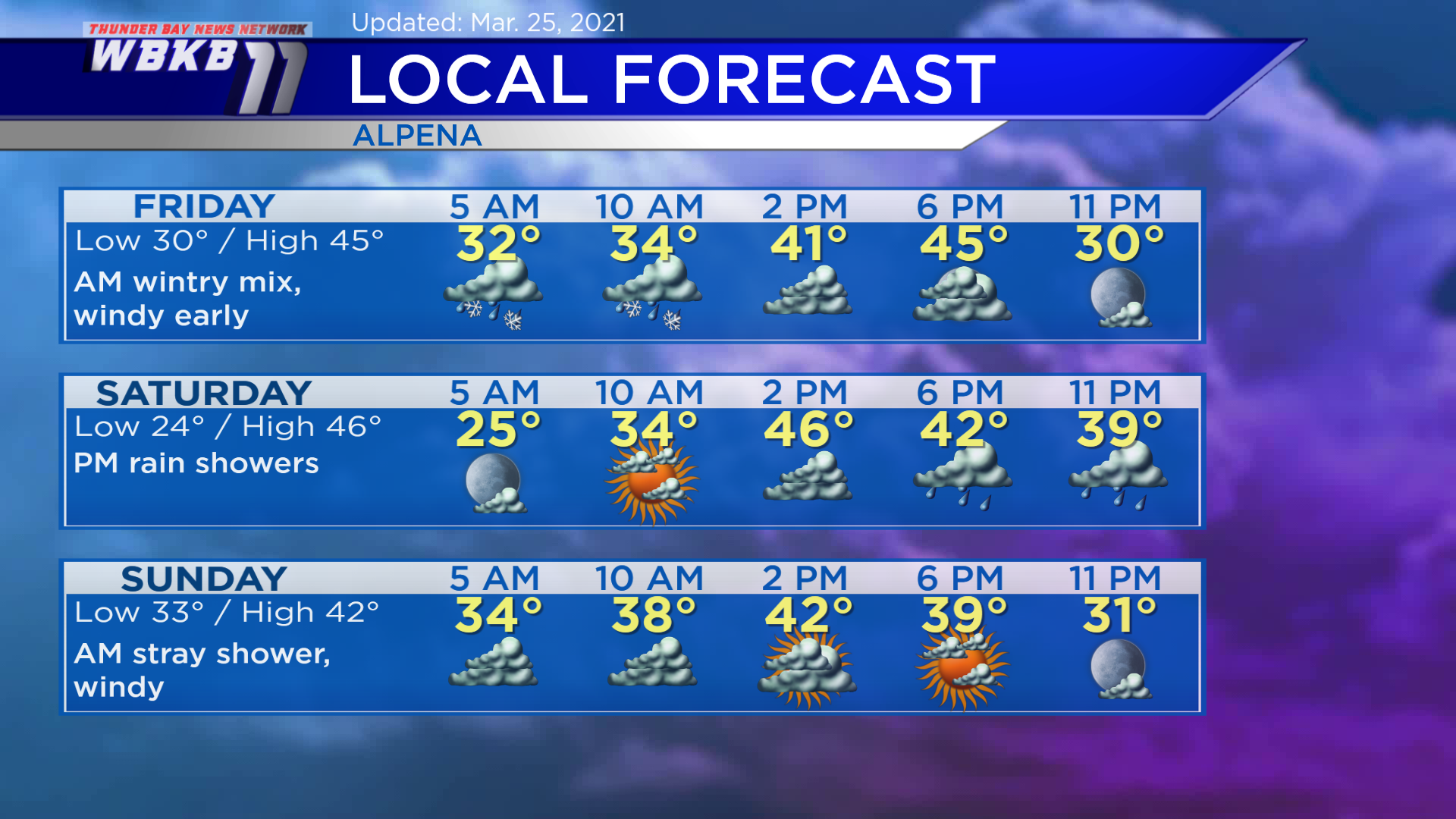
Friday: Wintry mix or snow in the morning, it’ll be a messy start to the day. Predawn lows will be near 30 degrees. Midday temperatures will climb to the upper 30s or near 40 degrees. Afternoon highs will reach close to 45 degrees. Evening temperatures will cool to the 30s.
Saturday: Starts dry, then some rain showers will move in late-day. Predawn temperatures will drop to about 24 degrees. By late-morning, temperatures will rise to the middle/upper 30s. Afternoon highs will get up to around 46 degrees. Evening temperatures will be near 40 degrees.
Sunday: Maybe a stray shower early, windy and mainly dry. Predawn temperatures will head into the lower 30s. Afternoon highs will be near 42 degrees. eVening temperatures will go into the 30s.
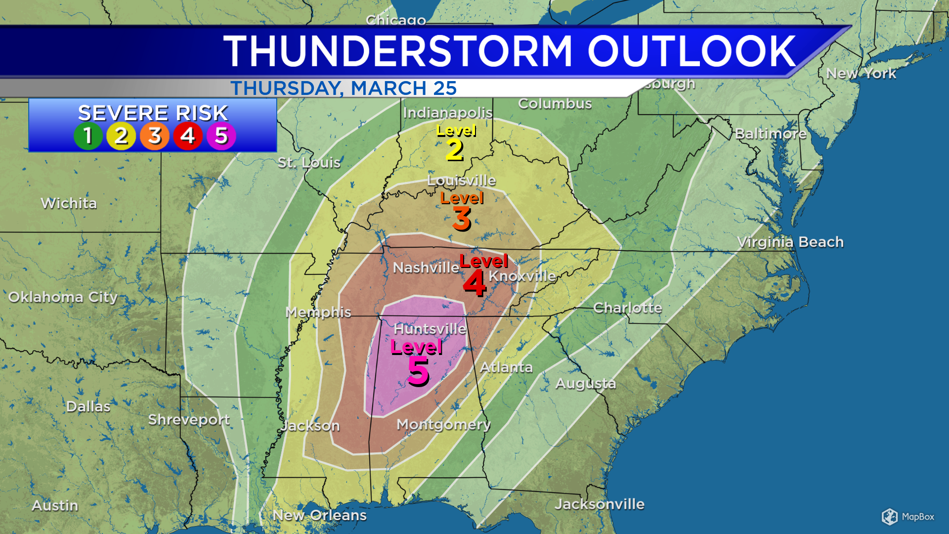
Elsewhere, the Storm Prediction Center has issued a level 5 risk of severe weather over parts of Alabama and southern Tennessee. Level 5 is the highest or most threatening end of the severe weather scale. Alabama has seen an outbreak of tornadoes Thursday. We will not get severe weather in Michigan. But it’s the same storm system moving in early Friday, we’re going to be on the cold side of it.
For the rest of Northeast Michigan’s weather forecast, watch the latest weather video by clicking the weather tab at the top of the page.


