Warmer Thursday; Much-needed rainfall coming late Friday and Saturday
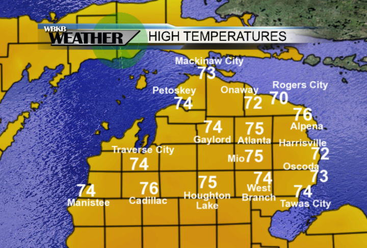
High temperatures today reached the mid-70s across Northeast Michigan under mostly sunny skies. A light breeze out of the east has been keeping afternoon temperatures a few degrees cooler along the shoreline of Lake Huron.
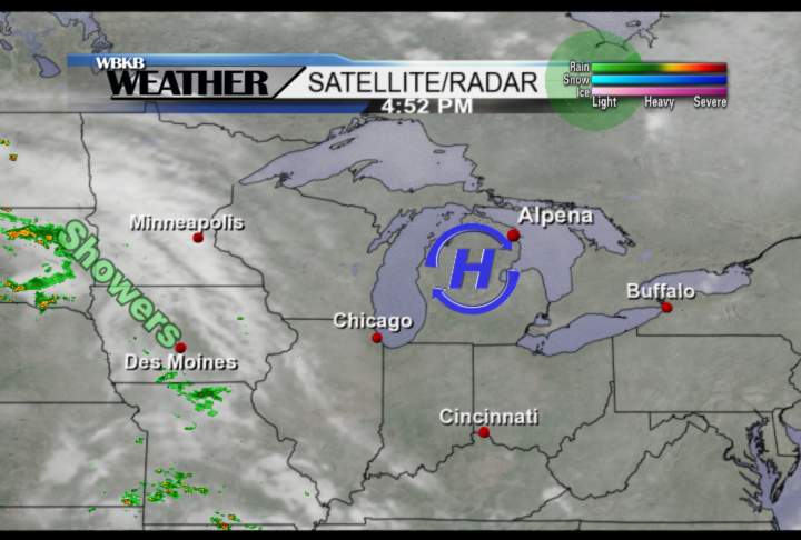
A high pressure system over the state is providing dry weather, which will continue into tomorrow. As the high pressure system gradually moves to the east, temperatures will become a bit warmer tomorrow afternoon. A storm system is developing over South Dakota, currently bringing scattered showers from South Dakota to Missouri. This storm system will gradually move towards our area over the next couple of days, bringing rain late Friday and Saturday.
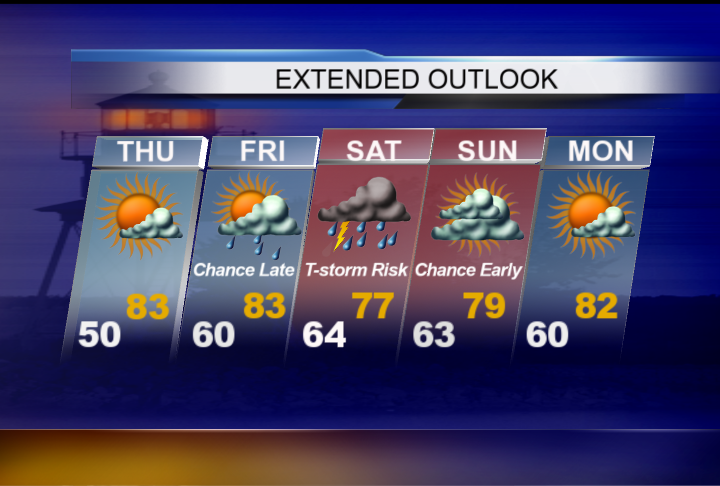
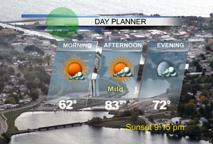
For tomorrow, temperatures in the morning will be in the lower 60s with mostly sunny skies. High temperatures warm into the lower 80s with partly cloudy skies and a breeze out of the southeast about 10 mph.
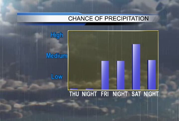
Tomorrow will remain dry, then the chance of rain will notably increase Friday afternoon and Friday evening. Perhaps, there could be a few rain-free breaks Friday night. The highest chance of rain will happen Saturday during the daytime hours, and only slightly lower Saturday night. Skies should dry out on Sunday albeit remaining mostly cloudy. Most places in Northeast Michigan could receive ⅓-1 inch of rain Friday midday through Saturday night.
Tomorrow, a partly cloudy day is in store, and despite a cool early-morning low of 50 degrees, temperatures will warm to 83 degrees in the afternoon. Rain will move in by Friday afternoon or evening, though remaining mild as high temperatures warm into the lower 80s. Widespread periods of rain and a risk of thunderstorms will move through on Saturday, limiting afternoon temperatures to the upper 70s. Mostly cloudy skies will last through Sunday, then a return to brighter weather is expected Monday.