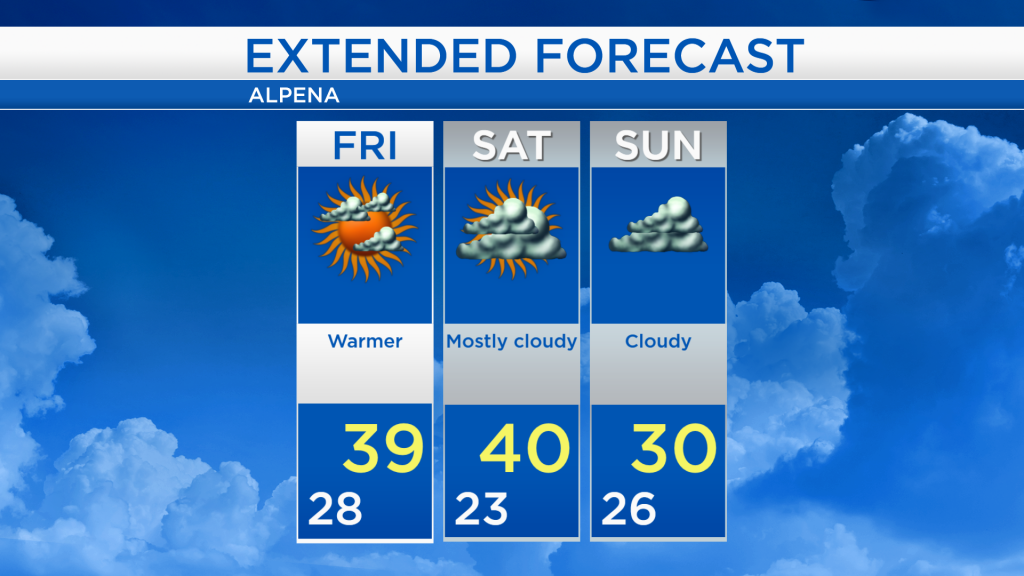
Warmer and Dry Friday-Saturday
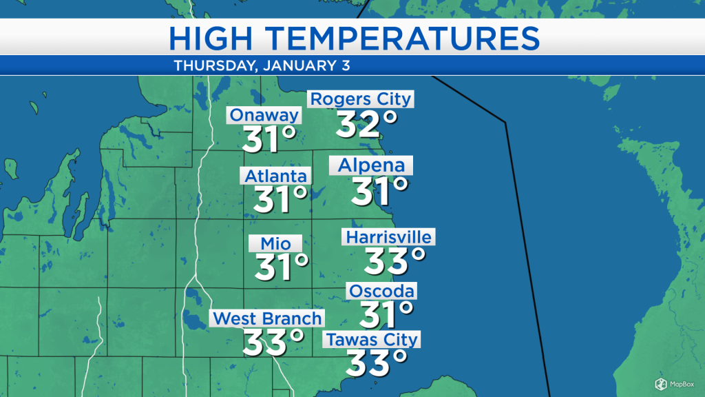
High temperatures today reached the lower 30s with cloudy skies, but winds out of the southwest about 10-15 mph have started to bring in warmer temperatures. The warming trend will continue tomorrow and Saturday.
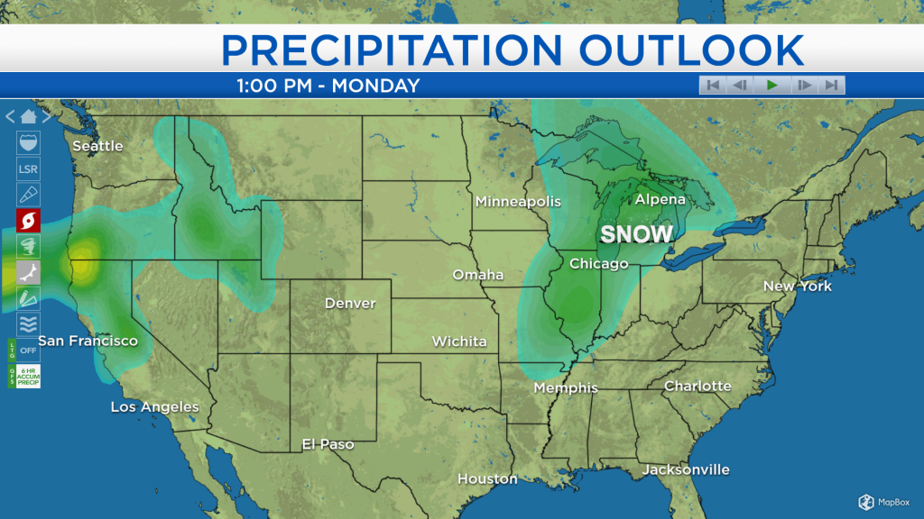
An area of snow/sleet/light freezing rain has been moving across the Upper Peninsula today. Otherwise, much of the Midwest is dry (some areas with more cloud cover than others), and that’s a sign we will see some dry weather over our area for the next couple of days.
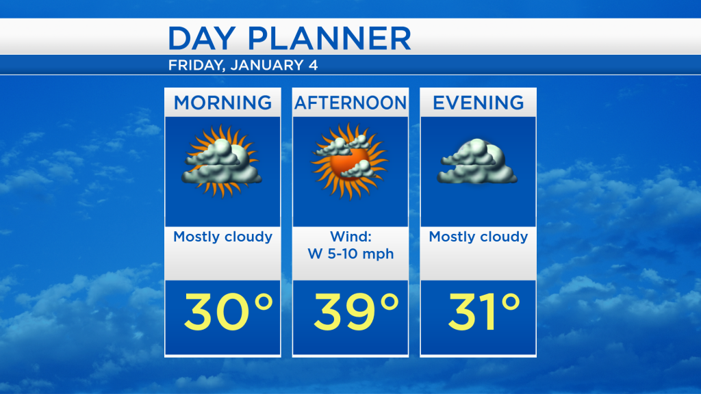
Low temperatures tonight will cool to the upper 20s, remaining quite mild. Tomorrow will start with mostly cloudy skies and temperatures near 30 degrees in the morning. Highs will reach close to 40 degrees in the afternoon with a mix of sun and clouds. Pleasant and mild weather will continue into the start of the weekend.
After the weekend, our attention turns to Monday, when snow is likely to enter Northeast Michigan. The storm system responsible for this has not even fully developed yet. It will only get well-organized on Sunday over the Plains, and then move eastward, into our area. Here is a snapshot of an early precipitation outlook for Monday.
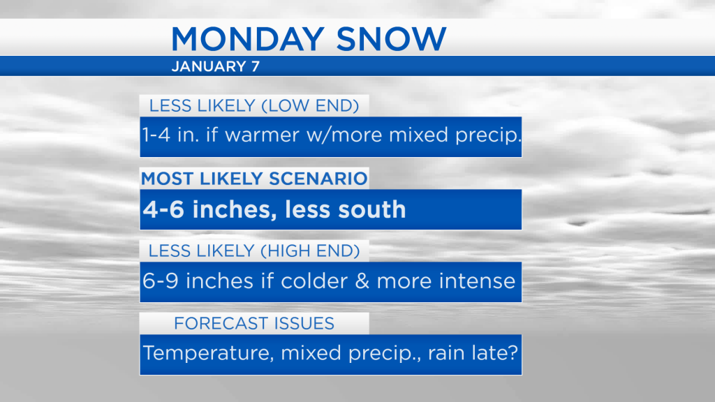
A few issues remain in forecasting exact snowfall amounts on Monday. Mainly, it remains to be determined exactly how warm the temperatures will climb late Monday. The warmest period on Monday is likely to occur in the evening, and a small difference of 3 degrees would mean the difference between rain and snow. As the forecast appears currently, there is a low chance we could get just 1-4 inches of snow, if more mixed precipitation or rain gets involved late Monday. The most likely scenario at this point is for 4-6 inches around Alpena and for points west and north, with lower snowfall amounts south of Alpena — for the shoreline of Alcona County, most of Iosco County and most of Ogemaw County where more mixed precipitation or rain would get involved. There is a less likely scenario of 6-9 inches of snow possible, only if our weather gets cold enough and more intense than the current forecast. In any event, the snow will likely start early Monday morning, and the steady precipitation would come to an end Monday night or early Tuesday.
Until we get to Monday, our weather is dry and pleasant for the next few days. We could see a few breaks of sunshine tomorrow afternoon, as highs get close to 40 degrees. Lows will drop to the lower and middle 20s early Saturday morning, and the dry weather will continue with mostly cloudy skies and afternoon temperatures around 40 degrees. Cooler temperatures will move in Sunday with cloudy skies. For the rest of Northeast Michigan’s weather forecast, watch the latest weather video by clicking the weather tab at the top of the page.