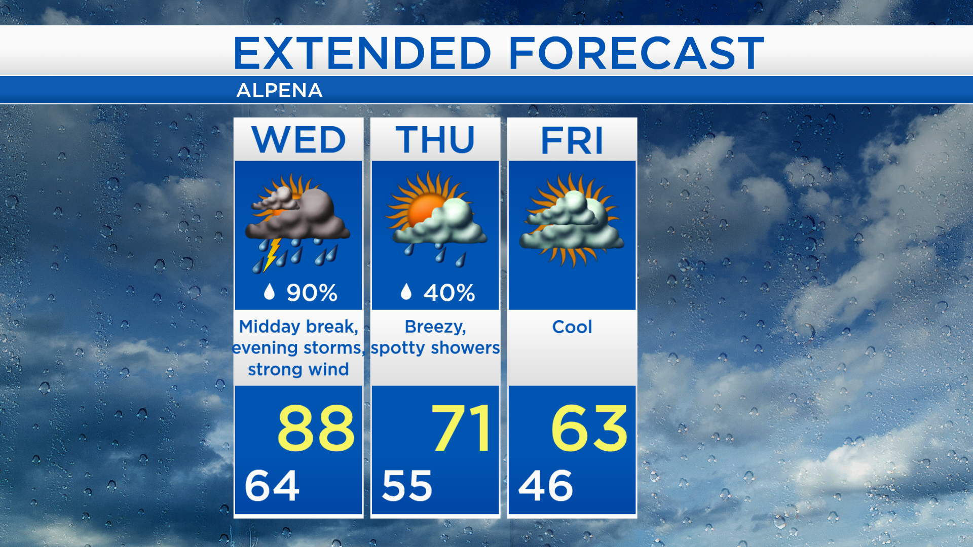
Two rounds of storms: Tuesday night-Wednesday morning and Wednesday late afternoon-evening
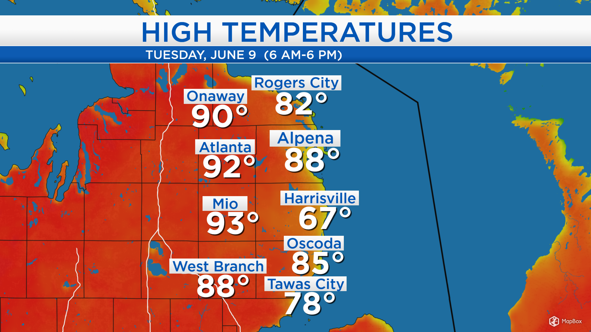
Temperatures today were sizzling in the upper 80s and lower 90s except at the Lake Huron shoreline. Highs reached 88 degrees at Alpena airport, 88 degrees in West Branch and 92 degrees in Atlanta. At the shorline where there was a light breeze from the southeast, highs reached 78 degrees in Tawas City and 82 degrees in Rogers City.
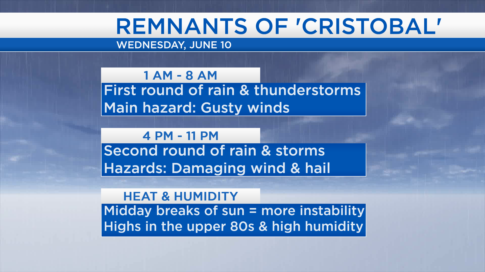
All attention is turning to the remnants of what was Tropical Storm Cristobal. Its center is currently located near the Iowa-Illinois border and moving north. This will bring the first round of thunderstorms overnight. It will also bring a tropical air mass with higher humidity levels Wednesday.
The first round of rain/thunderstorms will move through Northeast Michigan approximately 1 a.m. to 8 a.m. early Wednesday. There could be some gusty winds, heavy downpours and lightning. Then there will be a break without rain midday, and any sunshine will lead to additional instability in the afternoon. The second round of storms will move through Northeast Michigan around 4 p.m. to 11 p.m. Wednesday. The second round could potentially become severe with damaging wind gusts and large hail.
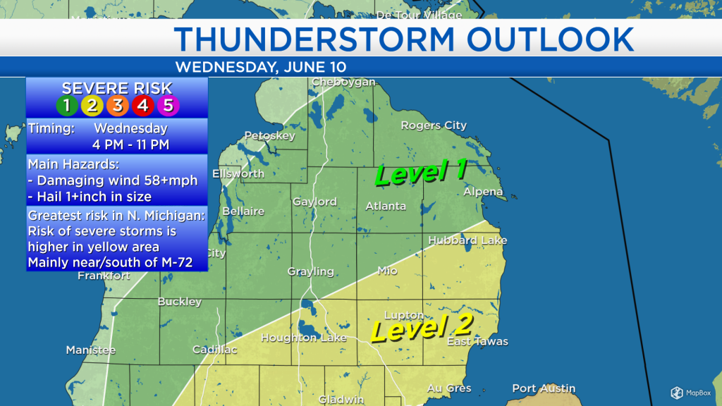
The Storm Prediction Center has highlighted parts of Northeast Michigan with a “Level 2” risk of severe storms Wednesday. That area in yellow extends from Hubbard Lake to Saginaw Bay, Houghton Lake and south to the Indiana border. A “Level 2” risk denotes a higher chance of severe weather. Farther north, a “Level 1” risk of severe storms includes Alpena, Montmorency and Presque Isle counties. The threat of severe weather on Wednesday will take place from 4 p.m. to 11 p.m.

Between two rounds of storms, there will be a break midday Wednesday. High temperatures will get up to 88 degrees, humidity will also be high, and winds will gust up to 40 mph. Spotty showers are possible Thursday, and highs will be in the lower 60s. Temperatures will get even colder Friday, highs will be in the lower 60s with mostly cloudy skies. Saturday will have less cloud cover and highs in the middle 60s. For the rest of Northeast Michigan’s weather forecast, watch the latest weather video by clicking the weather tab at the top of the page.