
Thunderstorms mainly late-day Wednesday; Hotter and muggier late in the week
An approaching cold front is producing a line of thunderstorms moving through the Upper Peninsula, Wisconsin and Iowa. That will bring a risk of thunderstorms to our area mainly in the afternoon and evening on Wednesday.
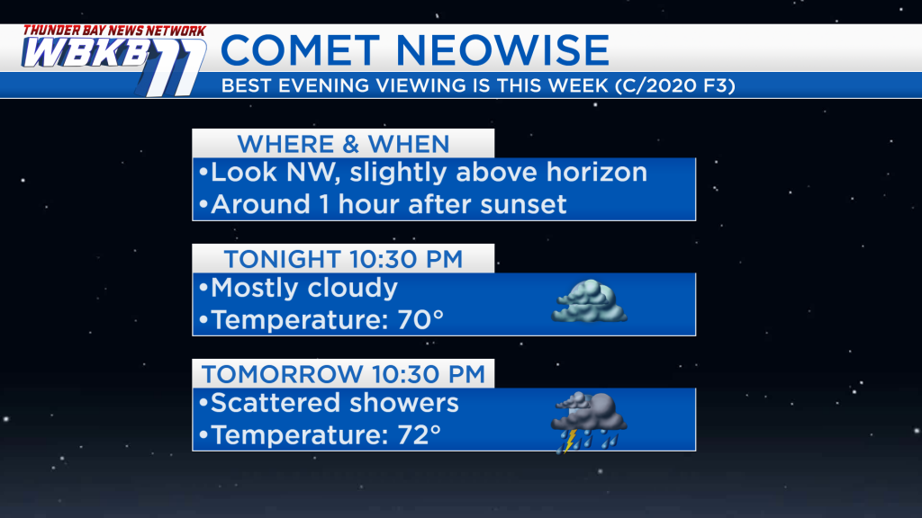
As WBKB News reported last week, the comet NEOWISE (C/2020 F3) will be visible in the evening sky this week. To see the comet, look toward the northwest, slightly above the horizon, about one hour after sunset. This evening’s forecast is mostly cloudy with a temperature near 70 degrees. There will be a risk of showers and thunderstorms Wednesday evening with temperatures in the lower 70s.

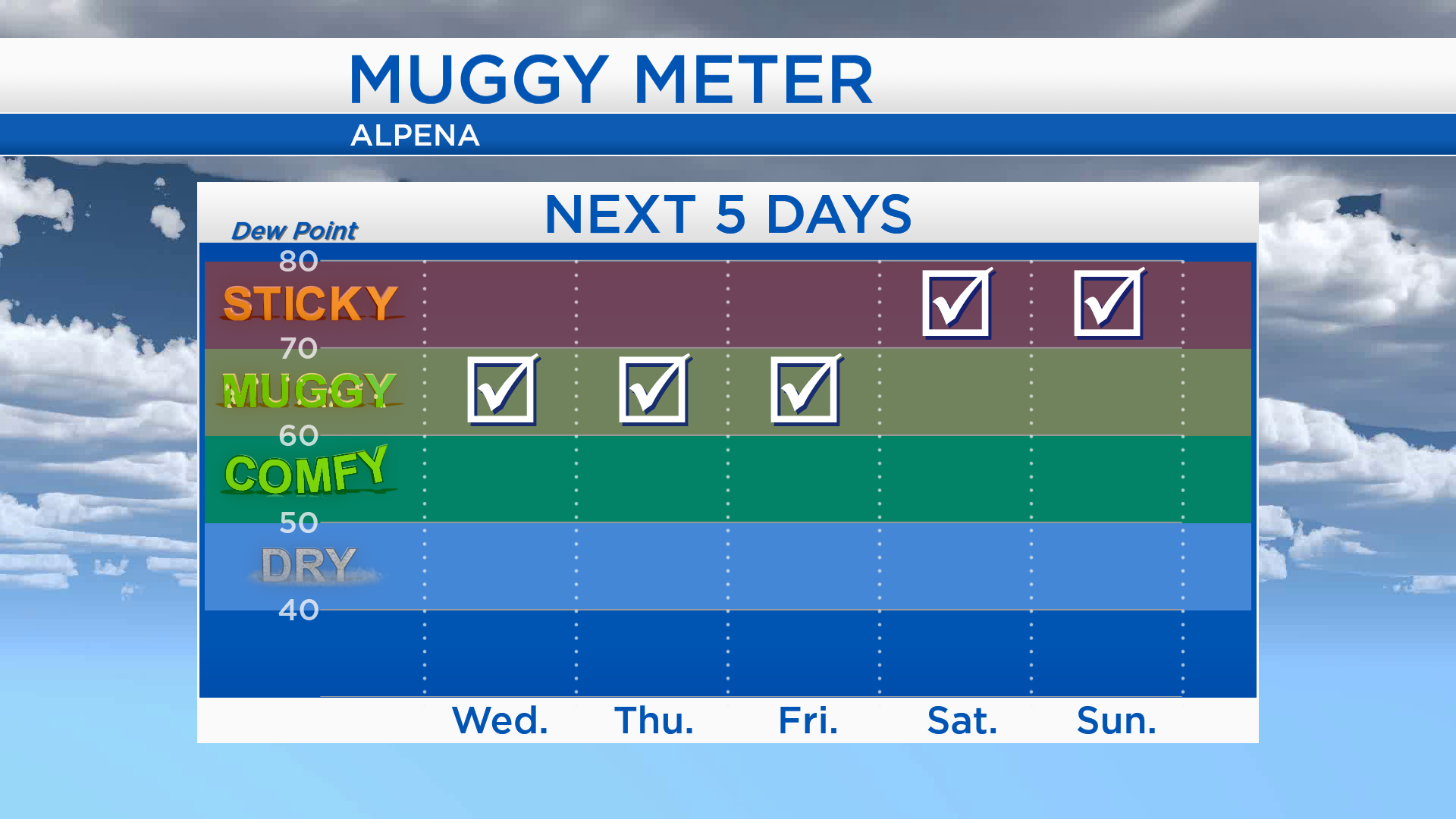
Humidity levels will become higher as of Wednesday. Dew points in the 60s will make it feel muggy Wednesday, Thursday and Friday. Dew points will rise to about 70 over the weekend, making it feel even stickier.
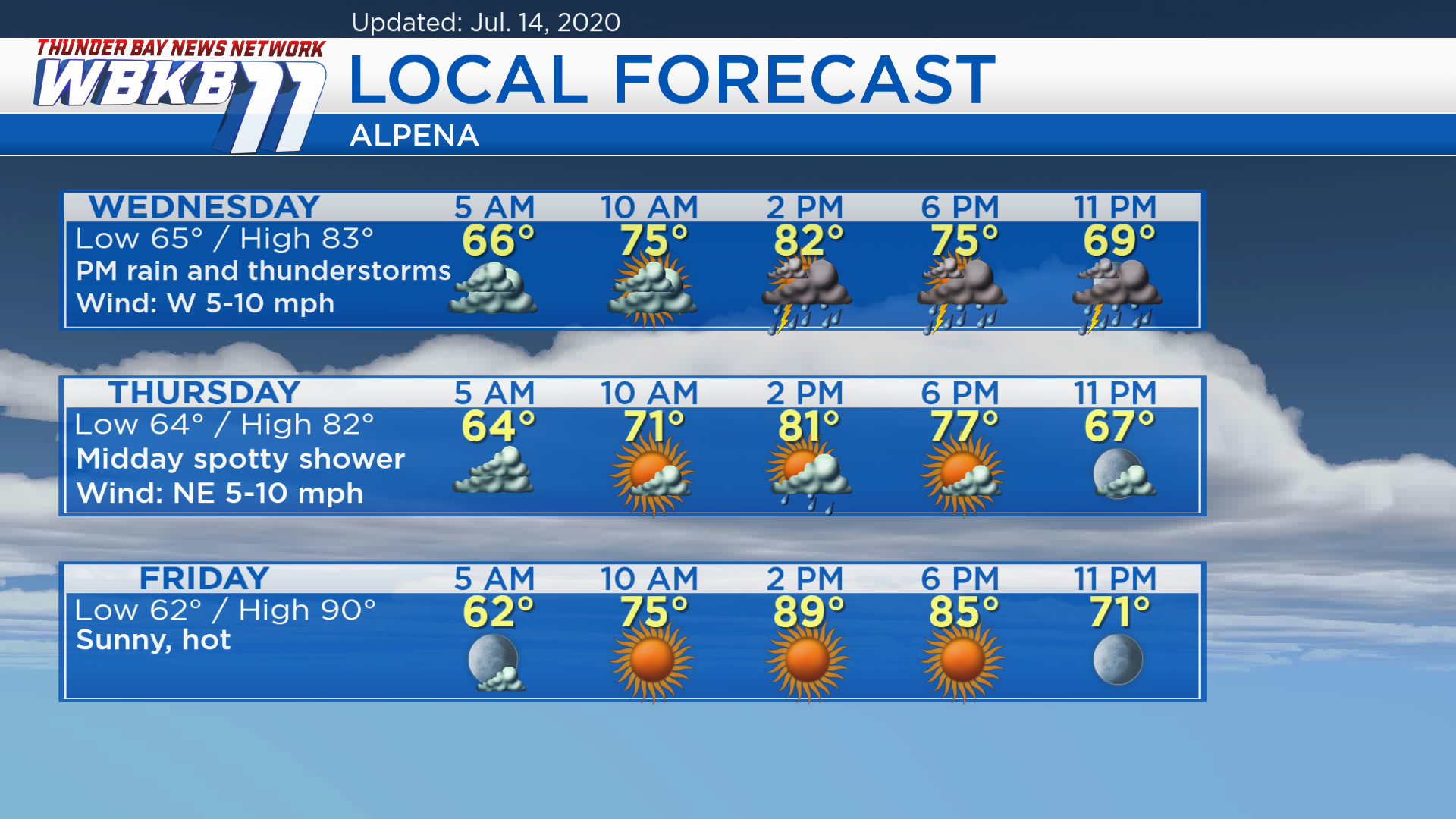
Wednesday: Mostly cloudy with a small chance of showers in the morning, then a greater risk of downpours/thunderstorms in the afternoon and evening. Predawn temperatures will be in the middle 60s. Afternoon highs will reach about 83 degrees. Early-evening temperatures will be in the middle/lower 70s.
Thursday: Mix of sun and clouds with but a midday spotty shower is possible. Predawn lows will be near 64 degrees. Late-morning temperatures will rise to the lower 70s. Afternoon highs will be near 82 degrees. Temperatures will be in the middle 70s during the early-evening.
Friday: Mostly sunny and hot. Predawn temperatures will be in the lower 60s. Late-morning temperatures will reach the middle 70s. Afternoon highs will heat up to about 90 degrees. Early-evening temperatures will remain quite warm, in the lower 80s.
For the rest of Northeast Michigan’s weather forecast, watch the latest weather video by clicking the weather tab at the top of the page.


