Snow showers incoming Tuesday; Arctic blast Wednesday

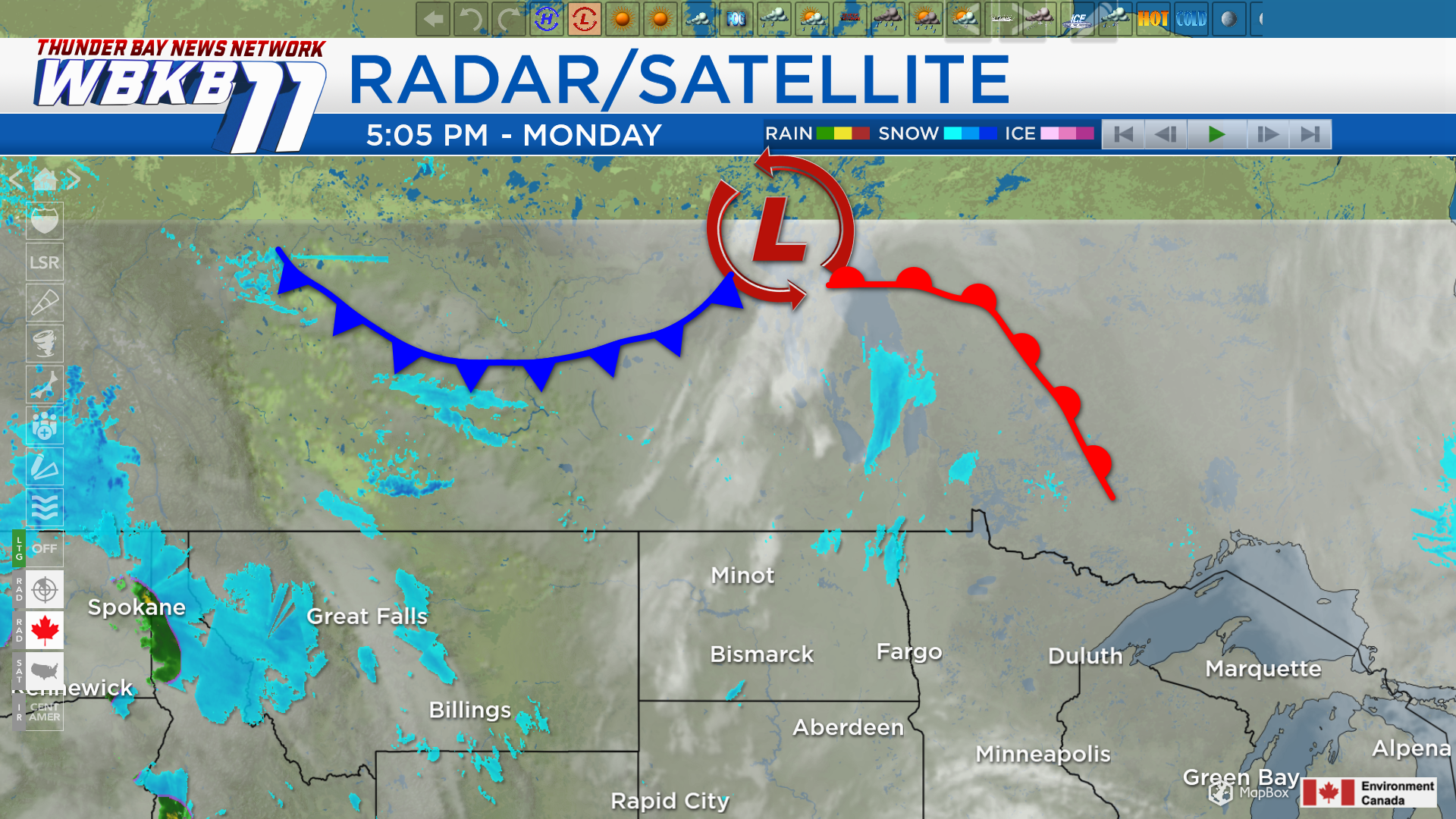
A developing storm system over central Canada will move in tomorrow. It will bring scattered snow showers beginning Tuesday afternoon. The cold front will usher in much colder temperatures for Wednesday.
Low temperatures overnight will cool to the middle 20s. Cloud cover will increase, but sky conditions are expected to remain dry into tomorrow morning. A chance of snow showers will begin in the afternoon as the incoming cold front approaches Northeast Michigan. High temperatures will reach about 36 degrees, and winds will come from the west around 15 mph.
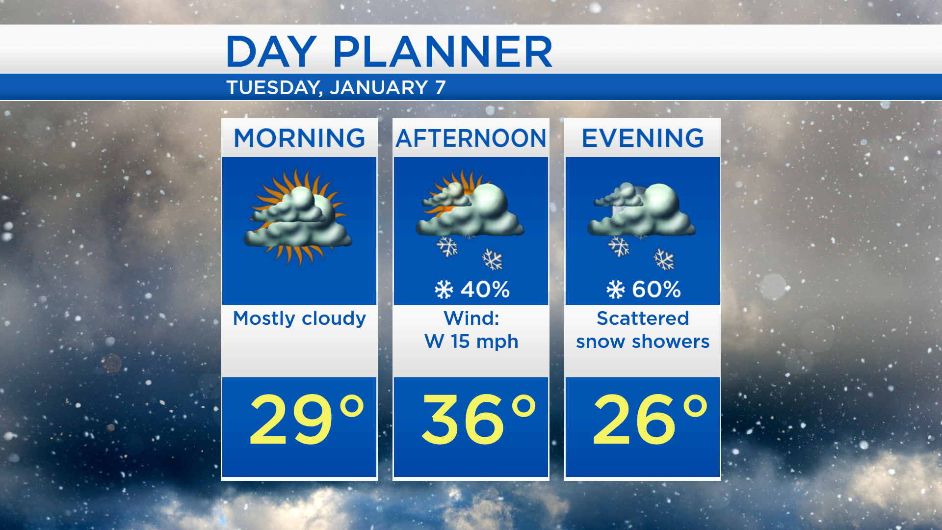
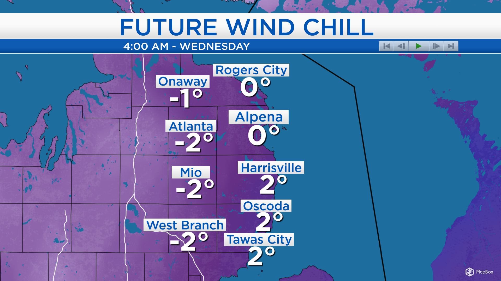
Wind chill values during the daytime hours of Tuesday will be in the 20s. After the cold front moves through, winds out of the northwest will bring a sharply colder air mass late Tuesday through Wednesday. Wind chills will drop close to zero early Wednesday.
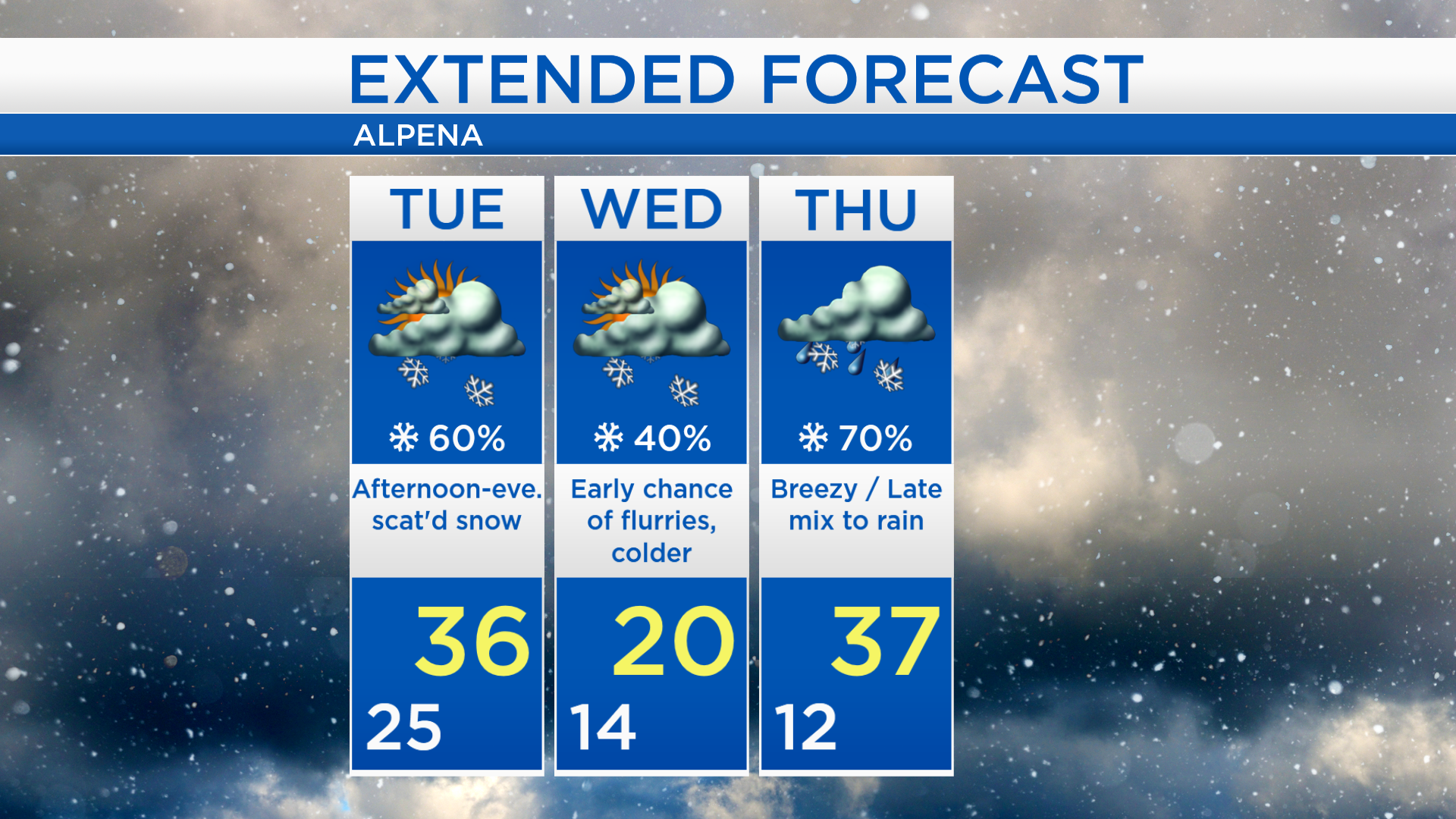
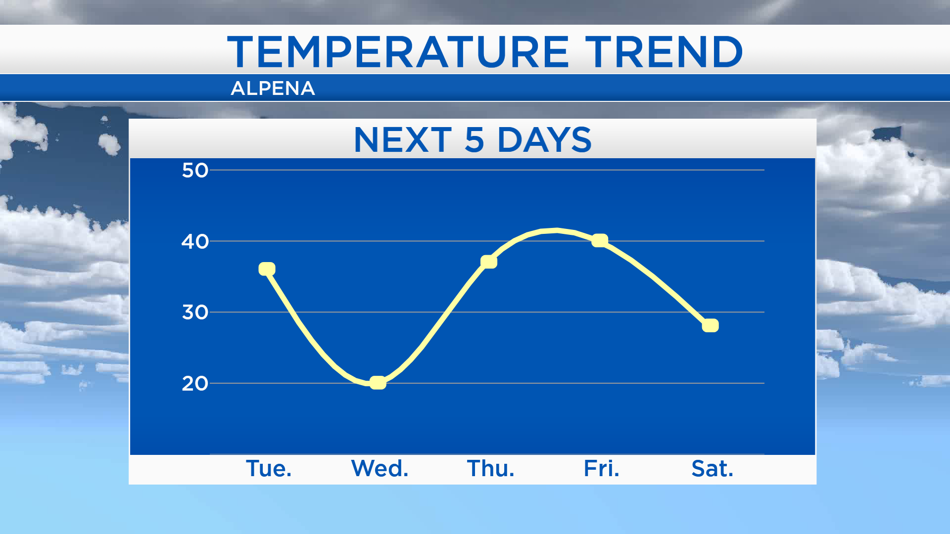
Temperatures will be on a roller coaster ride over the next few days. High temperatures will get into the middle 30s on Tuesday. But Wednesday afternoon, temperatures will reach only 20 degrees. Thursday morning will start with cold temperatures, then highs will climb to the upper 30s. Warm temperatures will remain in our area Friday.
Scattered snow showers are expected Tuesday afternoon to evening. A few flurries are possible early Wednesday but most of the day should be dry — and colder. Thursday will start dry, then mixed precipitation or rain showers will move in late-day. A chance of rain showers will linger early Friday.