Snow showers clearing early tomorrow; Wintry mix to rain on Friday
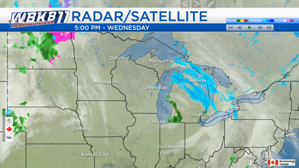
Snow showers have entered Northeast Michigan, progressing from southwest to northeast across the area over the next few hours. Dry weather across Minnesota, Iowa, Wisconsin, and Illinois will move in tomorrow, although skies will remain cloudy.
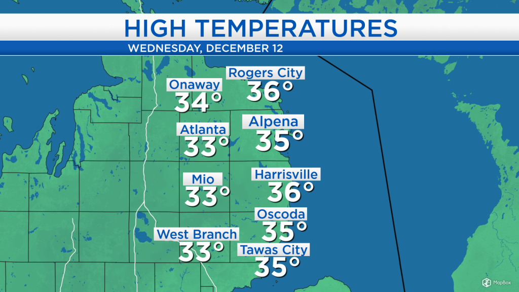
High temperatures today reached the middle 30s under cloudy skies (until the snow showers moved in), and a breeze out of the southeast at 10-15 mph. A breeze out of the southeast will continue overnight, keeping temperatures a little warmer for communities closer to shoreline of Lake Huron.
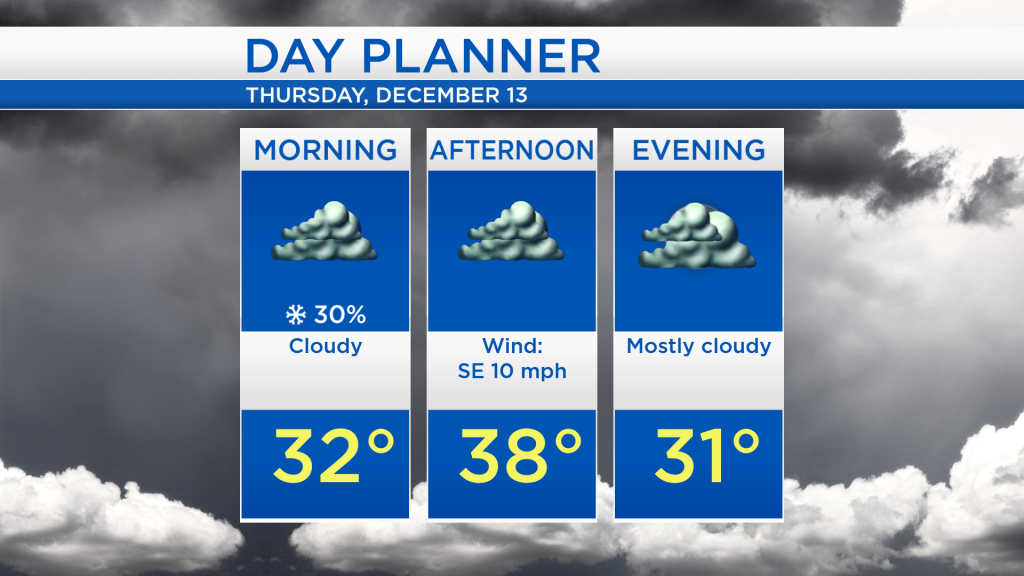
Overnight lows will drop to around 30 degrees for areas close to the shoreline and mid-20s farther inland. Snow showers will clear out by tomorrow morning, and cloudy skies will linger throughout the day as afternoon highs reach the upper-30s.
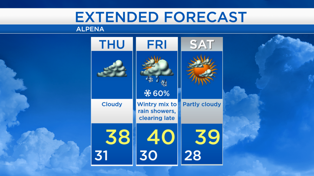
The next significant chance of precipitation will move in late Thursday night, lasting through Friday midday. With early-morning lows on Friday below the freezing mark, the precipitation will likely start as a wintry mix (consisting of rain/snow/sleet), then transition to rain showers as highs approach 40 degrees.
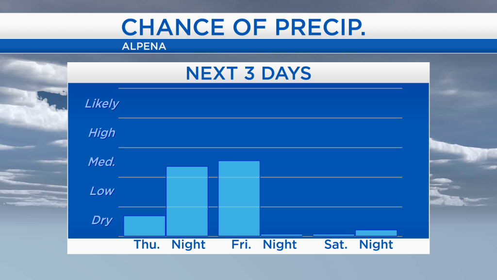
Skies will remain gray tomorrow with pleasant afternoon temperatures in the upper 30s. A wintry mix is forecast to move in late Thursday night, then switch to rain Friday. High temperatures on Friday are expected to reach 40 degrees. Clouds will begin to clear late on Friday, giving way to partly cloudy skies this weekend with highs in the upper 30s. For the rest of Northeast Michigan’s weather forecast, watch the latest weather video by clicking the weather tab at the top of the page.