Risk of severe thunderstorms with gusty winds Saturday
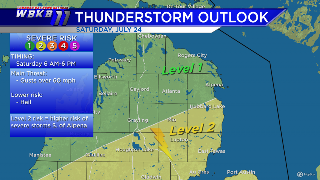
The National Weather Service has highlighted parts of Northeast Michigan in a level 2 risk of severe weather in the yellow area, south of Alpena. Level 2 indicates a higher chance of where thunderstorms could become severe Saturday. The main threat with Saturday’s thunderstorms will be damaging winds. There’s a lower, level 1 risk farther north. Thunderstorms will begin early Saturday and continue into Saturday afternoon.

An approaching warm front is going to bring much more humidity for Saturday. The humidity combined with a more unstable airmass will lead to an outbreak of thunderstorms. Then the cold front will move through and drier air will move in late Saturday, giving way to a much calmer Sunday.
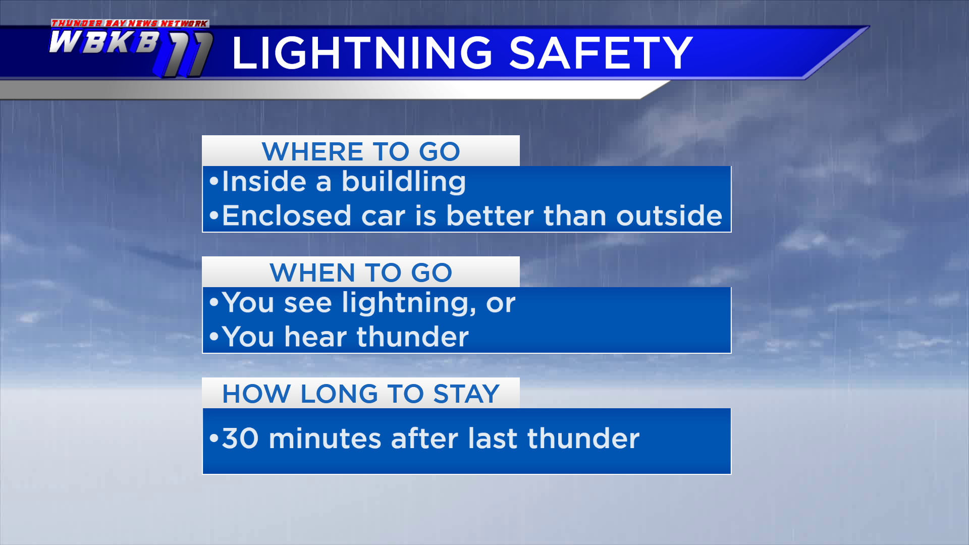
With outdoor plans popular this time of year and the Brown Trout Festival going on, it’s best to keep in mind lightning safety precautions. Go inside when thunder rumbles or lightning strikes, and stay there until 30 minutes after the last thunderclap. Going into an enclosed car is better than standing outside when lightning strikes.
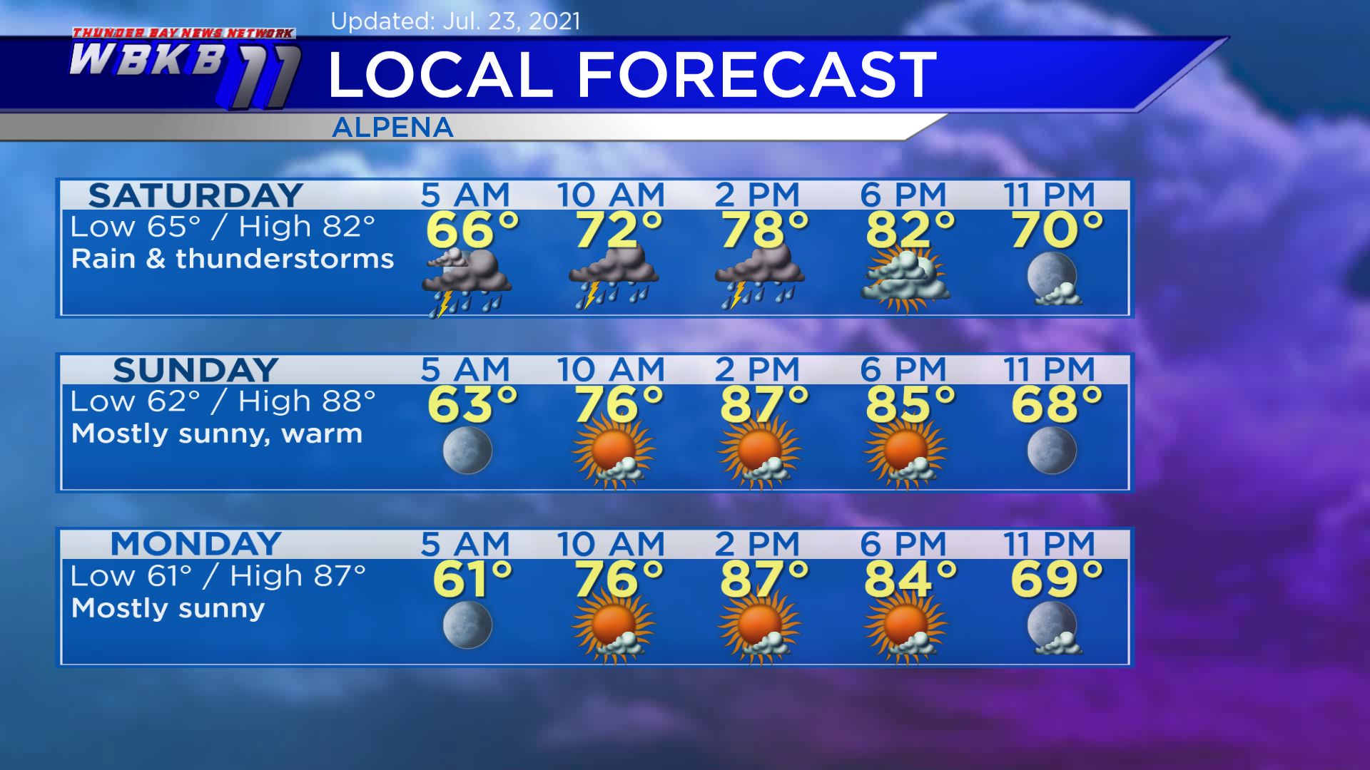
Saturday: Rain and thunderstorms in the morning-afternoon, some storms could produce gusty winds, and very humid. Early-morning lows will be near 65 degrees. Midday temperatures will rise to the middle 70s. High temperatures will reach around 82 degrees late-day. Evening temperatures will go into the 70s.
Sunday: Calmer, mostly sunny and very warm. Predawn lows will head down to about 62 degrees. Afternoon highs will get up to near 88 degrees. Evening temperatures will head to the 70s.
Monday: Mostly sunny and warm. Early-morning lows will cool off to around 61 degrees. Afternoon highs will head up to near 87 degrees. Evening temperatures will be mainly in the 70s.