Risk of severe storms Thursday; Extremely hot and humid Friday
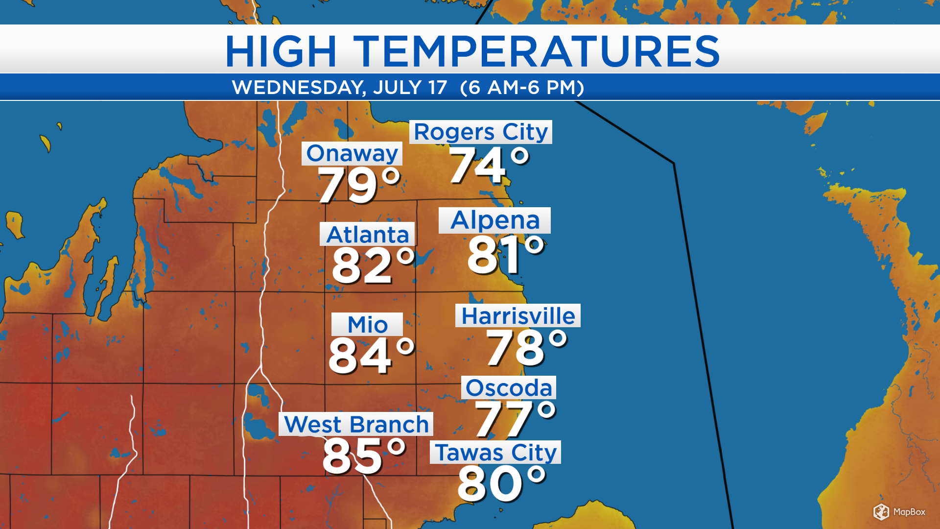
High temperatures today reached the upper 70s at the shoreline, cooled by a breeze out of the east off of Lake Huron. Farther west, high temperatures reached the middle 80s and all places saw mostly sunny skies.
A warm front is bringing unstable weather over Minnesota and Wisconsin, which will travel into our area tomorrow. A risk of severe thundertorms will be greatest in the midday and afternoon hours. This warm front will bring an intolerable combination of high heat and humidity on Friday.
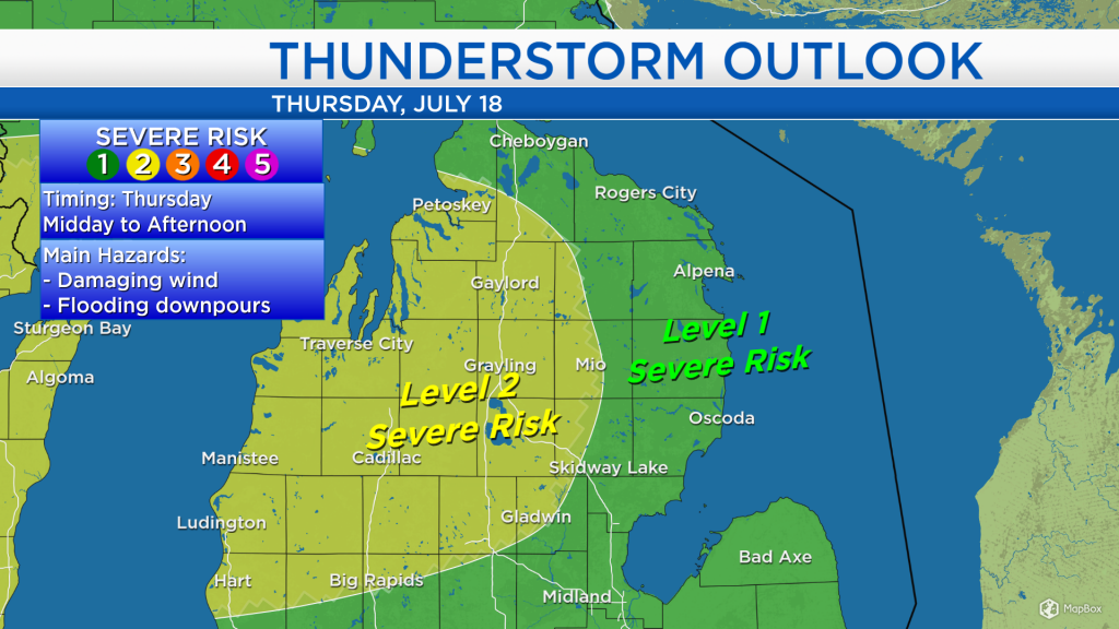
The Storm Prediction Center has issued a level 2 risk of severe storms for tomorrow for the area shaded in yellow, west of Alpena. The greatest hazards include damaging wind and flooding downpours. Several areas could get more than 1 inch of rain within a 6-hour period.

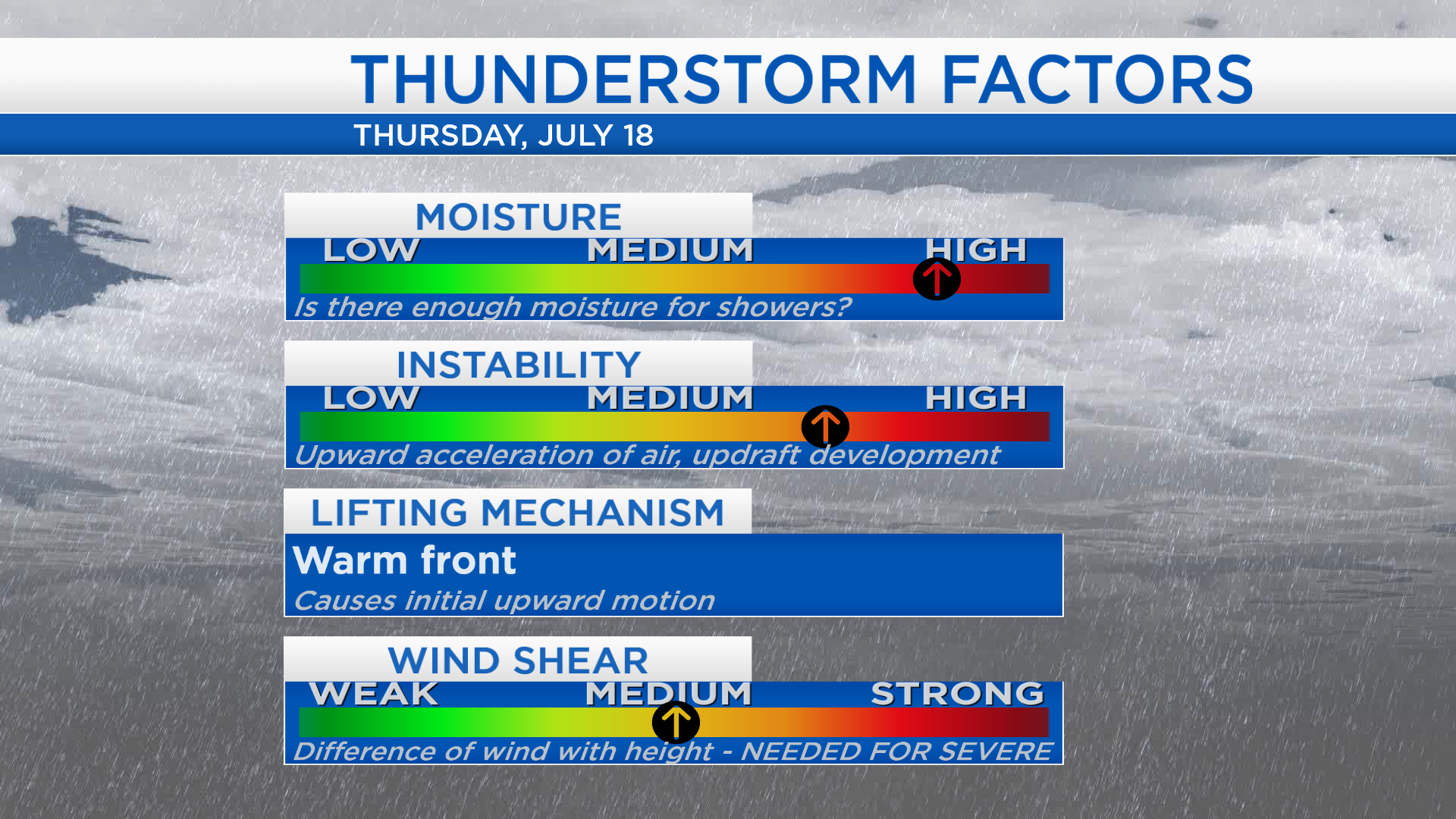
All the necessary factors leading to a risk of severe thunderstorms are apparent in tomorrow’s forecast. If all four factors coincide over the same place at the same time, that would set the stage for severe thunderstorms. There is plenty of moisture for rain to develop, plenty of instability for strong thunderstorms to form. The lifting mechanism forcing the upward motion of air will be an incoming warm front. Wind shear which in this case pertains to the difference of wind speed with height could lead to locally damaging wind gusts.
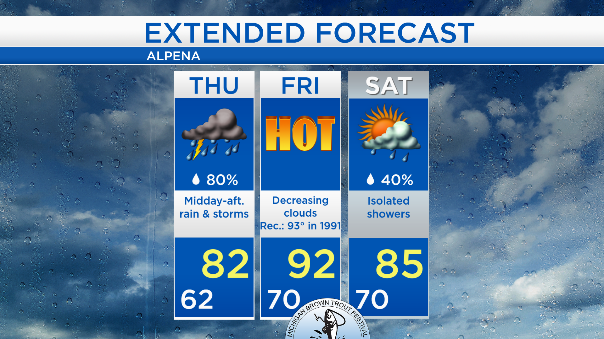
Rain and thunderstorms are likely sometime in the midday to afternoon hours tomorrow with highs in the lower 80s. The heat and humidity will spike on Friday, and high temperatures will reach the lower 90s. A few showers are possible on Saturday with highs in the middle 80s, then high temperatures will cool on Sunday to the upper 70s.
For the rest of Northeast Michigan’s weather forecast, watch the latest weather video by clicking the weather tab at the top of the page.