
Rain or snow shower possible late-day Wednesday; Turning breezy Thursday
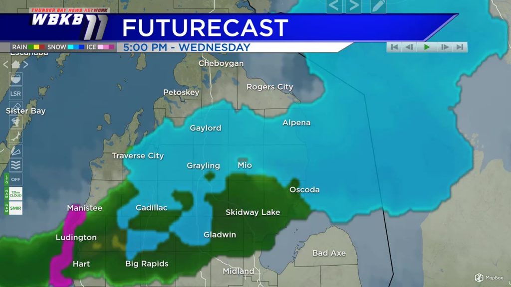
We have seen cloudy skies and cooler temperatures today across Northeast Michigan. The extensive cloud cover will continue into Wednesday. A weak disturbance currently located to the southwest of our area will bring a possibility of a rain/snow shower late-day Wednesday.
Wednesday will begin with a mix of sun and clouds in the morning, then clouding over pretty quickly. The chance of a rain or snow shower will begin close to 3 p.m. and continue until about 8 p.m. After that, drier conditions will build into the area, leading to some breaks of sun expected Thursday.
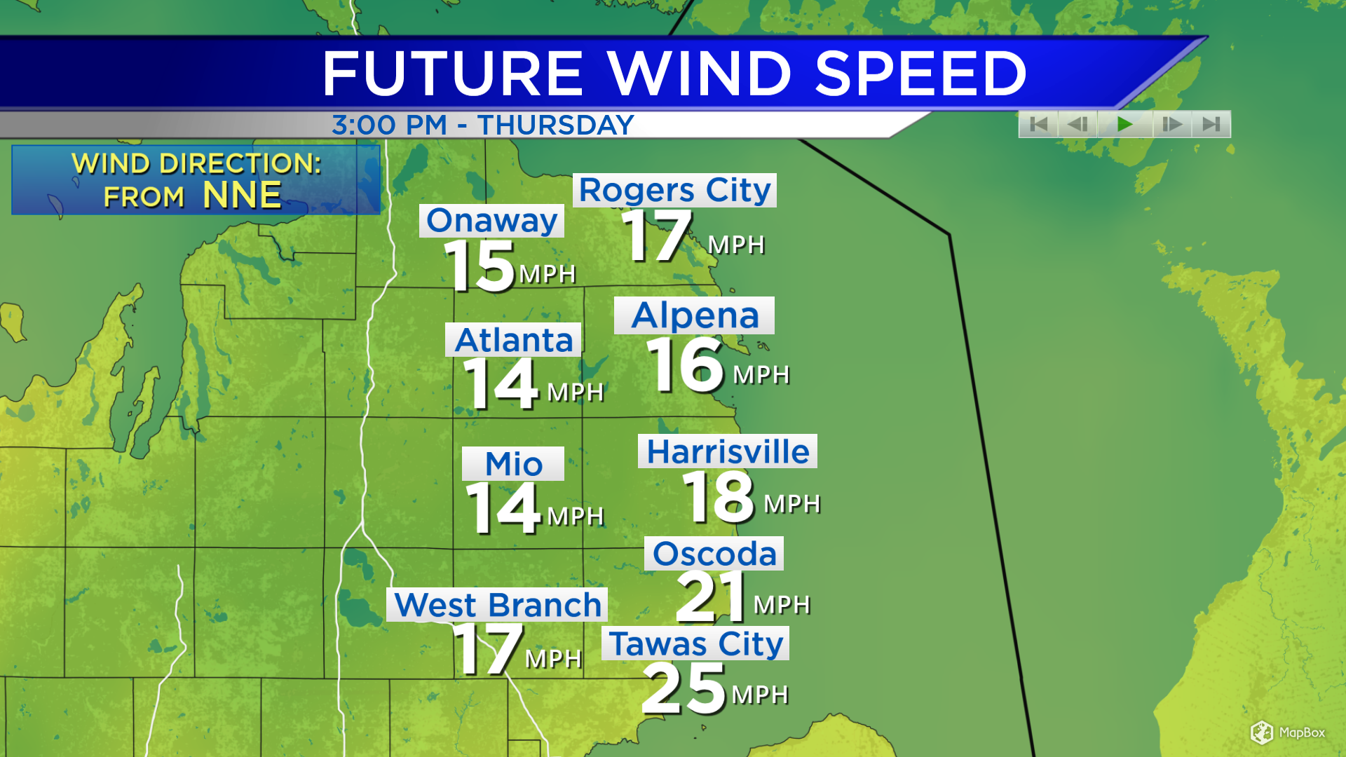
Winds on Wednesday will be very light and hardly noticeable. Stronger winds will develop Thursday. By Thursday afternoon, winds will be blowing at 15-20 mph out of the north-northeast. Wind speeds will decrease Friday.
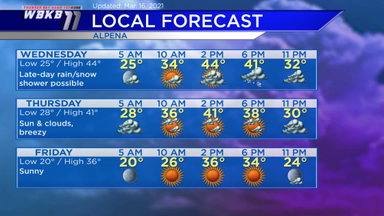
Wednesday: Any morning breaks of sun will be short-lived, then a rain or snow shower will be possible around suppertime (give or take a couple hours). Predawn temperatures will drop to the middle 20s. Temperatures will rise to the middle/upper 30s by the late-morning. Afternoon highs will reach about 44 degrees. Evening temperatures will head into the 30s.
Thursday: Breezy with a mix of sun and clouds. Early-morning temperatures will begin in the upper 20s. Afternoon highs will be near 41 degrees. Evening temperatures will cool to the middle/lower 30s.
Friday: Bright and cooler. Early-morning temperatures will be close to 20 degrees. The rest of the day will feel chilly with afternoon highs getting up to only 36 degrees. Evening temperatures will go from the lower 30s to the middle 20s.
Temperatures will become much warmer over the weekend. For the rest of Northeast Michigan’s weather forecast, watch the latest weather video by clicking the weather tab at the top of the page.


