More warmth, also showers midweek
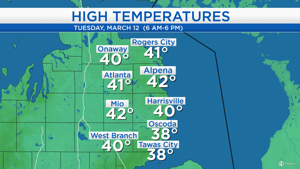
High temperatures today reached the lower 40s for most of Northeast Michigan combined with sunny skies and a breeze out of the southwest. The sunshine will get replaced by cloudier skies later tonight, and rain will approach our area early tomorrow.
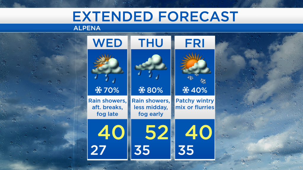
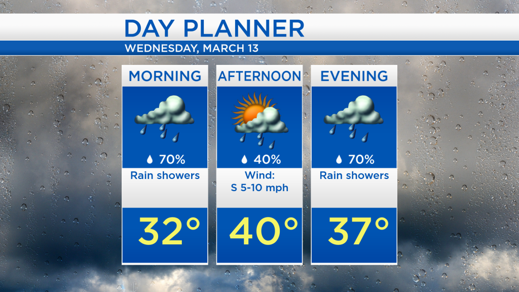
The first round of rain currently moving through Iowa and Minnesota will arrive here predawn lasting into tomorrow morning. There could be some wintry mix initially, then mainly rain for the morning hours. A dry break is possible midday-afternoon, then a storm system moving from Arizona to the Upper Plains will bring more widespread showers to Northeast Michigan area late tomorrow and Thursday.
The greatest chances of rain tomorrow will happen during the morning and evening, but a couple of spotty showers are possible in the afternoon as high temperatures reach around 40 degrees. As warm temperatures move over our existing snowpack, fog could develop late Wednesday and early Thursday.
Temperatures will drop to the upper 20s tonight, so a little wintry mix is possible as the precipitation starts early tomorrow. Mostly rain is expected throughout Wednesday and Thursday. Brief spells of dry weather are possible tomorrow afternoon and Thursday midday-early afternoon.
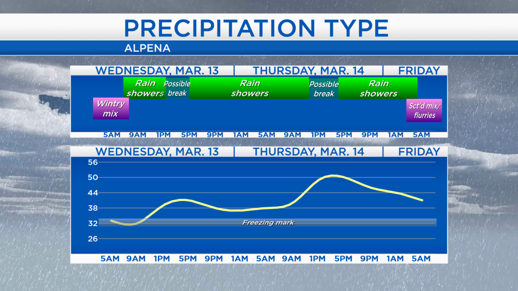
Expect a wet start tomorrow and also a wet finish with highs close to 40 degrees. Temperatures will warm further on Thursday with a breeze out of the south pushing afternoon highs into the lower 50s. We will likely see rain in the morning and evening again on Thursday. The incoming rain combined with warm temperatures will cause existing snowdrifts to shrink. Colder air begins on Friday, and even cooler air moves in Saturday. For the rest of Northeast Michigan’s weather forecast, watch the latest weather video by clicking the weather tab at the top of the page.