More showers late tonight; Mostly dry and warmer Thursday
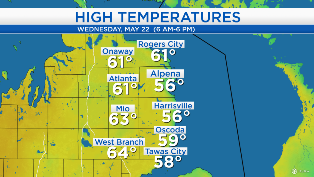
High temperatures today reached the lower 60s away from the shoreline, but only middle to upper 50s at the shoreline. Winds out of the southeast about 15 mph, coming off of Lake Huron, kept temperatures cooler at the shoreline. Temperatures will get warmer tomorrow with a brisk breeze from the west.
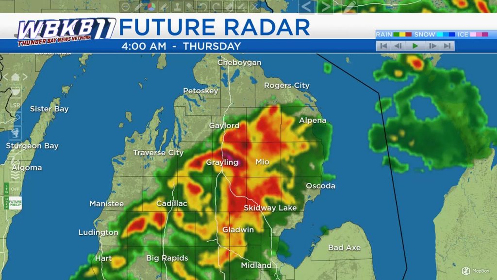
A storm system near the Minnesota-North Dakota border will move northward, and some showers are expected to develop within the yellow outline. These showers will move east into our are late tonight/predawn early tomorrow, and possibly produce a few thunderstorms. After that, we should see some afternoon sunshine.
The “Future Radar”, a high resolution forecast over the next 12 hours shows we will some some showers, localized heavy downpours (in dark red) and possibly some thunderstorms later tonight, between 2 a.m. and 7 a.m. tomorrow morning.
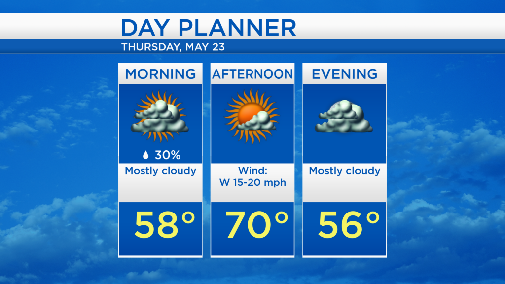
Other than a slim chance of morning showers, skies are expected to become partly cloudy in the afternoon. By the morning, temperatures will already rise to the upper 50s, and afternoon highs will get close to 70 degrees. A breeze will pick up out of the west, about 15-20 mph.
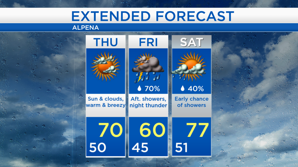
Tomorrow should end up mostly dry, and dry weather will continue into Friday morning. A few showers are possible Friday afternoon, then a significant chance of thunderstorms will arrive Friday night. A few showers might persist early Saturday, but dry weather and some sunshine are expected to return Saturday afternoon. Temperatures on Saturday are forecast to reach the upper 70s. So far this year, the warmest temperature was 76 degrees on April 22 — the current forecast is for 77 degrees on Saturday.