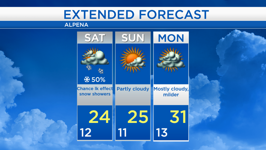
Lake effect snow Saturday; Dry Sunday
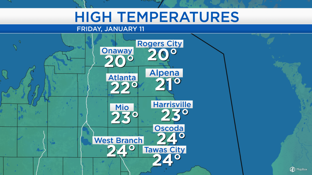
Lows in the early-morning bottomed out at 2 degrees in Alpena, then highs reached the lower 20s this afternoon under cloudy skies and light winds less than 5 mph. Highs will warm slightly this weekend, reaching the lower 20s.
An area of snow showers has been moving through the Upper Peninsula. A larger storm system to our south is bringing widespread rain to Kansas, Oklahoma, Arkansas, and Texas, and it is producing a large swath of snow to the north, across parts of Kansas, Missouri, and Illinois. While this low pressure system will stay to our south, the counter-clockwise wind flow around it will bring a breeze out of the east tomorrow.
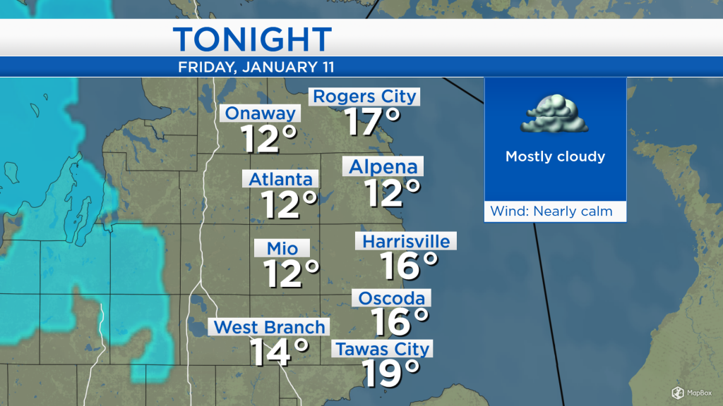
Low temperatures overnight will drop to around 12 degrees, except a little warmer at the shoreline, with mostly cloudy skies and nearly calm winds.
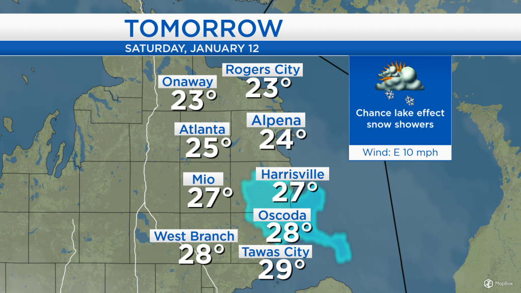
Light winds out of the east will cause lake effect snow showers to develop off of Lake Huron, mainly centered over Alcona county, with a few snow showers in the surrounding areas. The chance of lake effect snow is greatest in the morning-afternoon, and will wane in the evening. High temperatures on Saturday will reach the mid-20s for most of Northeast Michigan, and upper 20s in Iosco and Ogemaw counties.
Drier conditions are expected for the second half of the weekend. High temperatures on Sunday afternoon will reach the mid-20s with partly cloudy skies. More cloud cover is expected on Monday as highs warm into the lower 30s for the start of the work week. Then, a chance of flurries will move in on Tuesday with a cold front, bringing colder temperatures for middle/end of next week. For the rest of Northeast Michigan’s weather forecast, watch the latest weather video by clicking the weather tab at the top of the page.