Cooler this weekend; Snowy Sunday likely

Cloudy skies will continue over Northeast Michigan through the weekend. An area of snow showers over Minnesota and Iowa is progressing eastward, and could give a few isolated flurries early Saturday. Most of Saturday should end up dry. A separate storm system coming from western Canada will bring a more likely chance of snow on Sunday.
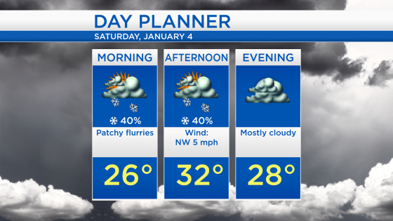
Low temperatures overnight will drop to about 24 degrees. A few flurries are possible during the first half of Saturday. High temperatures will reach about 32 degrees Saturday afternoon, and winds out of the northwest will be light.
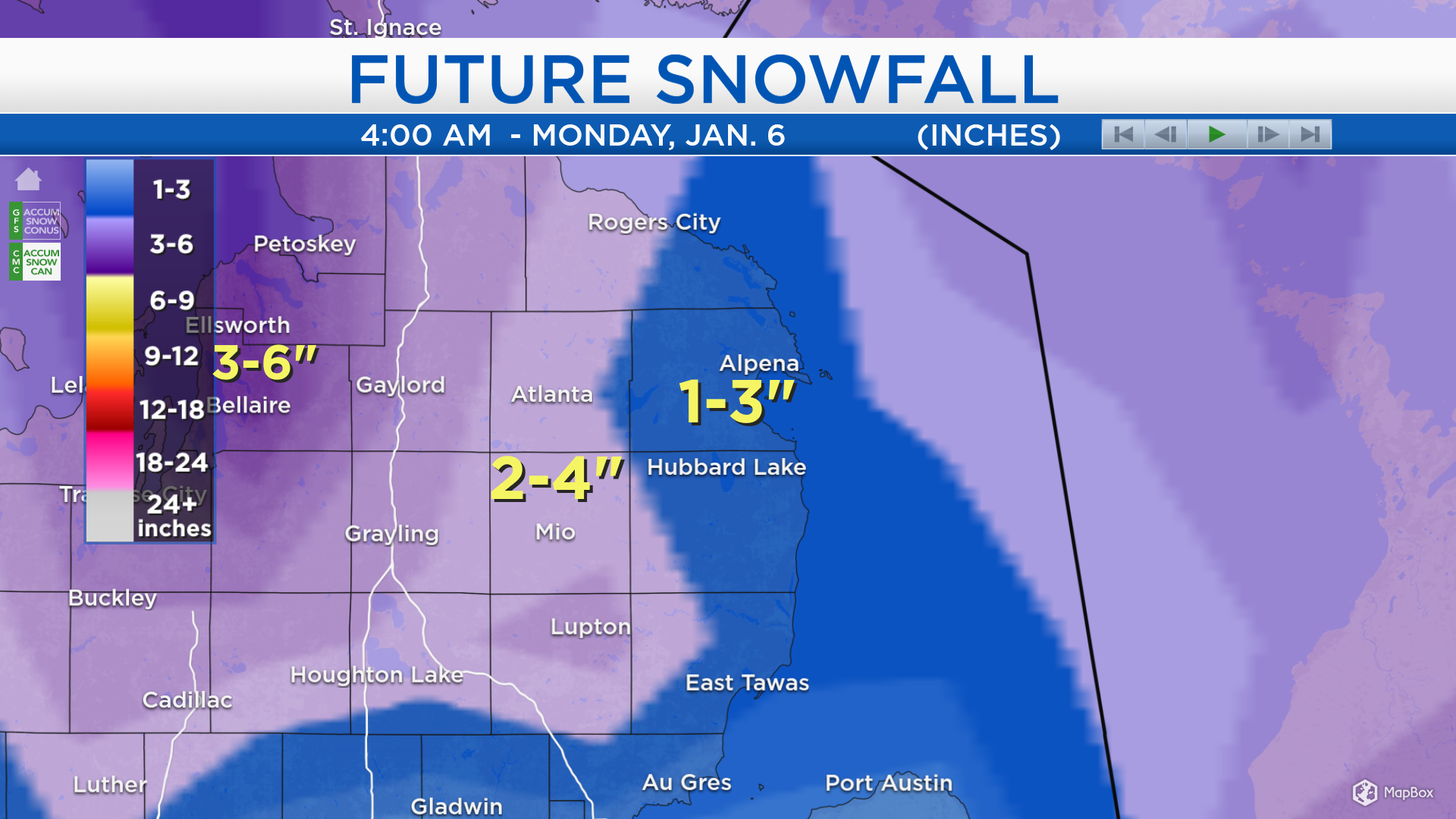
The highest chance of snow over the next few days will be Sunday afternoon-evening, and light snowfall accumulations are likely. Areas near Lake Huron will get 1-3 inches of snow, shaded in dark blue (including Alpena, Harrisville and Oscoda). Farther west, areas in light purple will get 2-4 inches of snow (including Atlanta, Mio and Rose City).
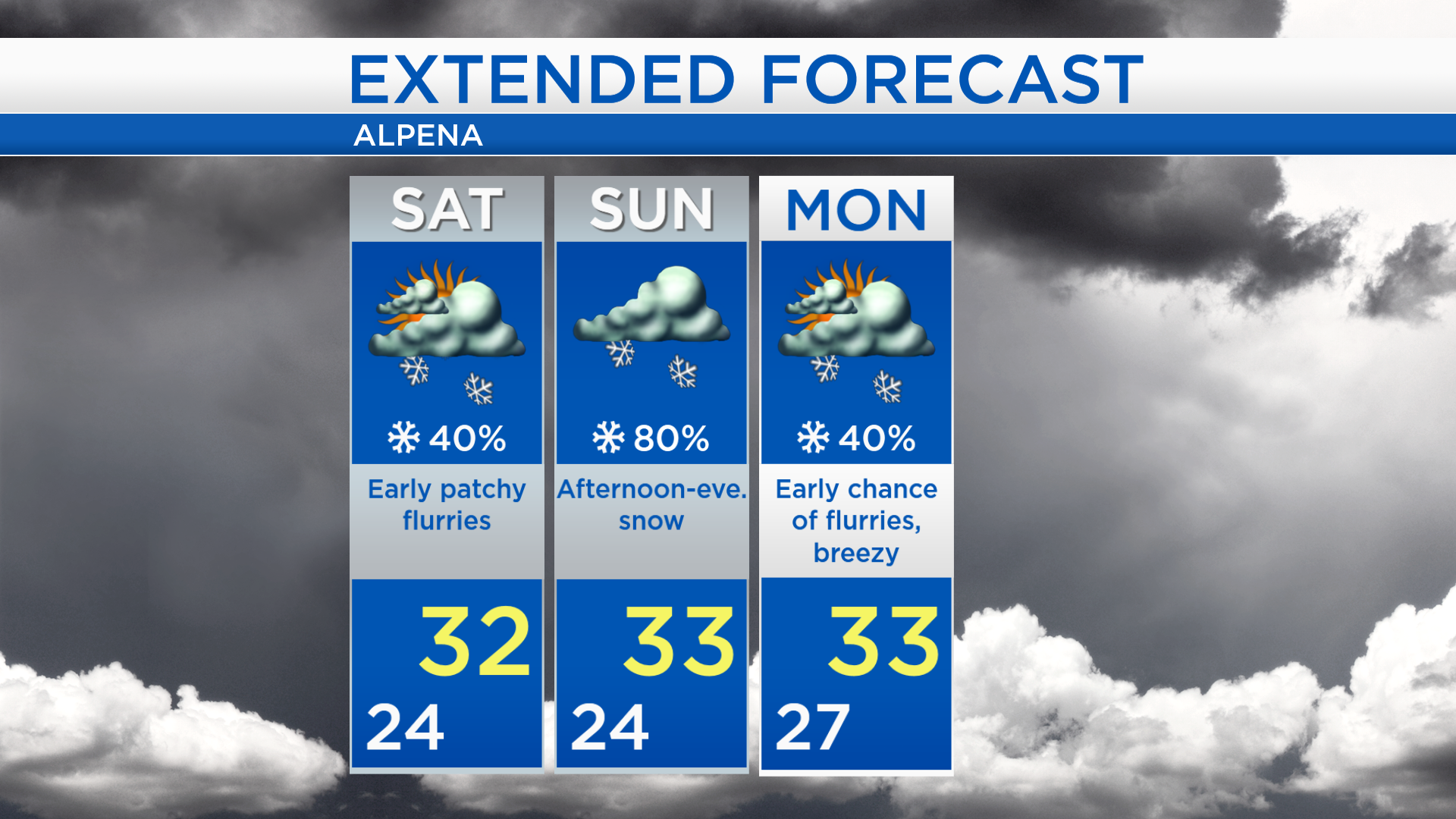
A few patchy flurries are possible early in the day Saturday, and high temperatures will get into the lower 30s. Snow will be likely Sunday afternoon-evening and highs will be around 33 degrees. A few flurries will be possible early Monday, then drier conditions late Monday. The next chance of flurries will develop late-day Tuesday, and temperatures will get colder midweek. For the rest of Northeast Michigan’s weather forecast, watch the latest weather video by clicking the weather tab at the top of the page.