Colder air arriving midweek; Enjoy a dry Wednesday
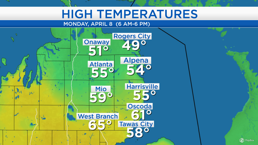
The high temperature in Alpena reached the middle 50s, while it was warmer in Iosco and Ogemaw counties where some places reached the 60s. A breeze out of the west about 10 mph and limited afternoon sunshine contributed to these warm temperatures. Winds will shift out of the northwest tomorrow, then out of the northeast Wednesday, and temperatures will progressively cool as a result.
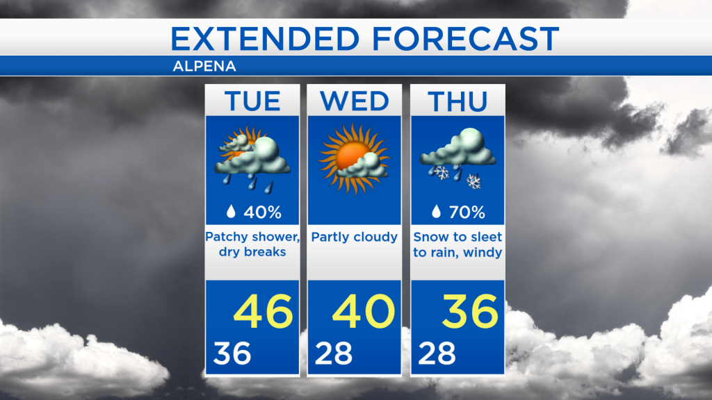
A weak disturbance currently over Wisconsin and the Upper Peninsula will bring rain showers to our area later this evening. After that, patchy showers are possible tomorrow but we should see plenty of dry time as well. Much drier air currently over the Upper Plains will move into our area Wednesday, providing a completely dry day and a greater amount of sunshine. A storm system currently over the Pacific Northwest will first travel to the Plains, then turn toward the Great Lakes. It will bring plenty of moisture and likely messy weather to our area Thursday.
A few patchy showers are possible tomorrow, otherwise, mostly cloudy skies. Morning temperatures will start in the middle 30s then high temperatures will reach the middle 40s with a breeze out of the northwest about 15 mph.
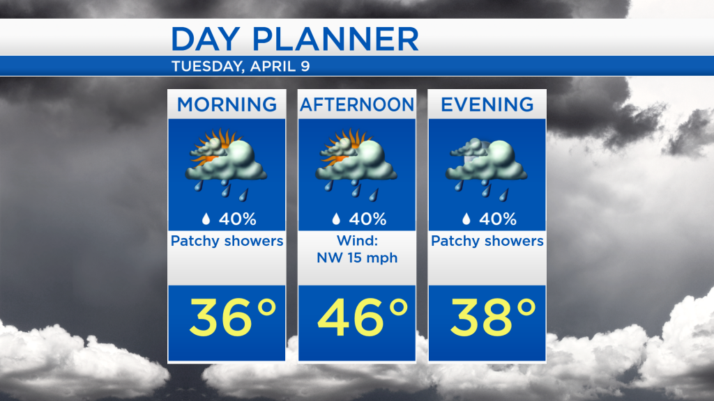
Possible raindrops mixed with dry periods are expected tomorrow with high temperatures around 46 degrees. Temperatures will drop to the upper 20s early Wednesday, then reach 40 degrees in the afternoon but we will see some sunshine. On Thursday, a storm system moving out of the Plains will likely bring snow to start, then a wintry mix, changing over to rain late-day. A surge of warmth is expected Friday which will keep the precipitation type as rain from late Thursday into Friday. For the rest of Northeast Michigan’s weather forecast, watch the latest weather video by clicking the weather tab at the top of the page.