
Cold front brings rain late Tuesday, much colder temperatures Wednesday
A cold front is moving through the Upper Peninsula tonight. An additional storm system over the southwestern states will ride along the cold front and move into our area late Tuesday.
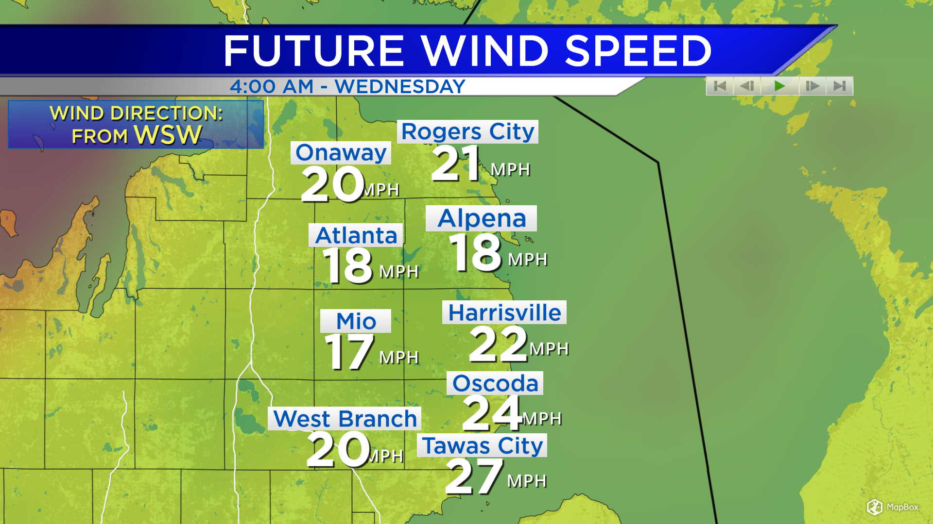
The incoming cold front will also bring stronger winds Tuesday night to early Wednesday. Winds will strengthen to 20-25 mph in that timeframe.
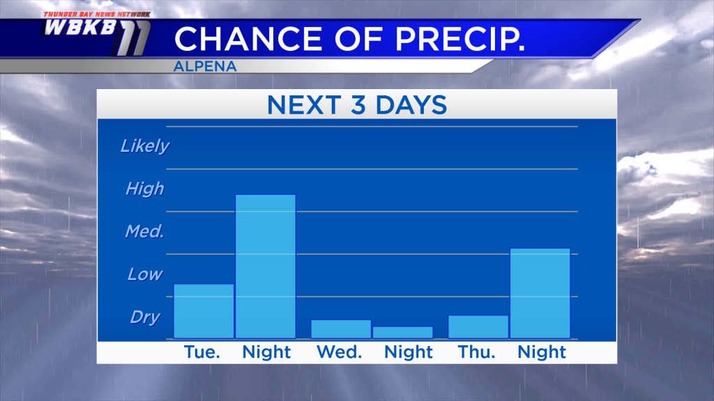
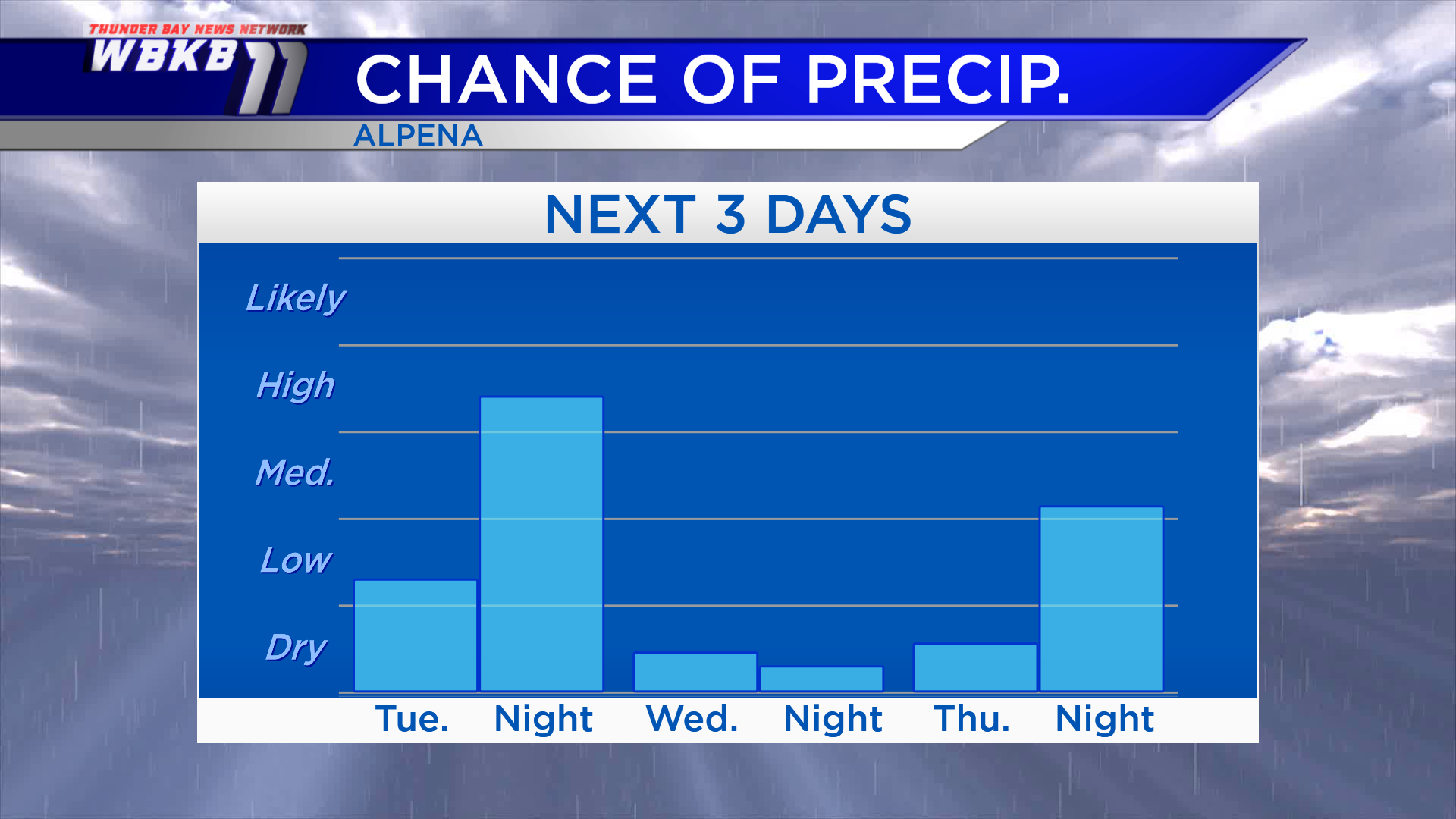
The chance of rain will climb highest Tuesday evening/night. Wednesday will be drier, we’ll see some breaks of sunshine but it’s going to feel much colder. There could be a stray shower late Thursday, but most of the dry will likely end up dry.
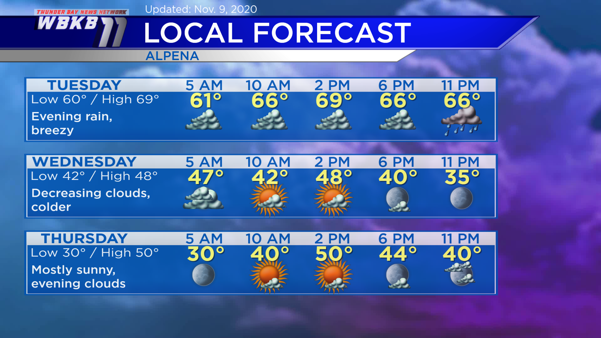
Tuesday: Mainly cloudy, warm, then evening rain. Predawn temperatures will be near 60 degrees. Temperatures will rise slightly to the middle 60s in the late-morning. Afternoon highs will get up to 69 degrees. Evening temperatures will be in the middle 60s.
Wednesday: Decreasing clouds, becoming mostly clear in the evening. Temperatures will cool to the lower 40s in the morning. Afternoon highs will reach only the upper 40s — which is typical for November! Evening temperatures will head into the upper 30s.
Thursday: Mostly sunny, some evening clouds. Predawn temperatures will drop to about 30 degrees. Late-morning temperatures will climb to about 40 degrees. Afternoon highs will be near 50 degrees. Evening temperatures will dip to the lower 40s.
For the rest of Northeast Michigan’s weather forecast, watch the latest weather video by clicking the weather tab at the top of the page.


