Bundle up Friday; Sunshine this weekend
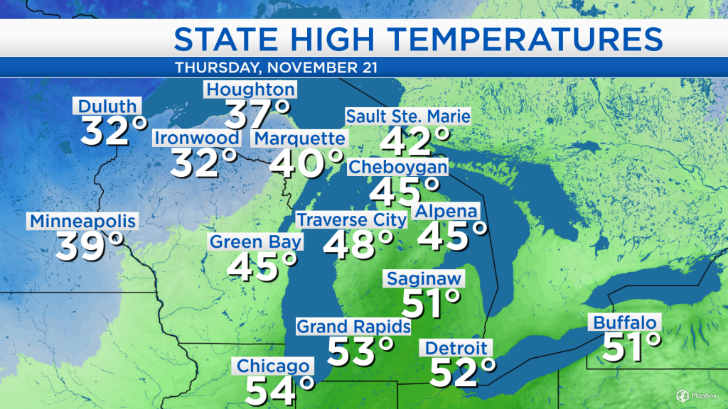
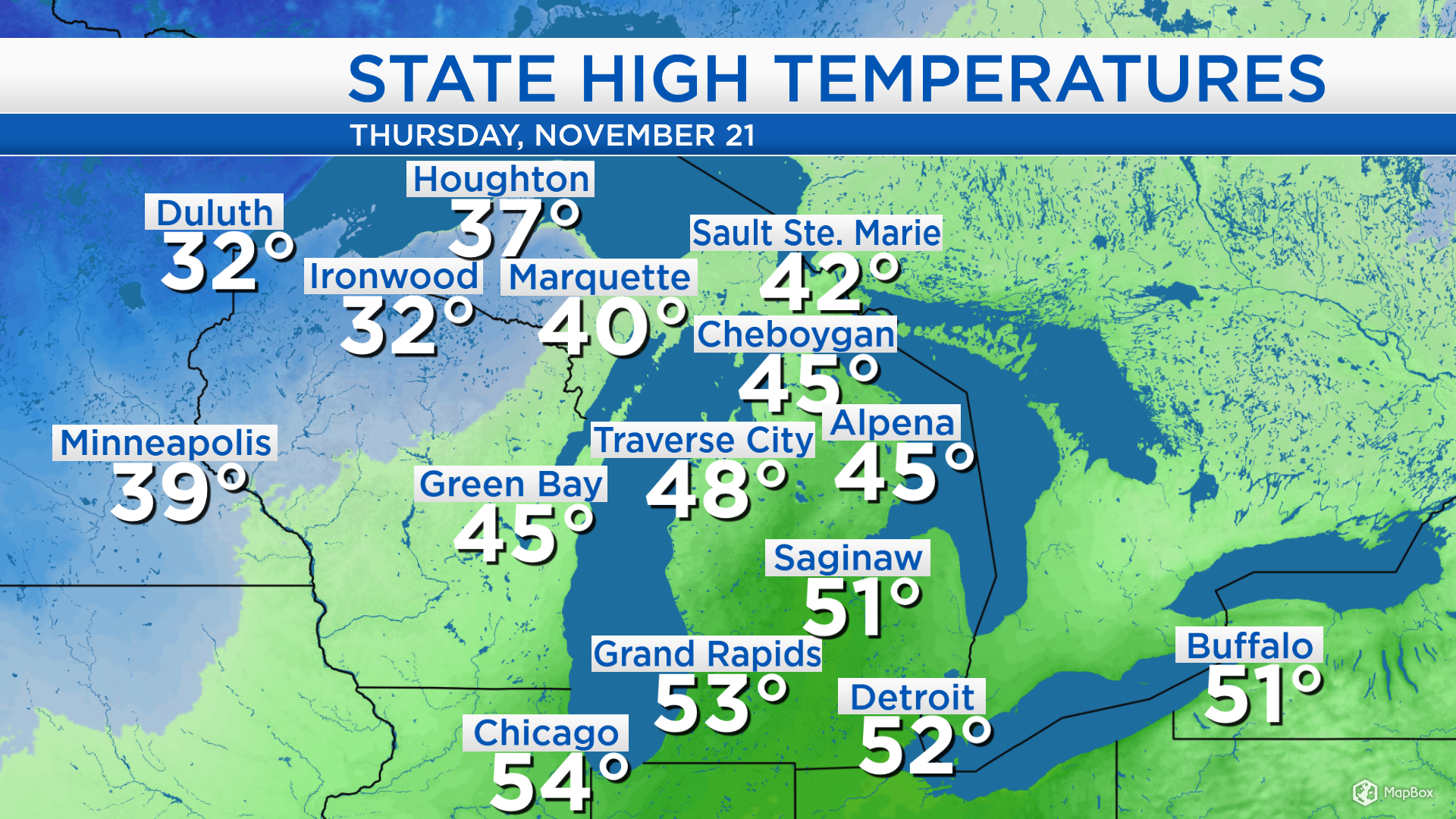
High temperatures today reached the middle 40s in Alpena. A storm system moved in from the southern Plains and has progressed to the northeast of Lake Superior. This brought rain to our area nearly all day. Beginning this evening, winds will become out of the northwest, which will send colder temperatures to our area. High temperatures in western areas of the Upper Peninsula reached only into the 30s, and that colder air will move into Northeast Lower Michigan tonight and tomorrow.
Most of the rain has moved to the northeast of our area. A few patchy showers are possible tonight and may also transition to flurries as the temperatures drop below freezing. Clearer skies currently in Minnesota, North Dakota and South Dakota will progress into our area tomorrow.
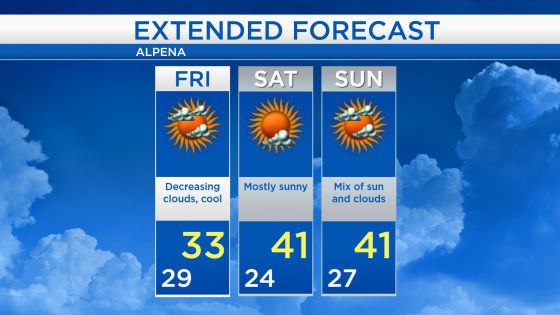
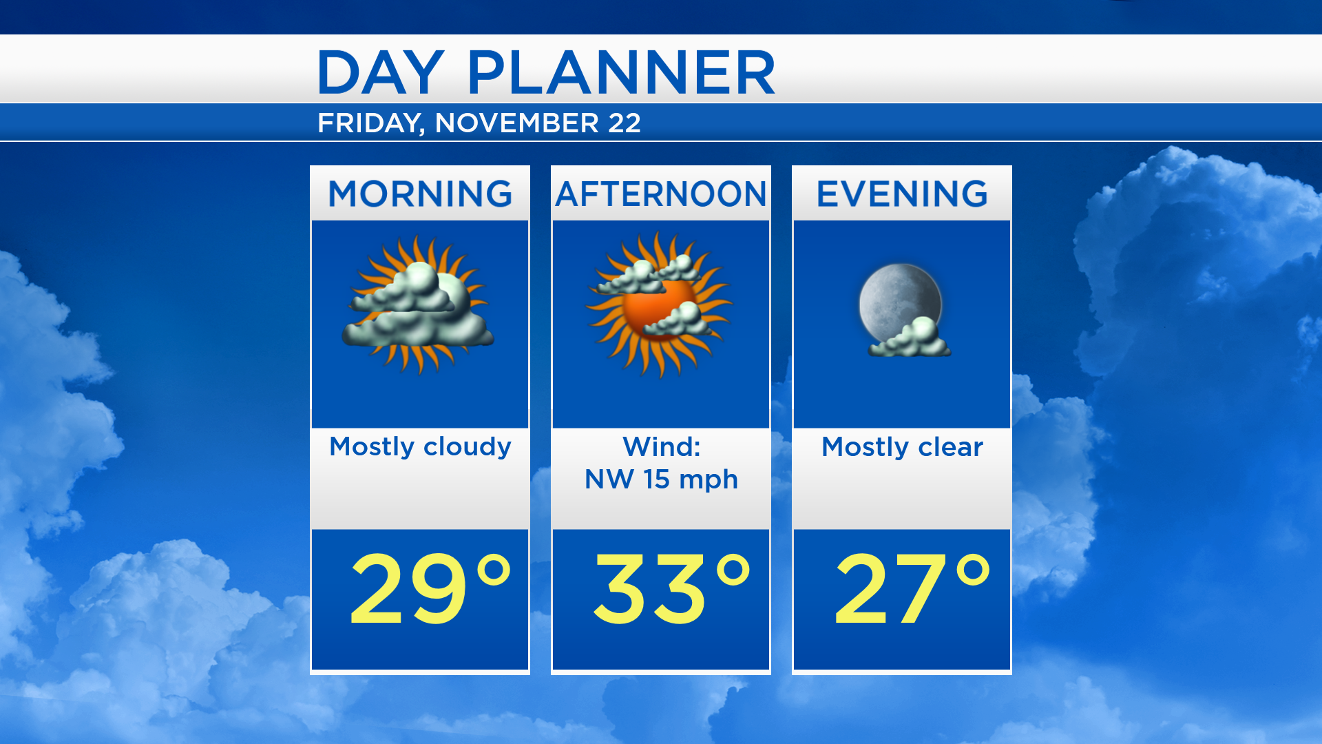
Low temperatures will drop to the upper 20s early Friday. The day will start with mostly cloudy skies, then cloud cover will gradually decrease. High temperatures will reach only about 33 degrees with a breeze from northwest, about 15 mph.
Although it will get colder tomorrow, temperatures will recover over the weekend. Winds will shift direction on Saturday, coming out of the southwest, and that will help temperatures climb to the lower 40s. Highs in the lower 40s will continue through Tuesday.
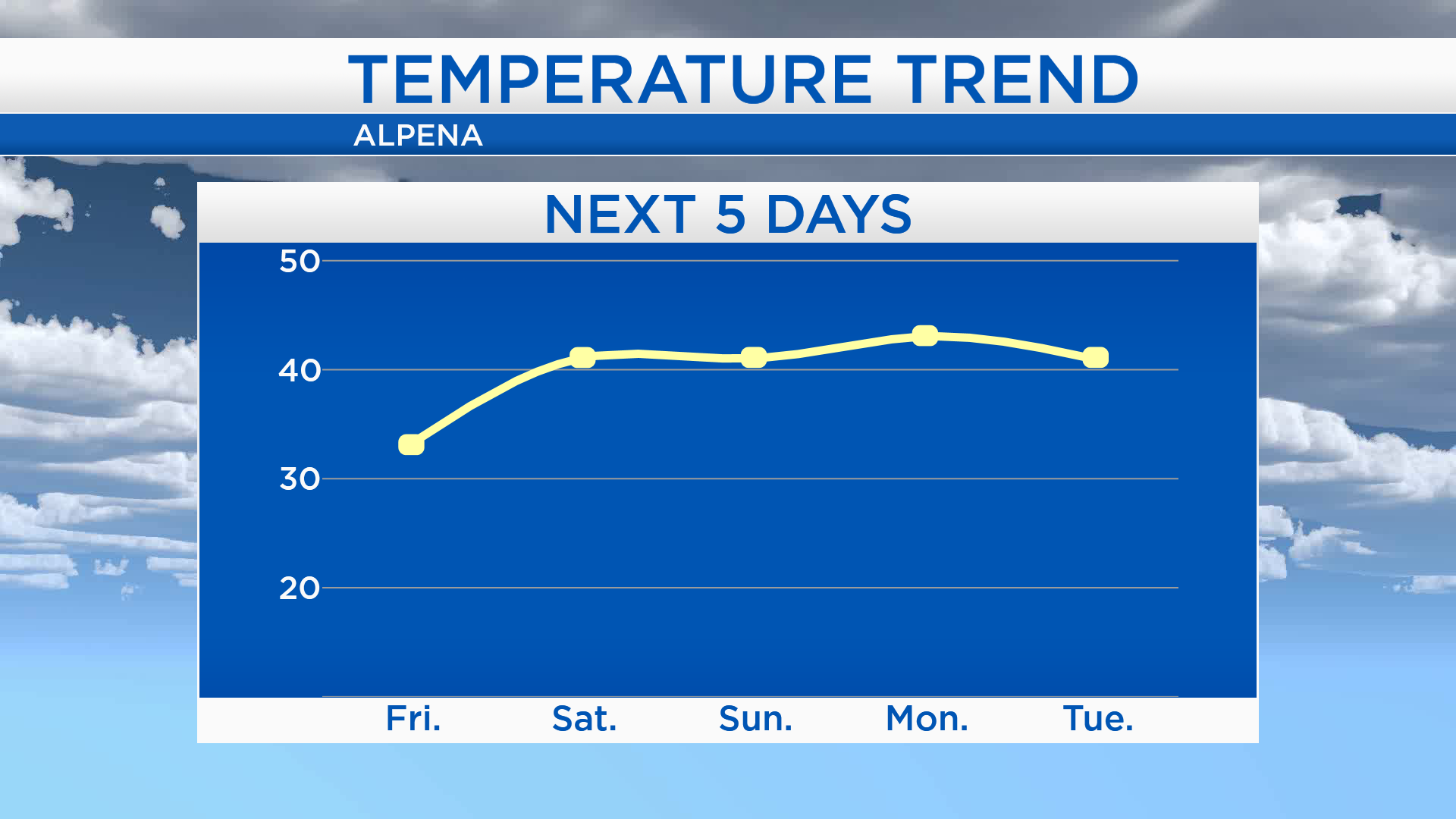
High temperatures tomorrow will only get into the lower/middle 30s with a mix of sun and clouds in the afternoon. Temperatures will cool to the lower/middle 20s early Saturday, mostly sunny skies are expected and high temperatures will get up to the lower 40s. A little more cloud cover is possible Sunday with highs in the lower 40s. Looking ahead, Tuesday and Wednesday could potentially be unsettled with chances of rain or snow showers. For the rest of Northeast Michigan’s weather forecast, watch the latest weather video by clicking the weather tab at the top of the page.