Brighter skies tomorrow; Dry until Wednesday afternoon
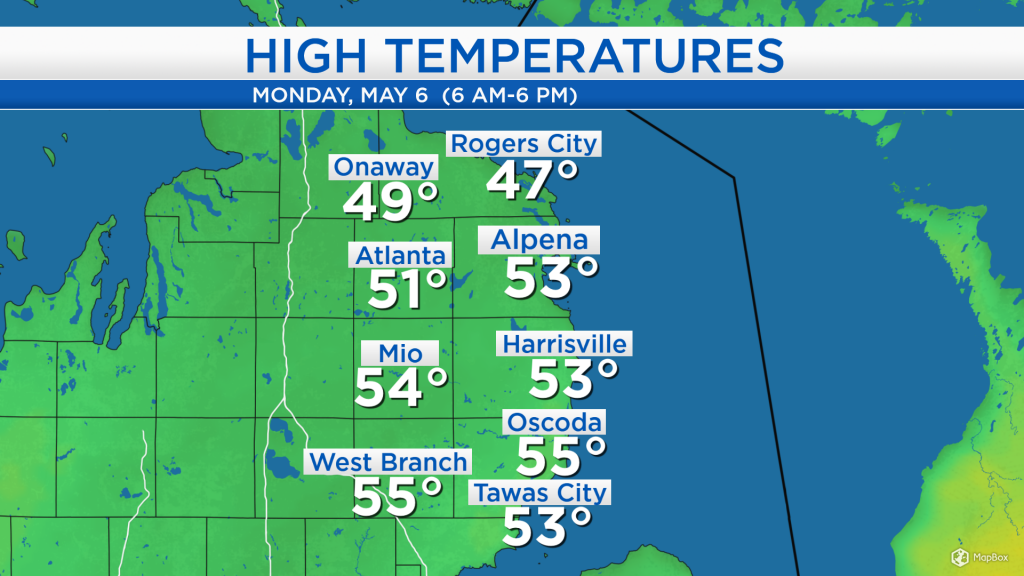
High temperatures today reached the lower 50s for most of Northeast Michigan. In most places, these high temperatures were 15-20 degrees colder than yesterday. A cold front moved through our area in the early-morning hours, producing colder temperatures today. This cold front was also responsible for a few midday showers, which unusually occurred just after the front moved through.
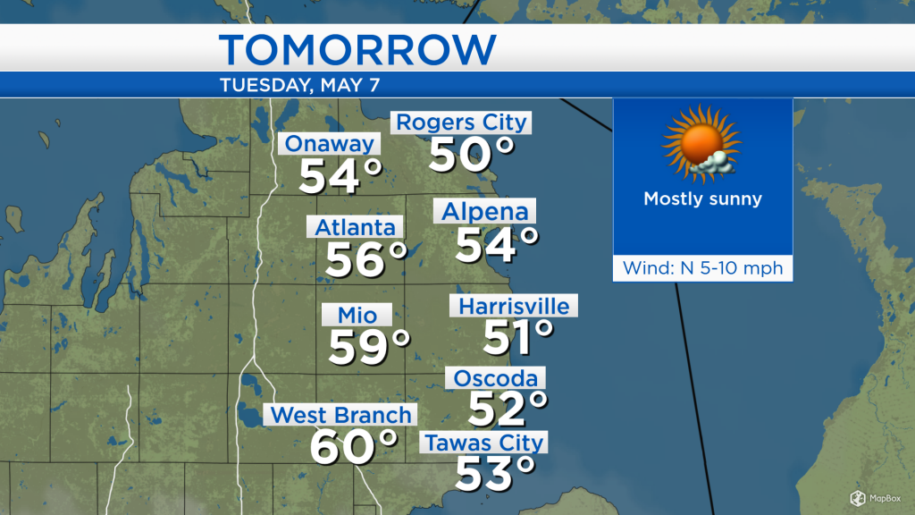
Showers currently over parts of South Dakota, Iowa and Nebraska will likely stay south of our area tomorrow. Drier and brighter weather to our northwest will move into our area, bringing mostly sunny skies for Tuesday. However, in the southwestern states, a separate storm system is developing which is forecast to soak our area late Wednesday and Thursday.
Low temperatures overnight will drop to around 34 degrees with partly cloudy skies and light winds. Skies will become mostly sunny tomorrow with high temperatures in the middle 50s — although, slightly cooler at the immediate shoreline and slightly warmer farther inland.
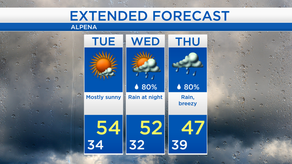
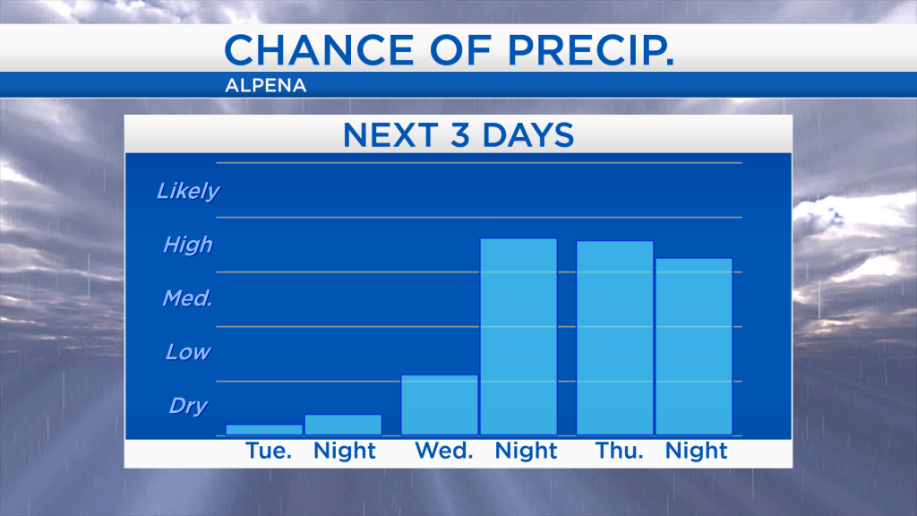
The forecast remains dry from tonight until Wednesday afternoon. The chance of rain will markedly increase Wednesday night as a storm system from the southwest approaches Michigan. The chance of rain will remain high through Thursday.
We will see plenty of blue sky tomorrow with high temperatures ranging in the 50s — lower 50s at the shoreline, upper 50s farther inland. Low temperatures will drop to the lower 30s early Wednesday. Dry weather will continue until Wednesday afternoon with high temperatures in the lower 50s. Rain will move in late Wednesday evening and continue through Thursday, pouring at times. The end of the week looks drier. For the rest of Northeast Michigan’s weather forecast, watch the latest weather video by clicking the weather tab at the top of the page.