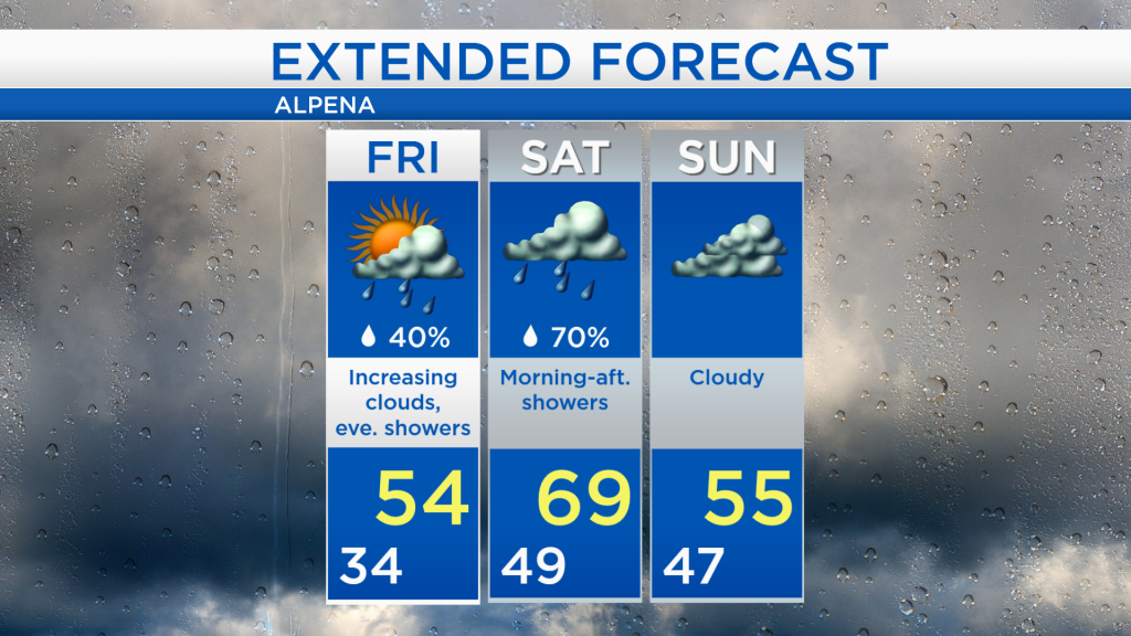
Wild ride of temperatures; showers late Friday-Saturday
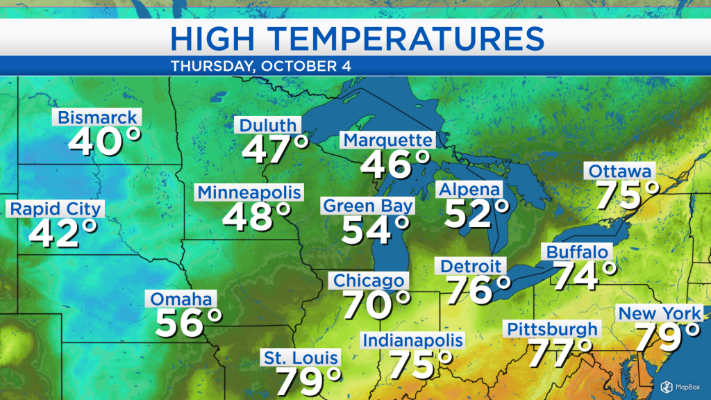
Temperatures warmed into the lower 70s last night with blustery winds out of the south ahead of a cold front. After the cold front passed through and moved to the east of our area, winds have flipped out of northwest pulling in some colder air. Temperatures are significantly colder to the west, where highs in the lower 40s were observed in North Dakota and South Dakota. High temperatures in Alpena only reached the lower 50s, and similar afternoon temperatures are forecast tomorrow.
A weak disturbance to our west is interacting with much colder air, producing snow showers and mixed precipitation of rain and snow combined together. This system will move east and spread rain showers into our area late tomorrow.
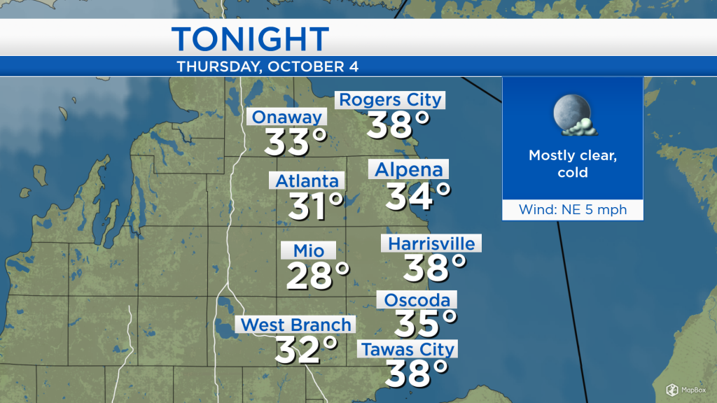
Temperatures will drop into the lower 30s tonight, except slightly warmer at the Lake Huron shoreline. Mostly clear skies, light winds, and winds out of the north or northeast are a perfect recipe for chilly overnight temperatures.
Tomorrow, clouds will increase leading to a few showers late in the day and in the evening. High temperatures will only reach the mid-50s, but much warmer temperatures will enter Saturday.
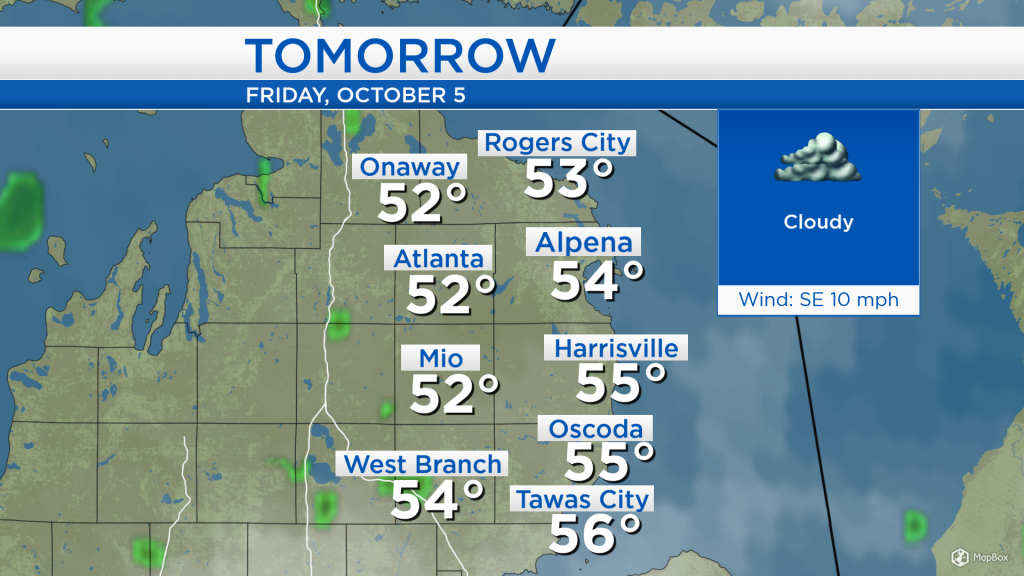
Tomorrow, most of the day should remain dry with increasing clouds and high temperatures close to 54 degrees. Showers will move into the area late Friday lasting through Saturday afternoon. On Saturday, a breeze out of the southwest will steer much warmer temperatures into our area as highs reach the upper 60s. Temperatures will cool into Sunday with cloudy skies. Much warmer temperatures will move in Monday and Tuesday; but the warmth will come with unsettled, showery weather. For the rest of Northeast Michigan’s weather forecast, watch the latest weather video by clicking the weather tab at the top of the page.