More storms tonight; Quieter and colder Thursday
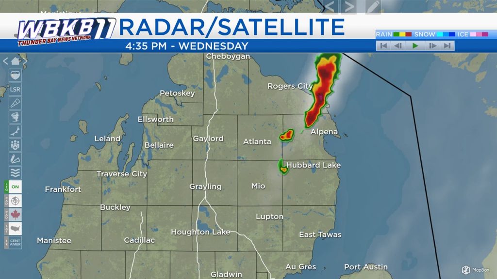
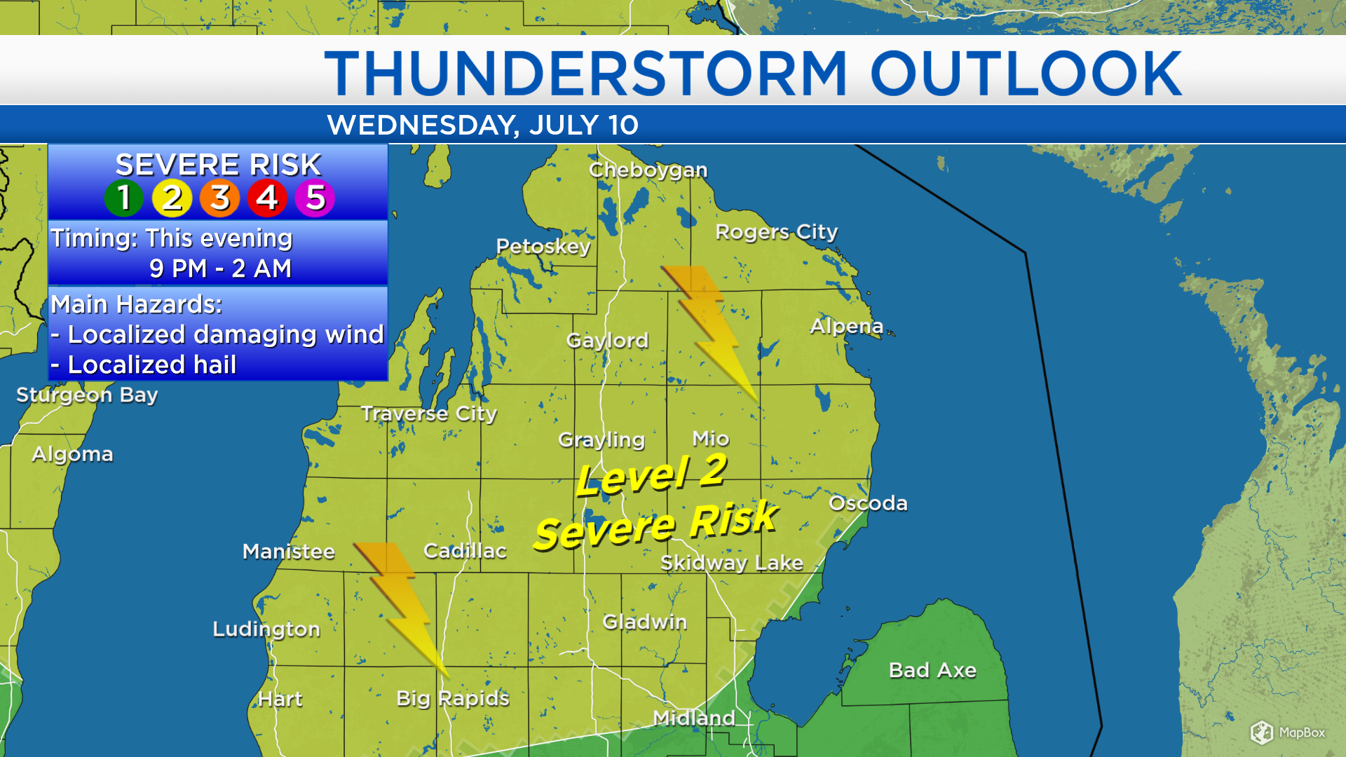
One strong thunderstorm moved through northern parts of Alpena and Presque Isle counties earlier this afternoon. A hot, humid and unstable air mass has moved into our area. As a cold front approaches from the west, it will trigger a risk of severe storms later this evening.
A “level 2” risk of severe storms remains issued for our area by the Storm Prediction Center. This risk highlights the potential of damaging wind gusts and hail with thunderstorms later this evening. The timing of the greatest risk of severe weather is from 9 p.m. this evening until 2 a.m.
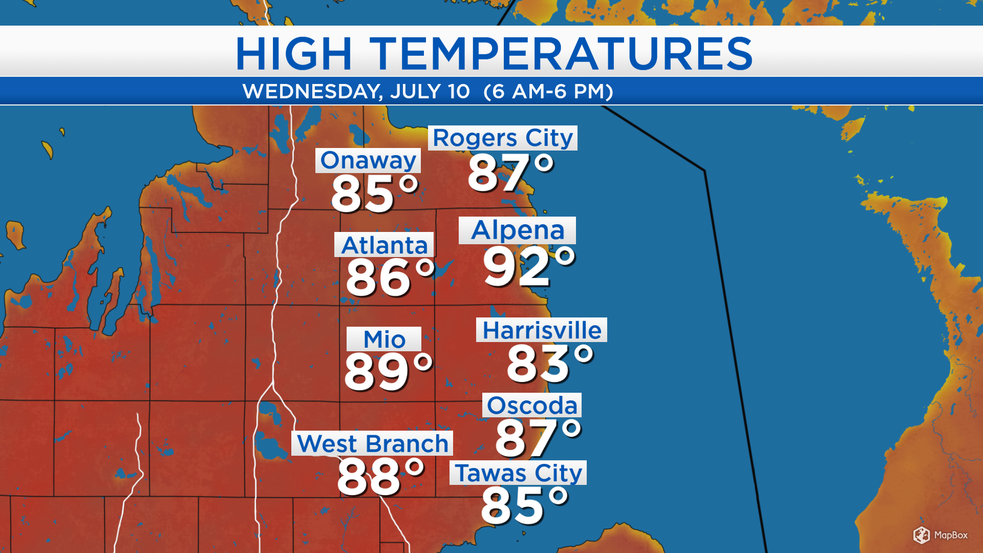
High temperatures today reached 92 degrees in Alpena prior to the late-afternoon thunderstorm. A downpour caused “rain-cooled” air and dropped the temperatures. Elsewhere, high temperatures reached the middle to upper 80s. The cold front moving through our area tonight will result in cooler temperatures tomorrow afternoon.
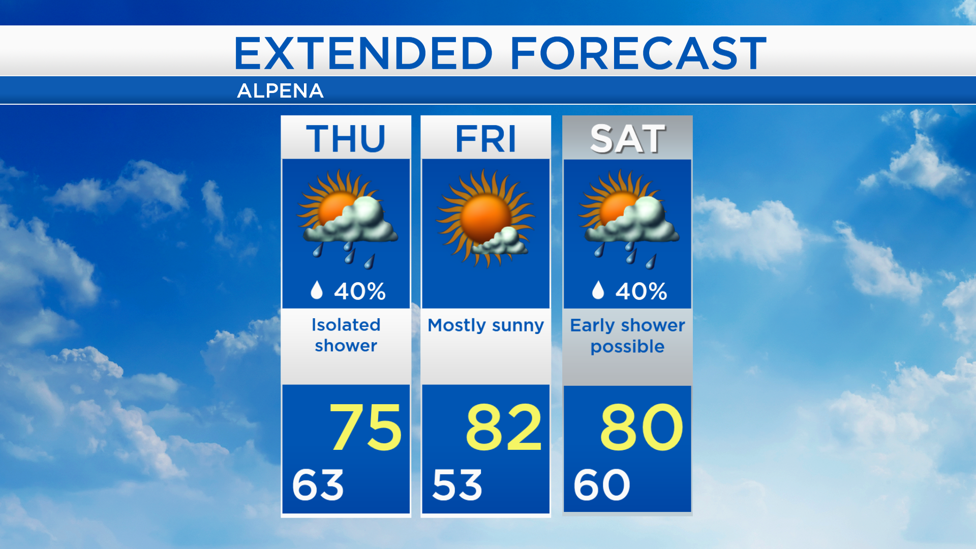
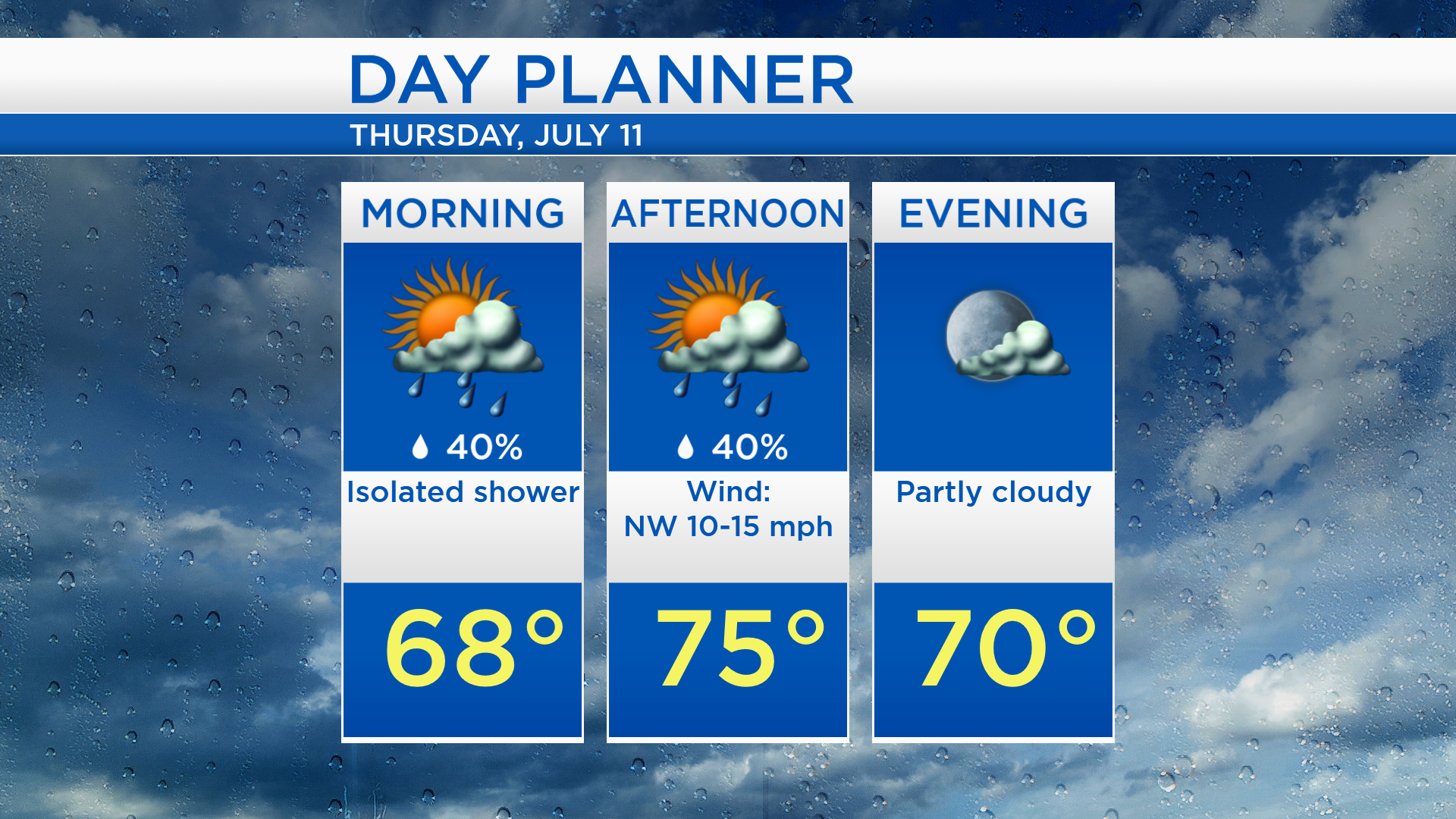
Low temperatures tonight will drop to the lower 60s as thunderstorms exit Northeast Michigan. An isolated shower is possible tomorrow morning/afternoon, although most of the day should end up dry. Morning temperatures in the upper 60s will feel comfortable, then afternoon highs will reach only the middle 70s.
The cool-down tomorrow will be short-lived. Warmer temperatures will return on Friday with high temperatures in the lower 80s and mostly sunny skies. A few showers are possible early Saturday, otherwise the weekend is looking mainly dry. High temperatures will get close to 80 degrees for both Saturday and Sunday. For the rest of Northeast Michigan’s weather forecast, watch the latest weather video by clicking the weather tab at the top of the page.