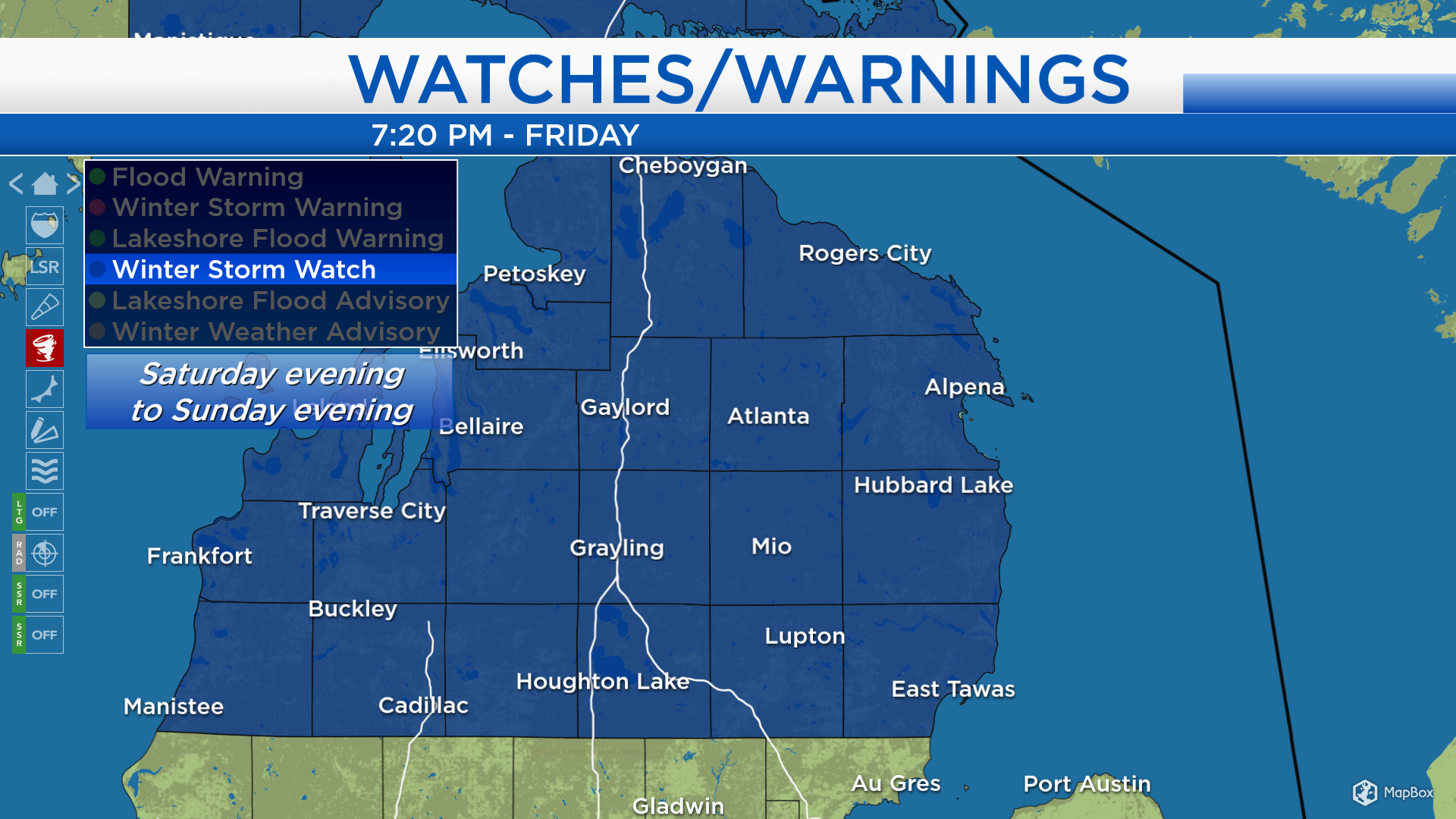
Winter Storm Watch for this weekend; Mix of snow, sleet and freezing drizzle

The National Weather Service has issued a Winter Storm Watch beginning Saturday evening and lasting through Sunday evening for all of Northeast Michigan. A mix of wintry precipitation types and accumulating snowfall are expecting during the time period covered by the watch. In addition, winds will gust up to 35 mph on Sunday.
The storm system moving toward our area is currently producing a wintry mix over Iowa, Nebraska and southern Minnesota, shown in pink and purple. However, mainly dry conditions should remain in Northeast Michigan until Saturday afternoon. A mix of snow/sleet/freezing drizzle is expected late Saturday and Sunday.
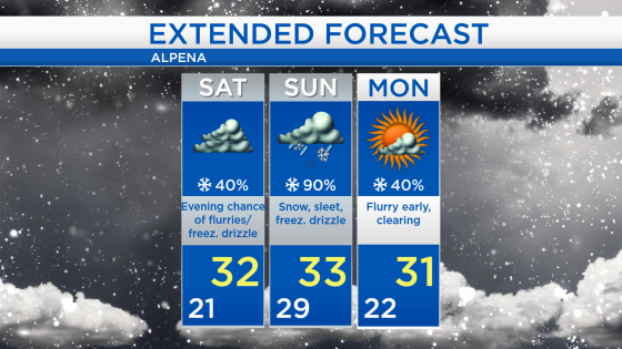
Saturday evening, a mix of flurries and freezing will move in. Snow and sleet are likely on Sunday, freezing drizzle will remain a possibility, and gusty winds are expected. Snowfall amounts will likely range from 5 to 10 inches — the lower end of that range will be near Saginaw Bay and the higher end of that range will be closer to the Tip of the Mitt.
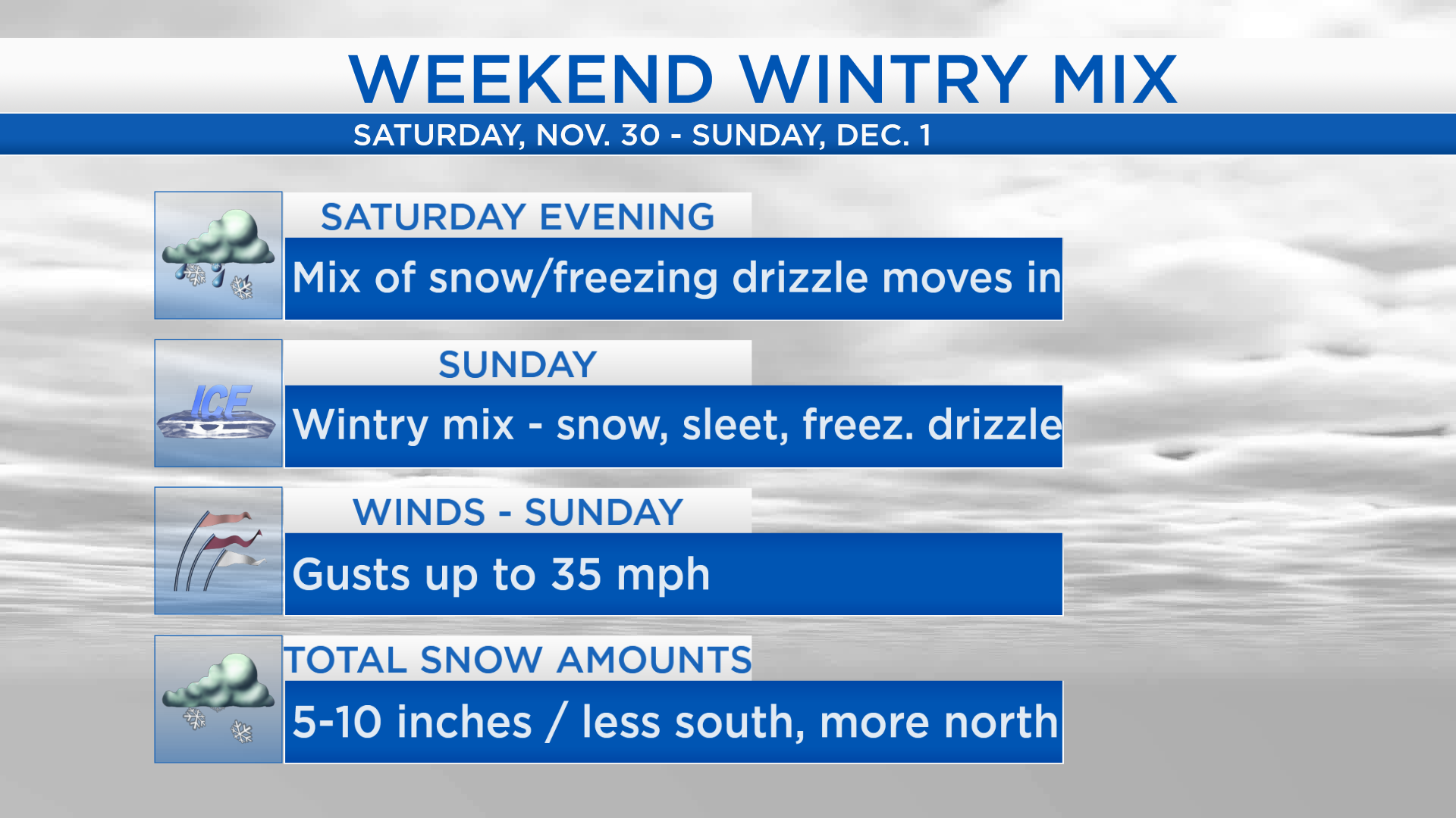
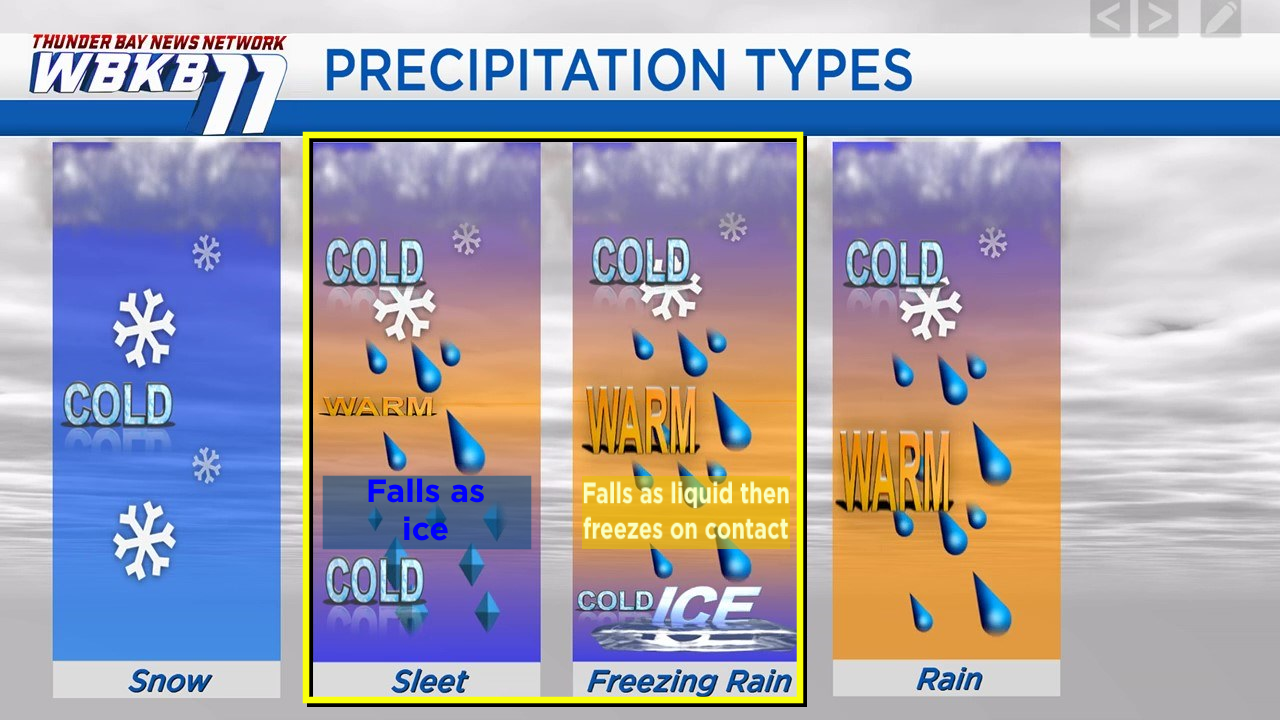
As a reminder, sleet falls as frozen bits of ice. A little different, freezing drizzle falls as liquid drops that freeze only when making contact with a sub-freezing surface.
Saturday will likely remain dry until the afternoon. Then messy, wintry weather will be an issue late Saturday and Sunday. High temperatures will reach the lower 30s over the next few days. A few flurries are possible early Monday but skies should begin to clear in the midday to afternoon hours.