
Thunderstorm risk develops Tuesday PM
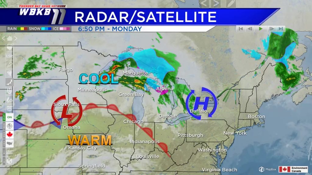
A mix of rain and snow moved through Northeast Michigan Monday afternoon, while we’re on the cold side of a warm front. This warm front, located to our south, will get closer to our area. It will provide more showers and a risk of thunderstorms Tuesday afternoon-evening.
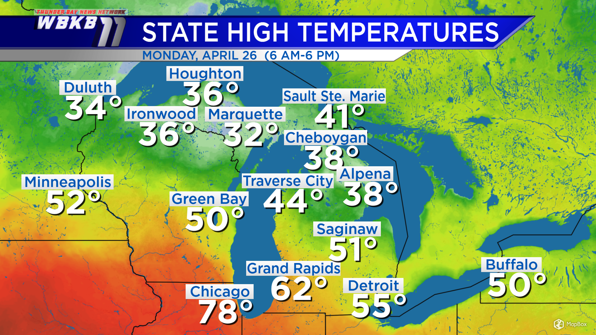
The warm front acts like a barrier between warm and cool temperatures. All of the really warm temperatures will remain south of the warm front. South of the warm front, temperatures warmed to the 70s and 80s. The high got up to 78 degrees in Chicago. Compare that to Northern Michigan where highs were 38 degrees in Alpena and 44 degrees in Traverse City.
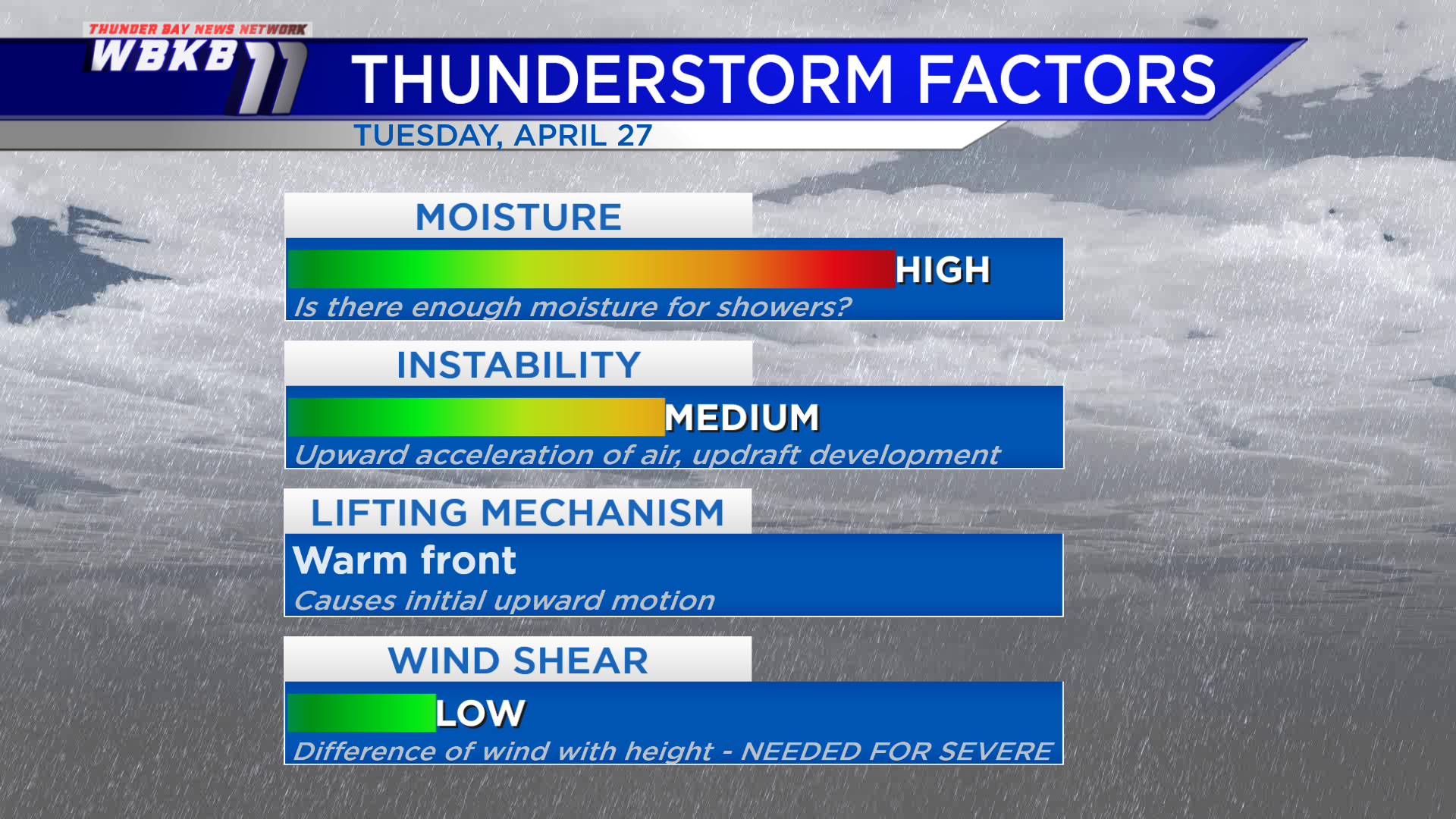
The approaching warm front will be a focal point for increased moisture. Instability will increase also, leading to a risk of thunderstorms. Wind shear will be low, so the risk of severe weather is very minimal.
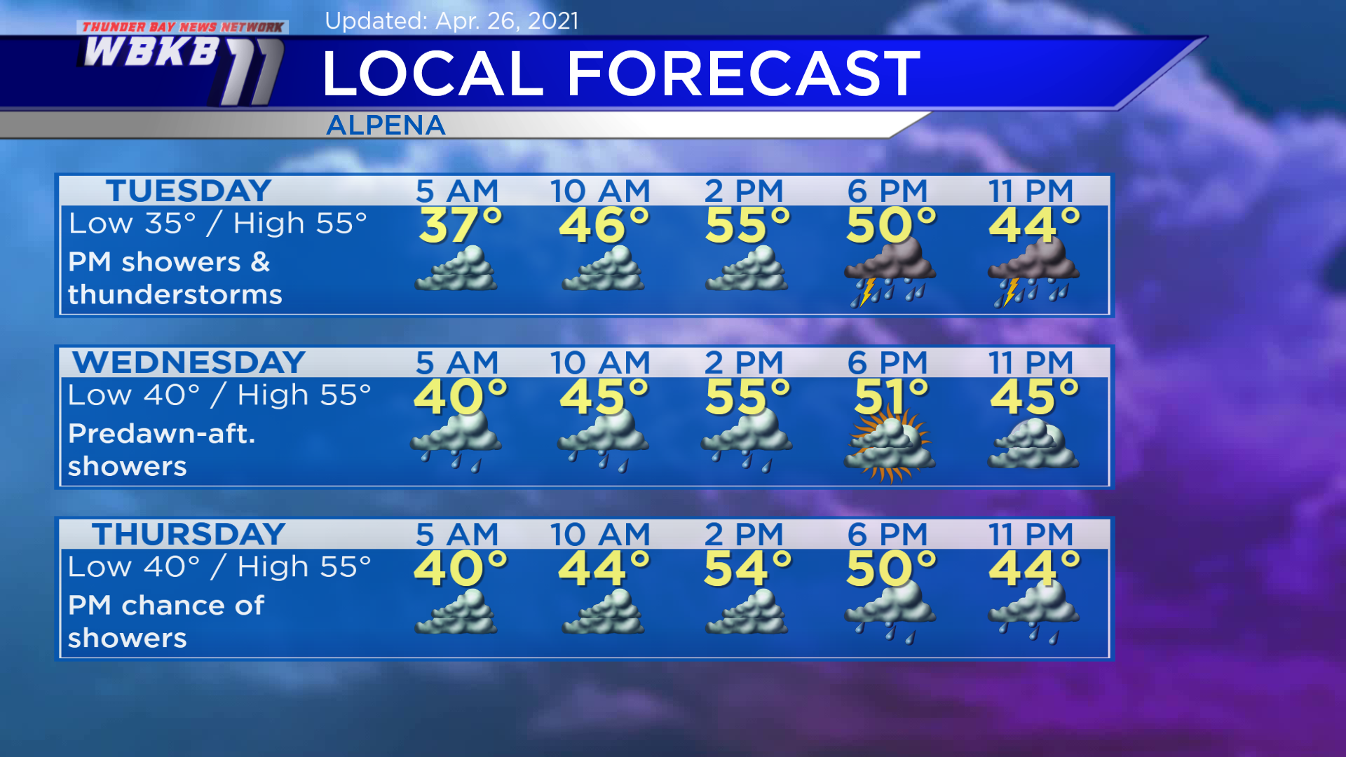
Tuesday: Mainly cloudy early, then showers and thunderstorms during the afternoon and evening. Early-morning temperatures will begin in the middle/upper 30s. Afternoon highs will reach about 55 degrees in the Alpena area, although temperatures across Northeast Michigan will range from near 50 degrees in Rogers City to near 70 degrees in West Branch. Evening temperatures will be in the upper/middle 40s.
Wednesday: Showers predawn to afternoon, then drier in the evening. Predawn lows will be near 40 degrees. Afternoon highs will get up to around 55 degrees. Evening temperatures will be around the upper 40s.
Thursday: Mostly cloudy to start, then a chance of showers in the afternoon and evening. Early-morning lows will begin close to 40 degrees. Afternoon highs will be near 55 degrees. Evening temperatures will head to the upper/middle 40s.
For the rest of Northeast Michigan’s weather forecast, watch the latest weather video by clicking the weather tab at the top of the page.


