Snow changing to rain tomorrow; More messy weather Friday
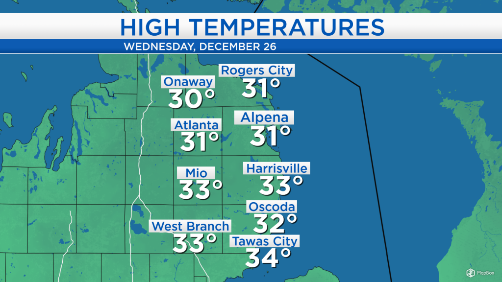
High temperatures today reached the lower 30s, just slightly warmer then normal. We saw overcast skies all day and light winds, only about 5 mph. The calm weather will continue tonight, then a mix of precipitation types will move in tomorrow.
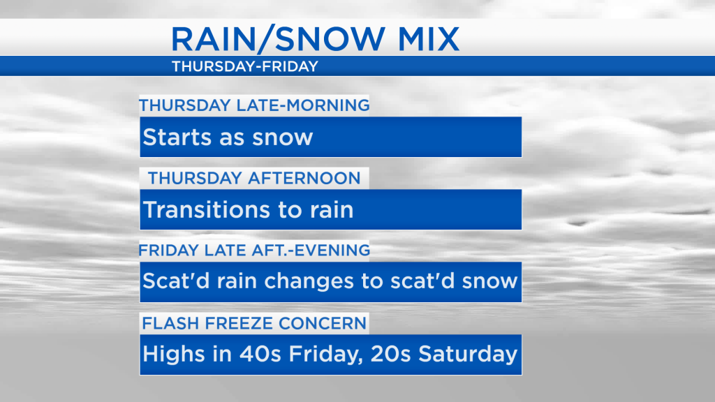
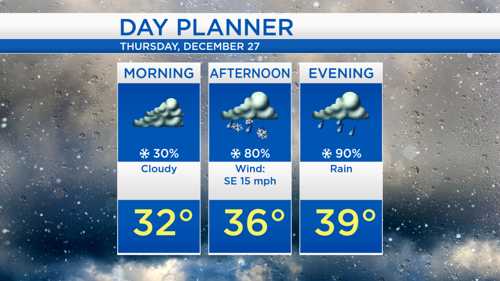
Overcast skies will remain in our area through tonight. Then our attention turns to a storm system coming out of the Plains, currently producing blizzard conditions in parts of North Dakota and South Dakota, and soaking rain in Iowa, Nebraska, Kansas, Oklahoma and Texas. Across Northeast Michigan, we will likely get a brief round of snow in the late-morning or midday hours tomorrow, then quickly transitioning rain during the afternoon.
The morning will start off with cloudy skies and mainly dry weather with temperatures in the lower 30s. Late-morning or around noon, a brief area of snow is forecast to move through, after which the precipitation will switch to rain, continuing through Thursday evening. With a breeze out of the southeast helping to provide warmer air, the warmest point of tomorrow will occur during the evening, as temperatures reach about 39 degrees.
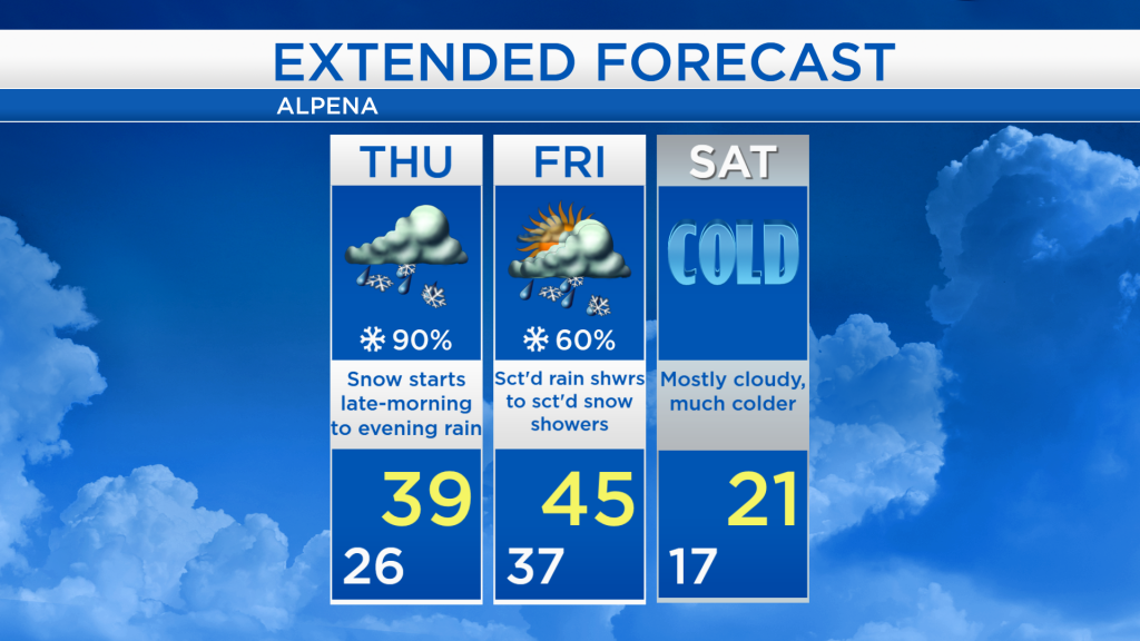
Overall, most of this storm system will affect us with rain, but rapidly cooling temperatures Friday night could also become a concern. From the time rain arrives Thursday afternoon, temperatures will remain warm enough for rain through Friday afternoon. Afternoon highs are expected to reach the mid-40s on Friday! Winds shifting out of the northwest will cause temperatures to tumble into the upper teens by early Saturday. This massive drop in temperatures could cause some localized flash freeze issues, with any standing water from the rain Thursday and Friday freezing over, creating icy conditions.
For tomorrow, snow will change to rain in the afternoon as highs reach the upper 30s tomorrow evening. Winds will pick up to around 15-20 mph tomorrow through Friday. Highs will reach around 45 degrees on Friday with scattered rain showers changing to scattered snow as colder temperatures begin to arrive Friday evening. Much colder weather is expected this weekend, reaching only the lower 20s Saturday afternoon with mostly cloudy skies. On Sunday, a little more sunshine and slightly warmer temperatures are expected. For the rest of Northeast Michigan’s weather forecast, watch the latest weather video by clicking the weather tab at the top of the page.