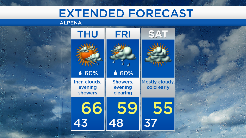
Slightly warmer tomorrow with evening showers; Cool weekend ahead
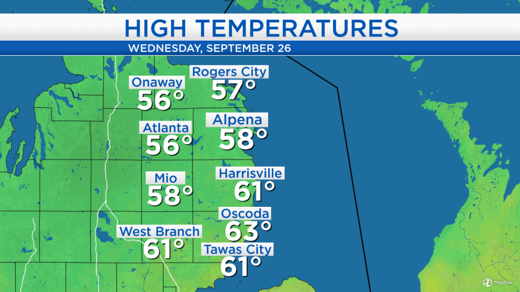
High temperatures today reached the upper 50s and lower 60s across Northeast Michigan. The day started with cloudy skies this morning, which then became partly cloudy in the afternoon. A breeze out of the west at 10-15 mph produced warmer temperatures near the shoreline, from Harrisville to Tawas City.
The cold front that moved through yesterday continues to travel eastward through New York an Pennsylvania. As a result, high temperatures today were about 15-20 degrees colder than yesterday. Another cold front is producing showers in Minnesota which will travel into our area tomorrow evening. That cold front will keep colder temperatures in the forecast through the upcoming weekend.
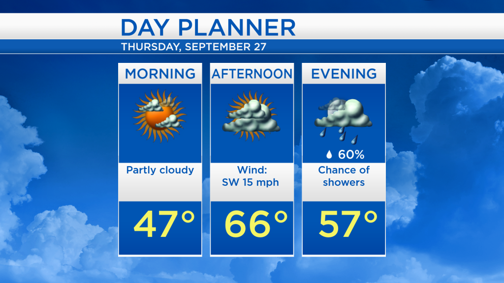
Tomorrow should be mostly dry with increasing clouds. Partly cloudy skies are expected in the morning with temperatures in the middle and upper 40s. Skies will become mainly cloudy in the afternoon as highs reach the mid-60s. Showers will enter the area tomorrow evening, lasting until Friday afternoon.
After a briefly warmer temperatures tomorrow, the cold front bringing showers Thursday evening-Friday afternoon will bring colder temperatures heading into the weekend. Showers are expected on Friday with highs reaching the upper 50s to around 60 degrees. Over the weekend, early-morning temperatures will start with chilly lows in the middle and upper 30s. Most of the weekend should remain dry although mostly cloudy, until a chance of showers enters Sunday evening. For the rest of Northeast Michigan’s weather forecast, watch the latest weather video by clicking the weather tab at the top of the page.