Showers and thunderstorms overnight; Warmer Saturday; Bright Sunday
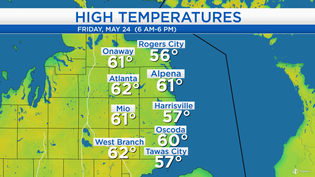
High temperatures today got close to 60 degrees with mostly cloudy skies. A light breeze out of the east kept temperatures a few degrees cooler at the shoreline. Tomorrow, winds will shift out of the southwest, bringing significantly warmer air to our area.
While the afternoon radar imagery is unimpressive, showers and thunderstorms are expected to develop to our southwest — these storms will then move into Northern Michigan overnight. A dry slot over South Dakota, Nebraska and Iowa will move into our area for tomorrow afternoon, bringing clearing skies.
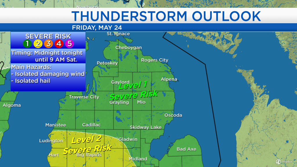
The Storm Prediction Center has placed our area under a Level 1 risk of severe weather overnight. Most storms should remain below severe criteria. However, isolated damaging wind gusts over 58 mph, and isolated hail larger than 1 inch remain a low-end possibility. Any severe weather or strong (but not severe) storms will likely occur between midnight and 9 a.m. Saturday.
Low temperatures tonight will drop to the upper 40s with a risk of thunderstorms. Temperatures will rise into the 50s tomorrow morning with showers. Temperatures will warm to around 76 degrees in the afternoon with a breeze out of the southwest. Clearing skies are expected in the afternoon although a slim chance of a shower cannot be ruled out.

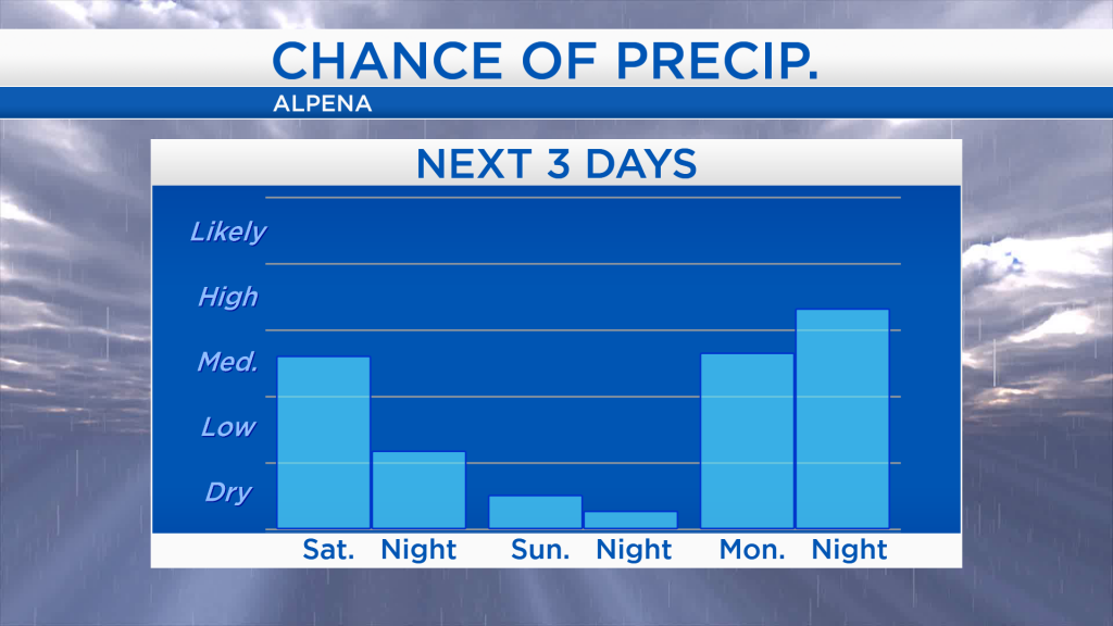
During the Memorial Day weekend, chances of rain are greatest tonight-tomorrow morning, then again beginning late on Monday.
Some sunshine is expected to appear tomorrow afternoon along with warm temperatures in the middle or upper 70s. Sunday will be slightly cooler but brighter with mostly sunny skies and afternoon temperatures in the middle 60s. Memorial Day will likely start with dry weather, then rain will arrive late in the day or in the evening. For the rest of Northeast Michigan’s weather forecast, watch the latest weather video by clicking the weather tab at the top of the page.