Risk of thunderstorms develops late-day Thursday
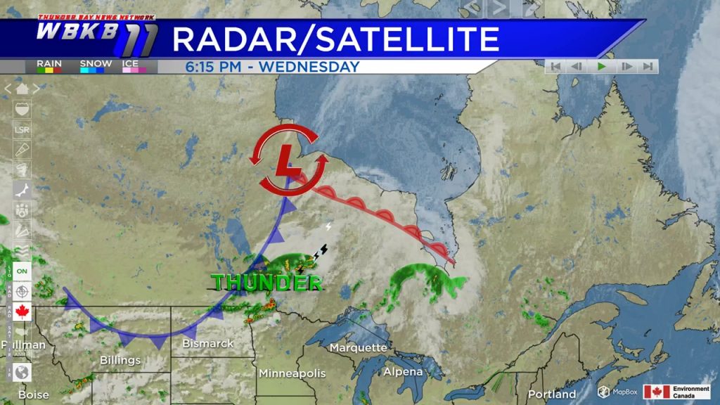
Mostly sunny skies shone over Northeast Michigan Wednesday. A low pressure system in central Canada will affect our local weather pattern Thursday and Friday. A cold front extends from Hudson Bay, through central Canada, into North Dakota and Montana. This cold front will bring showers and a risk of thunderstorms beginning late-day Thursday.
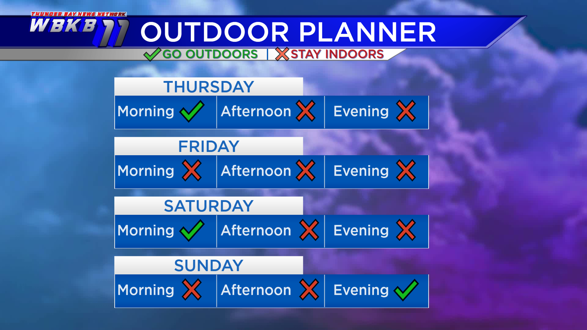
Thursday morning will begin dry. Then showers and thunderstorms will move in during the afternoon/evening. Friday will be wet and unsettled, also with a risk of thunderstorms. Saturday will likely start dry, then another chance of showers will build in for the afternoon and evening. More showers are possible Sunday morning and afternoon.
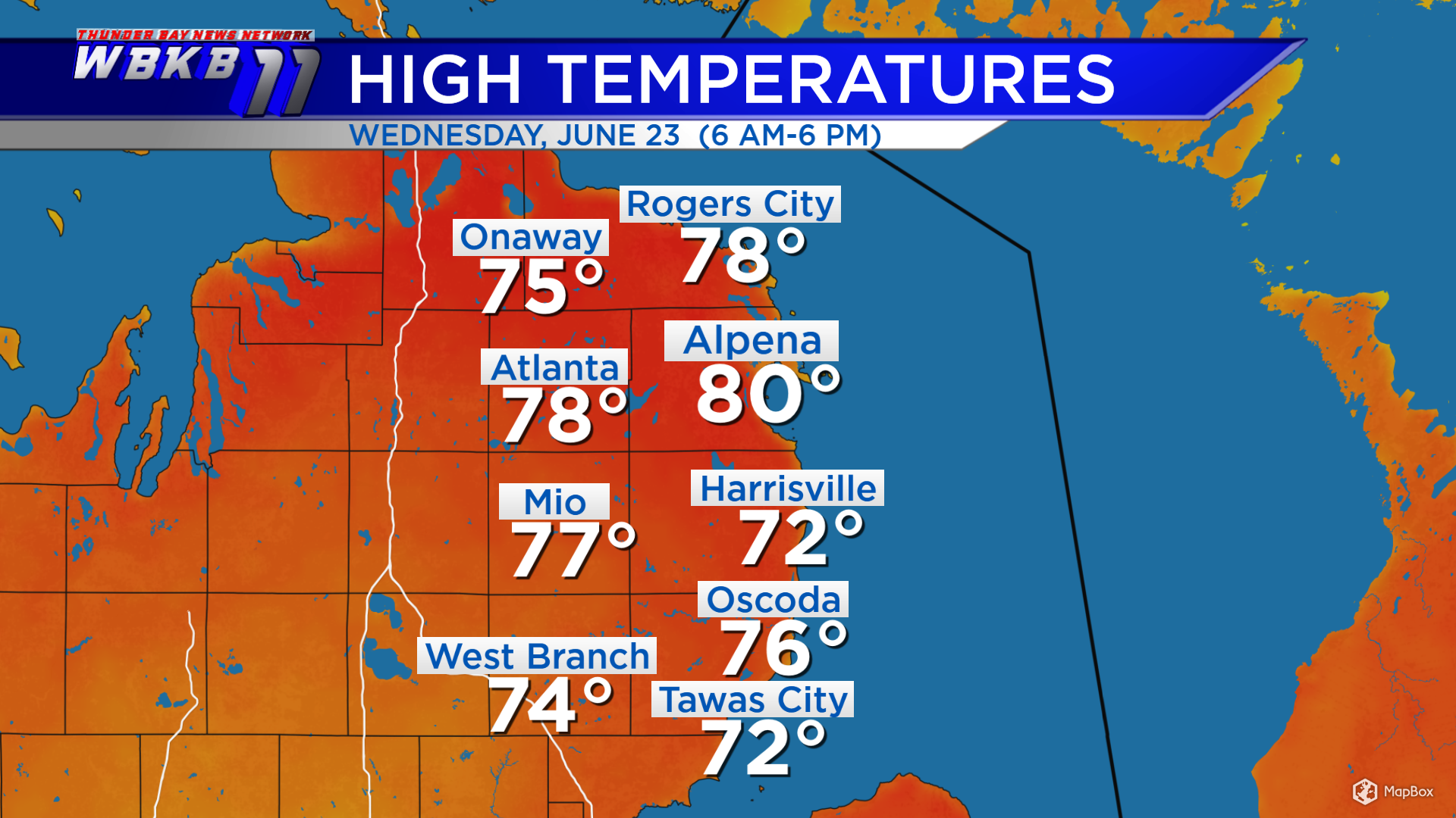
High temperatures warmed to 80 degrees in Alpena. Skies became sunnier for areas north of M-72, so temperatures became warmer in those places. West Branch had a high of 74 degrees, where skies were cloudier Wednesday afternoon.
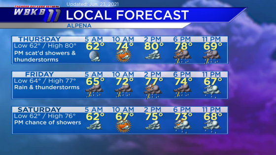
Thursday: Increasing clouds, then a risk of thunderstorms will move in late-day. Predawn temperatures will head down to 62 degrees. Afternoon highs will get up to about 80 degrees. Evening temperatures will be mainly in the 70s.
Friday: Rain and thunderstorms. Early-morning lows will be close to 64 degrees. Afternoon highs will reach about 77 degrees. Evening temperatures will cool from the lower 70s to upper 60s.
Saturday: Likely dry in the morning, then a chance of showers arrives in the afternoon/evening. Early-morning temperatures will begin near 62 degrees. Afternoon highs will be around 76 degrees. Evening temperatures will be close to 70 degees.
For the rest of Northeast Michigan’s weather forecast, watch the latest weather video by clicking the weather tab at the top of the page.


